
Geographic Information Systems > Projects
Geographic Information Systems - analysis Projects
Our GIS department handles many assorted projects from a wide array of client types. Here is a sampling of some of the types of projects that have been completed recently.
Sewer system Characterization / Creve Coeur, Illinois
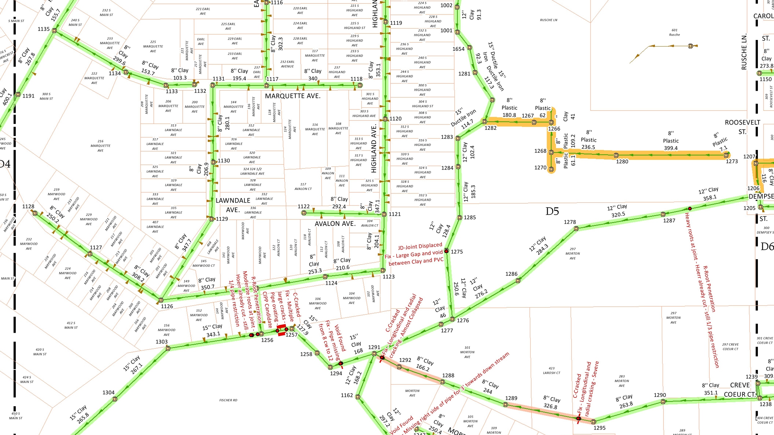
The Village of Creve Coeur began an exhaustive sanitary sewer system characterization effort as requested by the Illinois Environmental Protection Agency. As part of the update, all wastewater collection facilities including structures and sanitary sewers of various sizes and material types were to be inspected and documented as part of the system characterization component of the plan.
The project consisted of the field inspection of manholes and other collection system structures. The project also included the topographic survey of all of these items. All field data that was gathered was entered into a GIS system for quality control and for easier delivery and integration of the data to the owner which reduced overall cost. Comprehensive video inspection coordination and review was also conducted with all results being made a part of the Village’s nascent GIS database.
Sales Territory Analysis - Maui Jim / United States and the caribbean
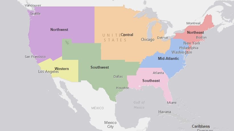
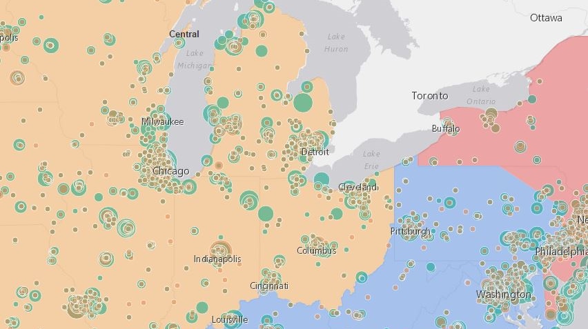
Maui Jim needed help in visualizing their sales territories through the United States and the Caribbean. Their primary goal was to review existing sales territories and the locations of their Account Executives within these territories.
Maurer-Stutz developed several online maps for Maui Jim to use to help with their review process. All retail locations were mapped for this area using geocoding and sales were represented by dynamic symbology for both product type and sales volume.
We added additional demographic layers such as median household income, disposable income, and population growth to help inform their decisions on territory boundaries.
Greenwood Cemetery / Canton, Illinois
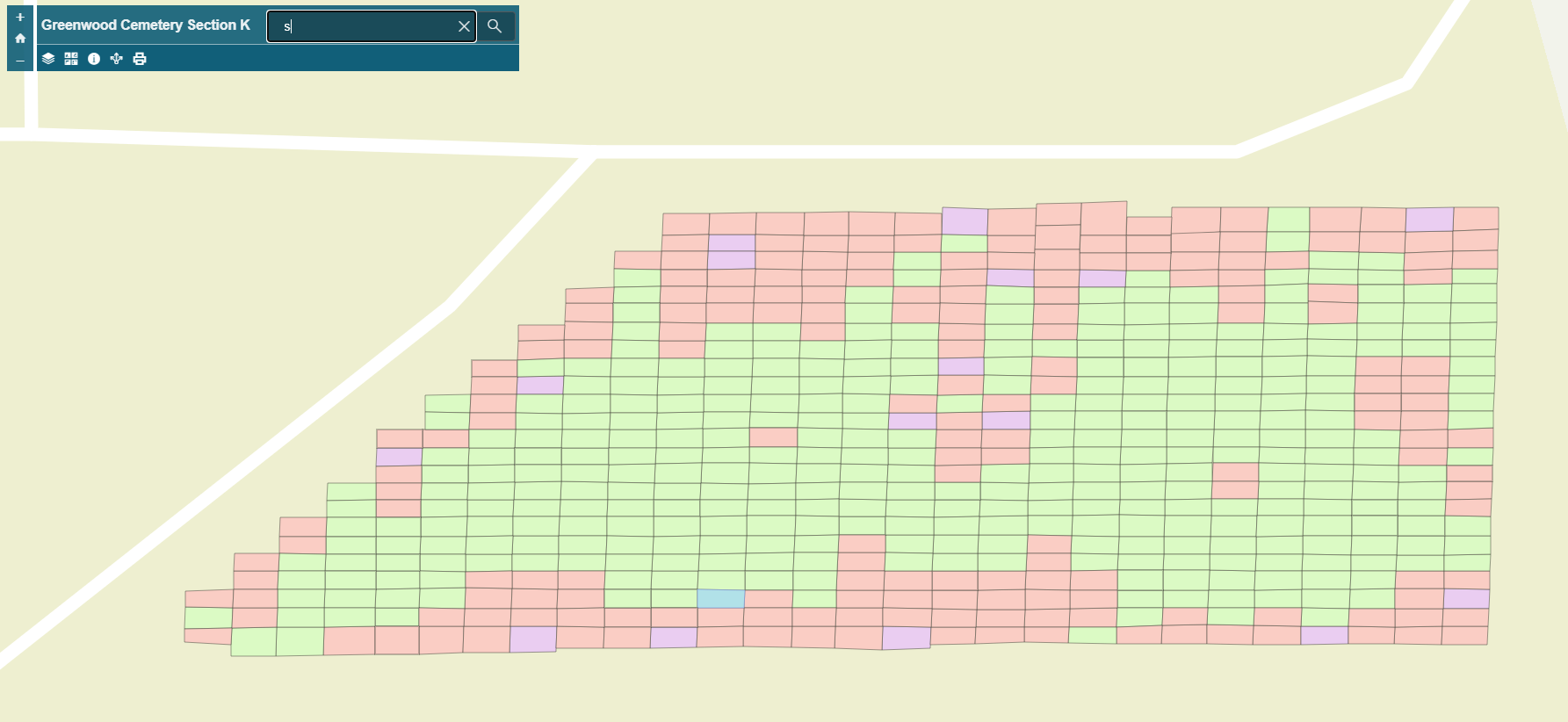
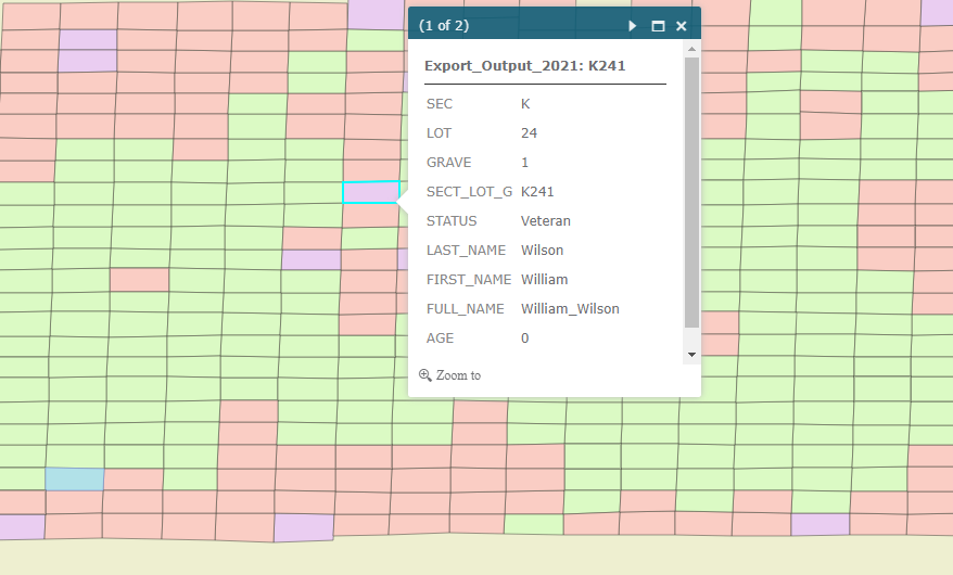
The City of Canton, Illinois tasked Maurer-Stutz, Inc with creating a public facing application for Section K of Greenwood Cemetery. The cemetery has been in operation since 1897, and the City wanted to digitize their existing paper records. By combining excel files and static maps, MSI staff was able to create the mapping application via the Esri suite platform. When complete, the public will be able to search the entire cemetery database to find deceased loved ones, available plots, and historical markers within the cemetery.