
Geographic Information Systems > Projects
Geographic Information Systems - Government Agency Projects
Our GIS department handles many assorted projects from a wide array of client types. Here is a sampling of some of the types of projects that have been completed recently.
Tornado Roadway Recovery / Washington, Illinois
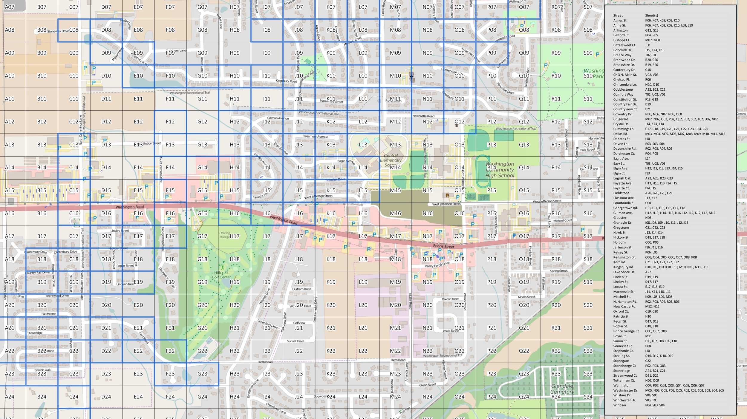
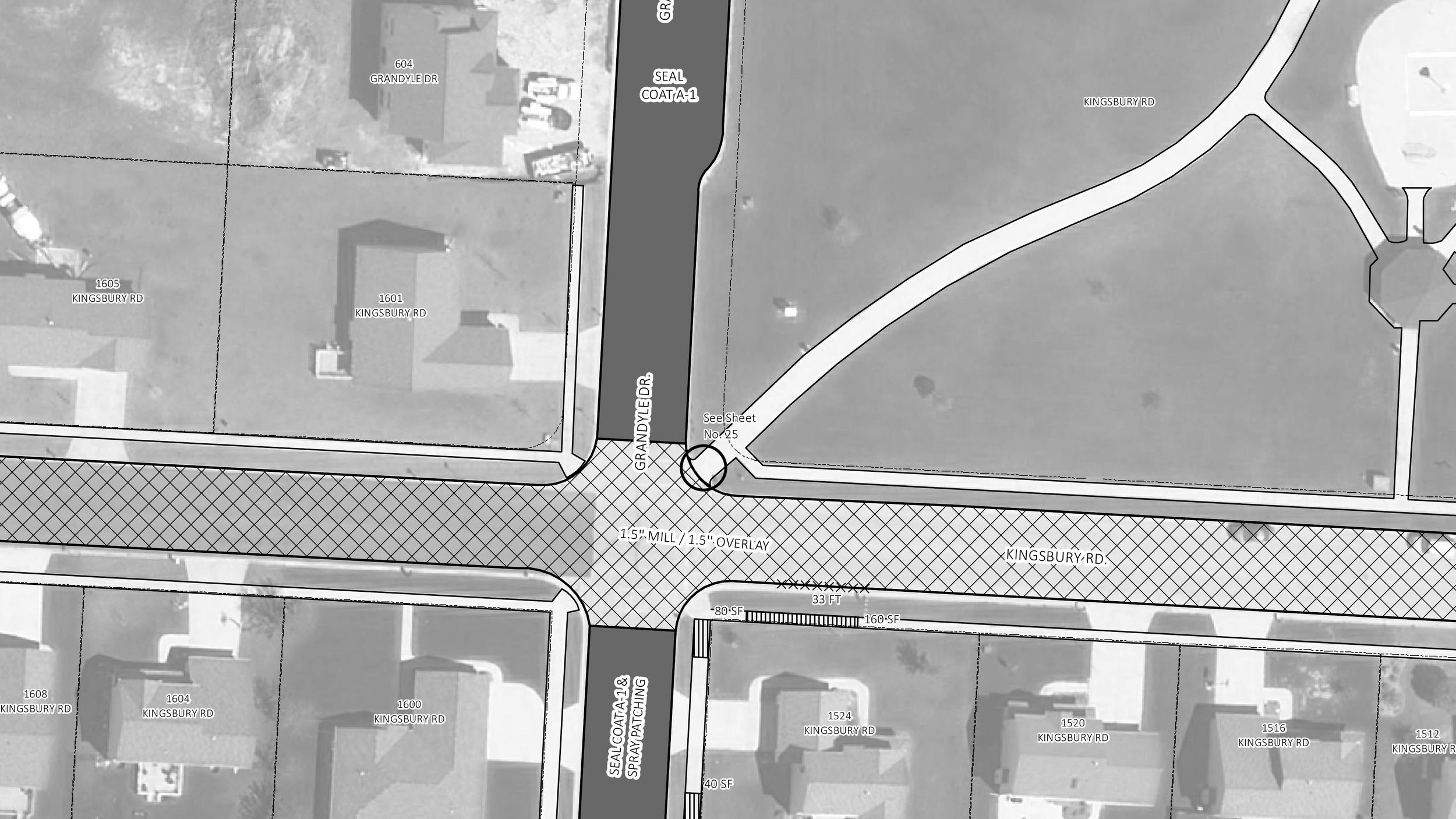
The City of Washington endured a devastating tornado in the fall of 2013 that destroyed a total of 633 homes, 7 businesses, 7 apartment buildings, and 2,500 vehicles. Along with this devastation, came a lot of damage to public infrastructure including roadway items such as streets, curbs and sidewalks.
The City of Washington received an emergency grant, totaling six million dollars, from the State of Illinois to help with the roadway restoration effort. Maurer-Stutz utilized a GIS database to manage damage assessments and to develop construction documents for the restoration efforts. The data generated by the project was also made available on the City's website through an interactive map to engage citizen participation with the project and to inform the public on the limits of the restoration.
Tif District Creation / Farmington, Illinois
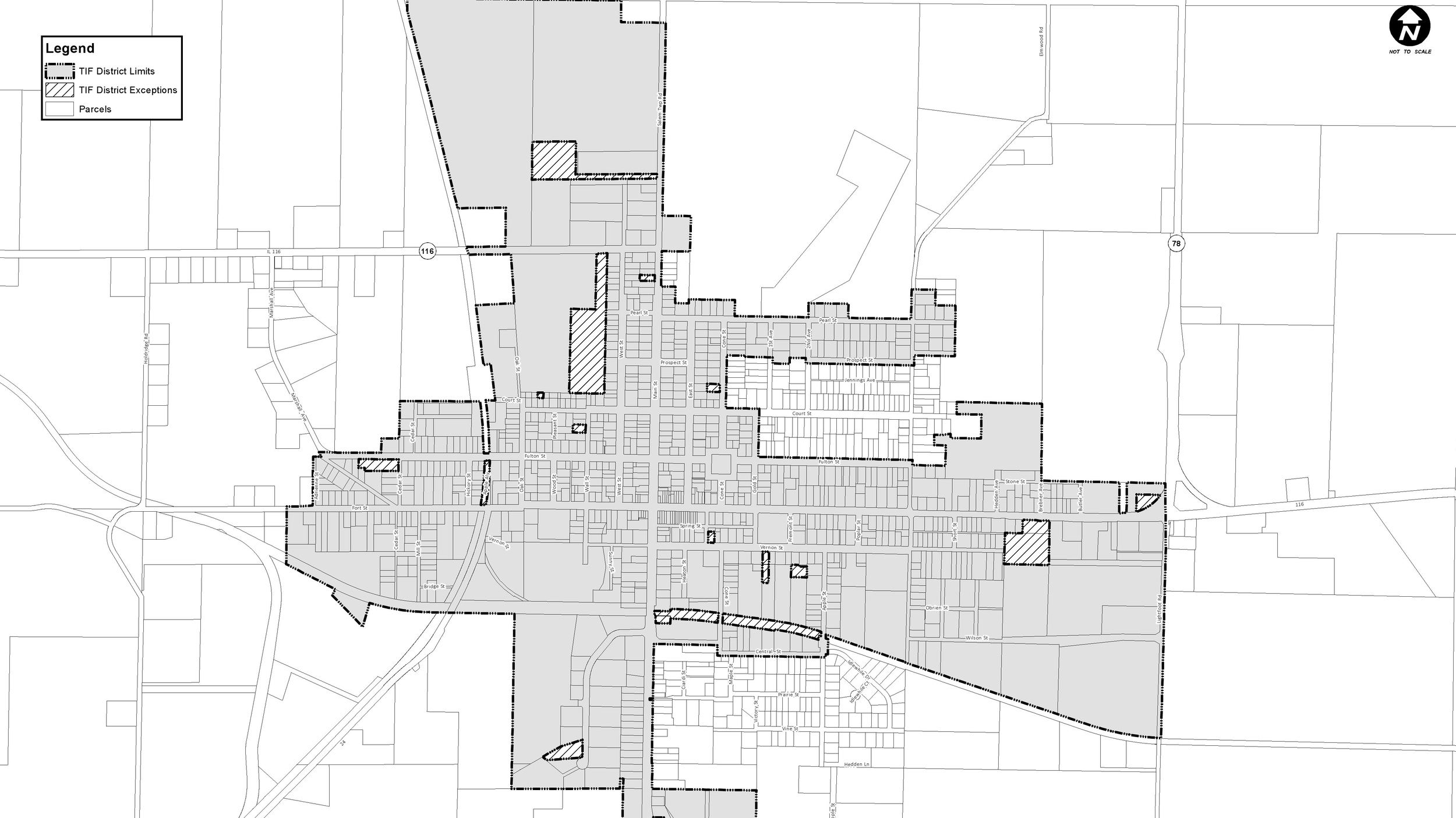
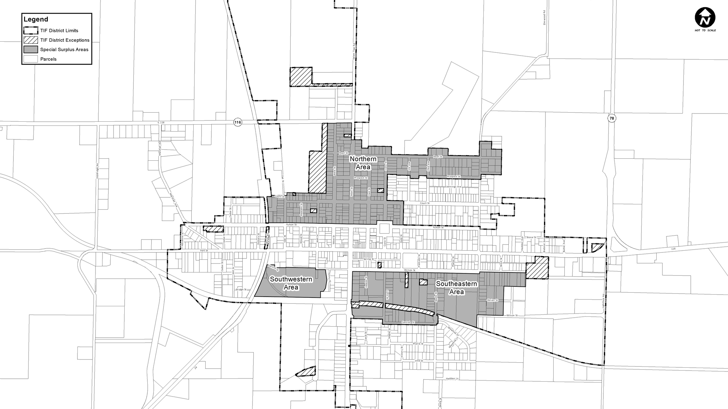
We assisted the City of Farmington and the Economic Development Group with the creation of a new TIF District. Parcel data from Fulton County was used to help establish boundaries of the proposed TIF District and develop a legal description and property list for filing.
Tax codes for the parcels were also used to verify the current municipal limits during the TIF District creation process. The City now has a parcel base layer for their GIS system as a result of this project.
Comprehensive Plan and ZOning / Elmwood, Illinois
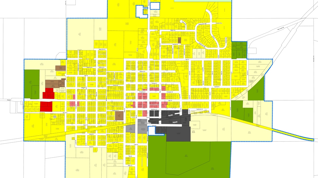
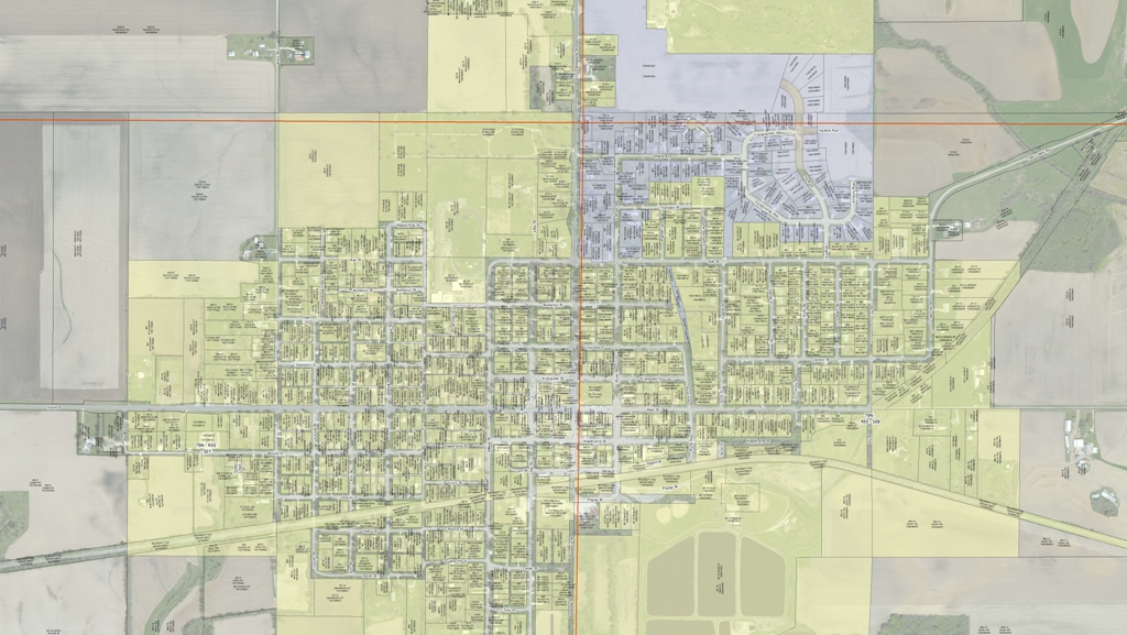
The City of Elmwood desired to change their own zoning process. Previously, Peoria County administered the City's zoning and land use plans as part of the overall County plans. However, the City of Elmwood wished to have control over their own zoning. This desire resulted in the adoption of a newly revised land use plan for the City and to bring in the existing County zoning .
The use of GIS in this process streamlined the editing and review of proposed changes to the land use plan, and helped verify that existing zoning classifications were consistent with current land use. The City now has a fully functioning parcel database that contains all zoning and land use information within their jurisdictional limits.