
Geographic Information Systems > Projects
Geographic Information Systems - Utility Projects
Our GIS department handles many assorted projects from a wide array of client types. Here is a sampling of some of the types of projects that have been completed recently.
Long term COntrol Plan / Canton, Illinois
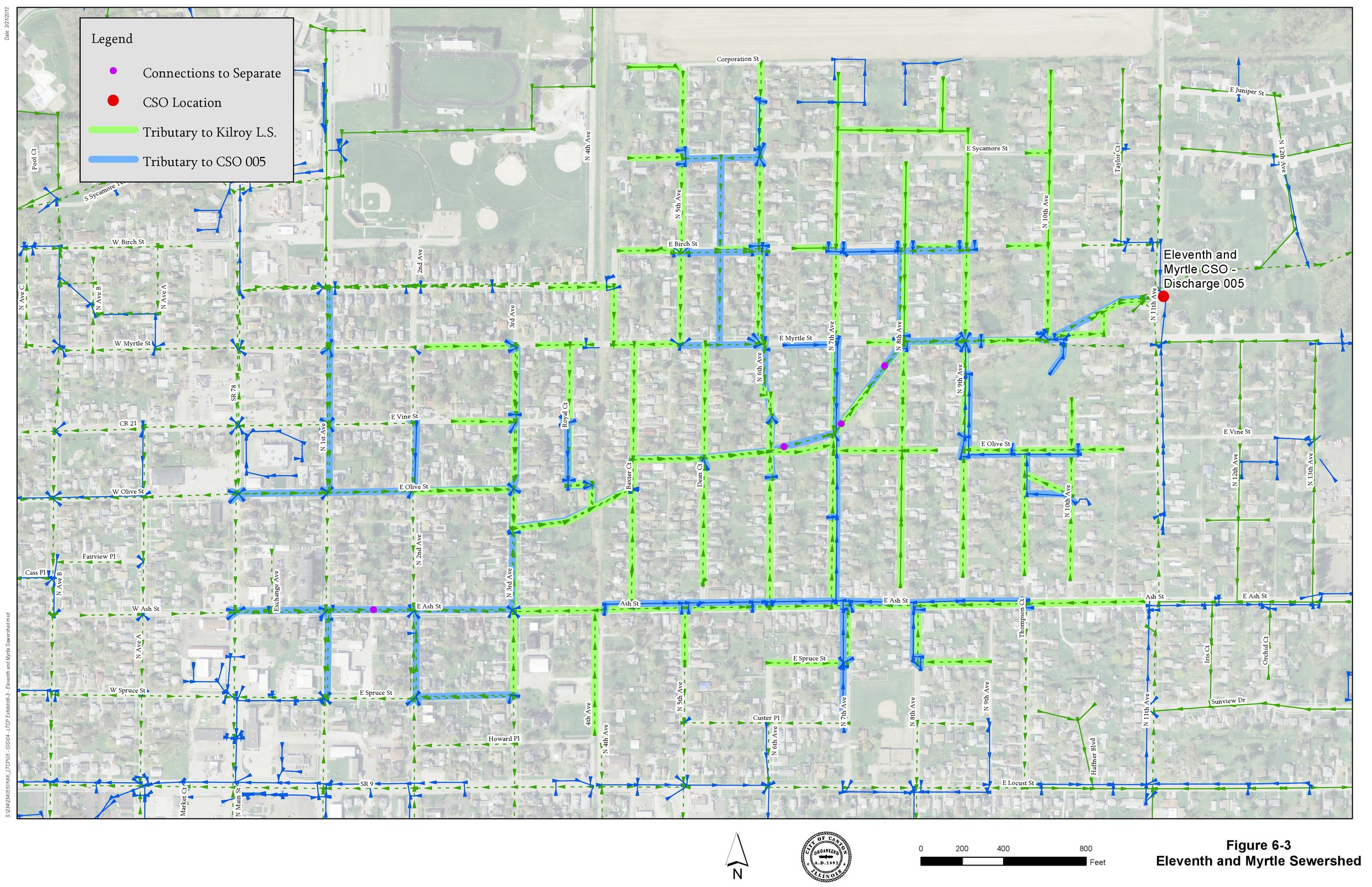
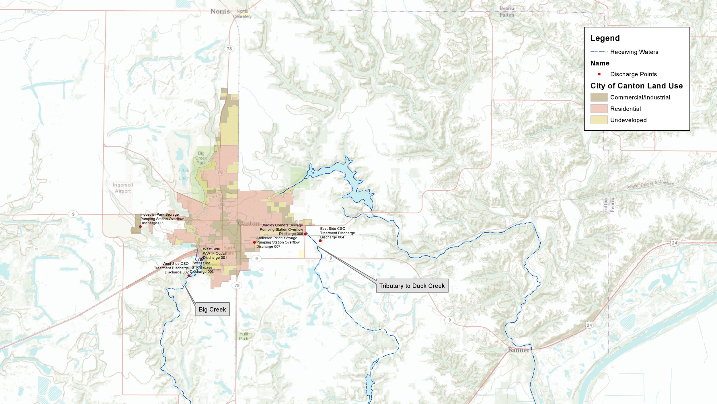
The City of Canton was required to update of their Long Term Control Plan as requested by the Illinois Environmental Protection Agency. As part of the update, all wastewater collection facilities including structures and sanitary, combined, and storm sewers of various sizes and material types were to be inspected and documented as part of the system characterization component of the plan. The work was recorded into a GIS database so that it may be used and maintained in the future.
Overall, the project consisted of the inspection of over 3,200 manholes and over 7,800 pipe connections within the sanitary sewer network. Thirty-four pieces of hydraulic monitoring equipment including flow meters, level monitors, and rain gauges were installed, maintained, and monitored for nearly two years. As a result of this project, the City now has a well developed mapping system for their sanitary sewer system.
Sewer system Characterization / Creve Coeur, Illinois
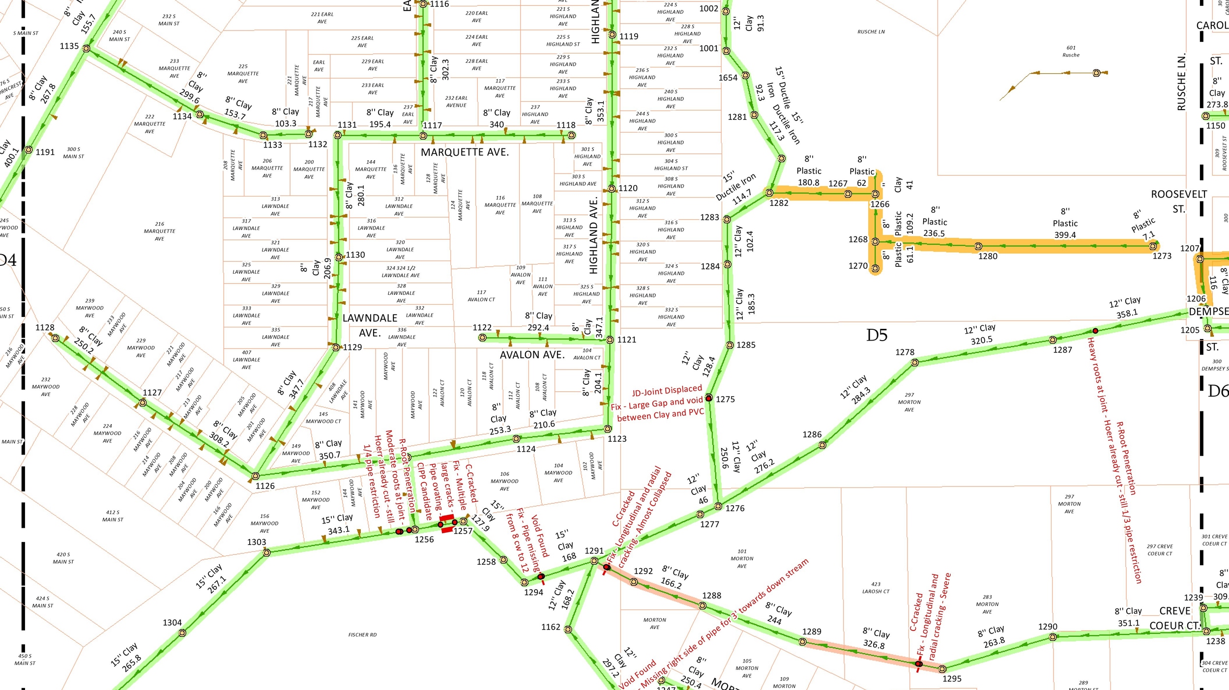
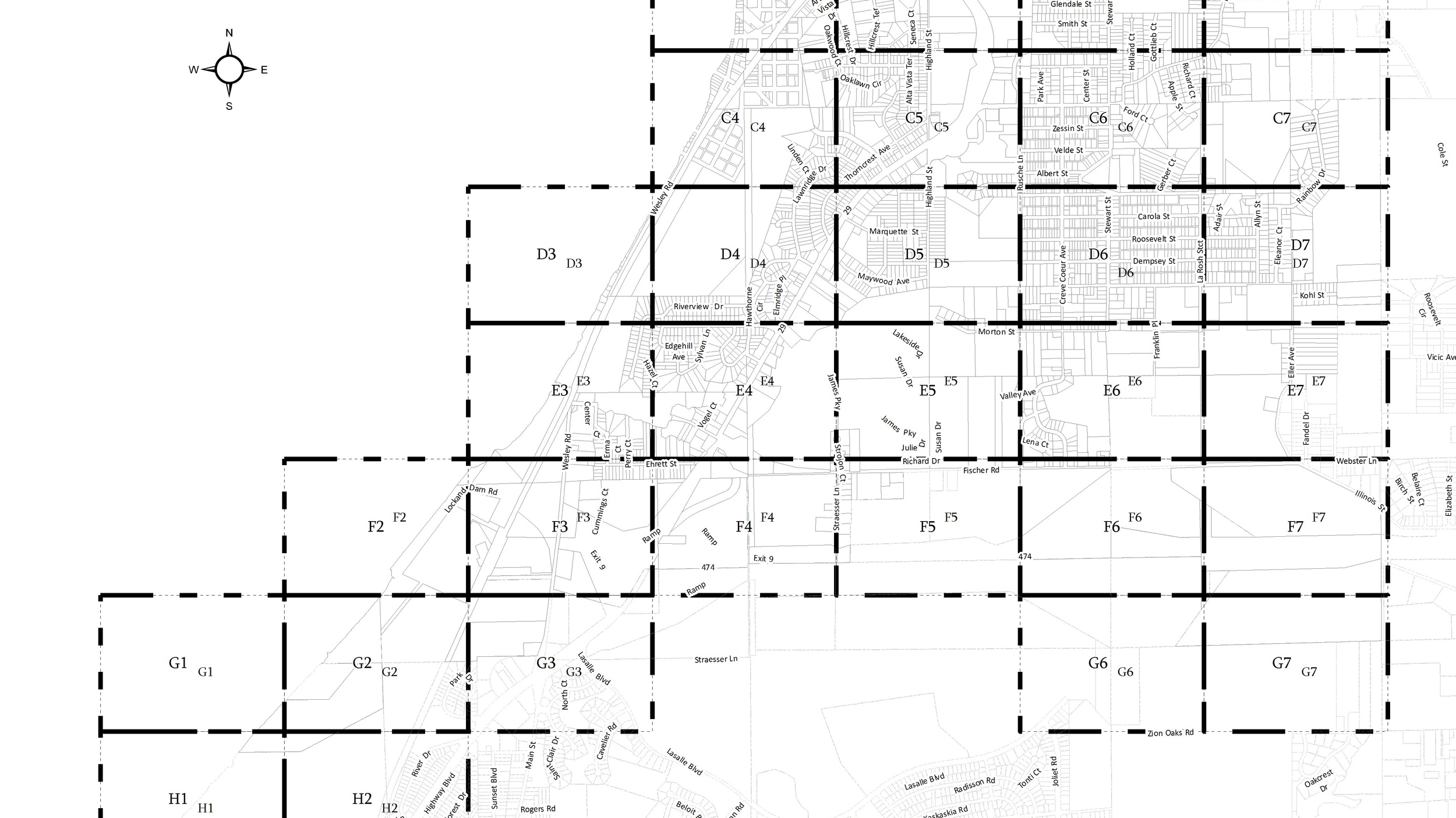
The Village of Creve Coeur began an exhaustive sanitary sewer system characterization effort as requested by the Illinois Environmental Protection Agency. As part of the update, all wastewater collection facilities including structures and sanitary sewers of various sizes and material types were to be inspected and documented as part of the system characterization component of the plan.
The project consisted of the field inspection of manholes and other collection system structures. The project also included the topographic survey of all of these items. All field data that was gathered was entered into a GIS system for quality control and for easier delivery and integration of the data to the owner which reduced overall cost. Comprehensive video inspection coordination and review was also conducted with all results being made a part of the Village’s nascent GIS database.
Hydrant Data Collection / Fulton County and Canton, Illinois
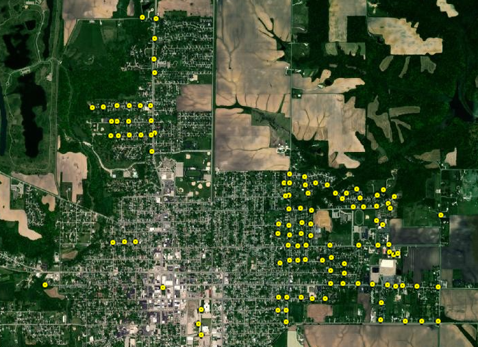
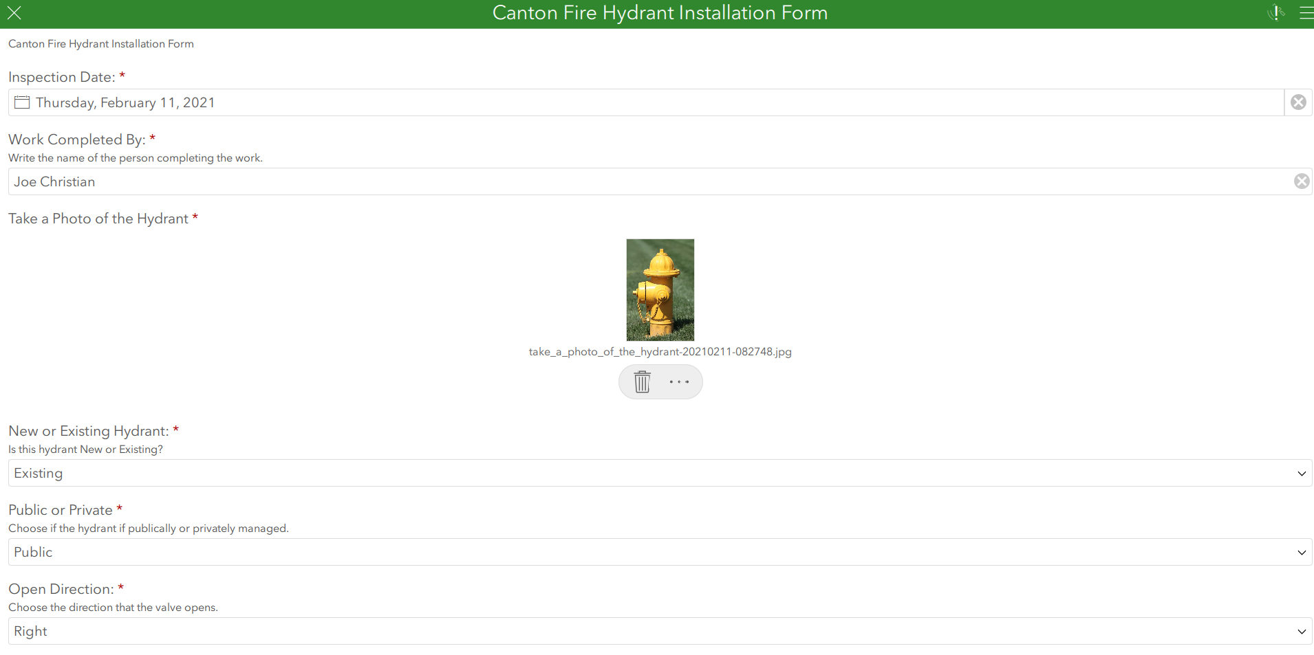
While working with the City of Canton, Illinois, Maurer-Stutz, Inc was approached to create a GIS application that allowed field crews to inventory the existing water hydrants not only for the City, but at the County level as well.
To achieve this, we created a Survey123 application through the Esri suite of applications. Survey123 allows field staff to collect hydrant specific data at each location, and log a photograph of each hydrant surveyed. In addition to that, all of the collected data is available to view online via ArcGIS Online.