GEOSPATIAL SERVICES
Our team of experts leverages cutting-edge geospatial technologies to provide precise, data-driven solutions that transform complex challenges into actionable insights. Whether you’re navigating civil utility asset inventories, environmental monitoring/inspections, infrastructure planning, agricultural facilities management, or any other geospatial challenge, we seamlessly integrate advanced GIS tools to unlock actionable insights for our clients.
Our mission is to transform our clients' and industry partners' unique visions into reality through specialized geospatial expertise.
By 2030, Maurer-Stutz Geospatial Services (MSGS) will be a recognized leader in geospatial services industry by providing solutions in the broadband, utility infrastructure, and consultant engineering domains.
Our Services
engineering assistance
Maurer-Stutz Geospatial Services handles many assorted projects from a wide array of client types. Different clients and jobs mean different deliverables and being able to adapt to the needs of each project.
-
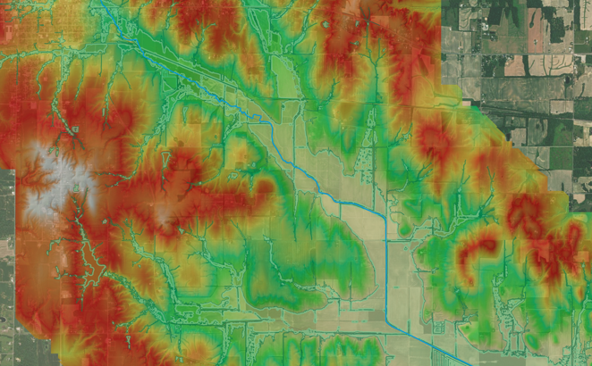
Watershed and flood-plain modeling using terrain, landcover, elevation, and stream data
Hydrologic analysis to support dam assessments, stormwater infrastructure design, and risk evaluation
Integration of geospatial layers and hydraulic data to predict runoff, flooding zones, and drainage behavior
Support for environmental compliance and long-term water-resource planning
-
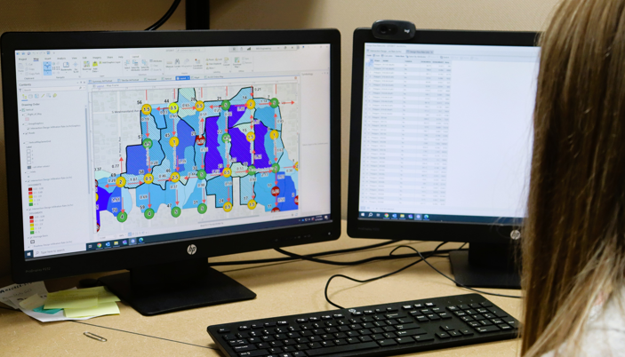
Advanced spatial data processing: network modeling for utilities, connectivity analysis, and asset tracing
Utility-network digitization, attribute-enriched mapping of water/sewer systems, and system connectivity checks
Custom geodatabase development and conversion of legacy data into organized spatial datasets
Analytical dashboards and reporting tools to help clients visualize, query, and manage infrastructure and spatial data
-
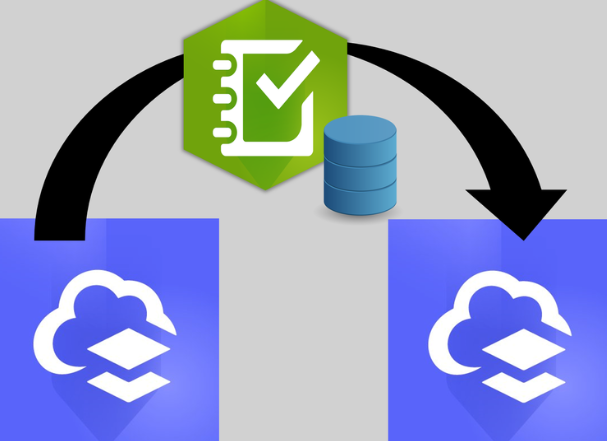
Setup and management of cloud-based GIS infrastructure for scalable, secure geospatial operations
Hosting, user-access control, and optimization of web-maps, feature layers, dashboards and apps
Seamless migration from on-premises GIS to cloud (e.g. Azure-based), reducing infrastructure overhead
Long-term support and maintenance: updates, backups, compliance, and performance tuning
-
Public-facing maps and interactive GIS apps for utilities, infrastructure, zoning, and assets
Digitization and mapping of municipal assets (water mains, sewer lines, storm systems, public works) for better asset management
GIS-enabled planning, inspection workflows, and infrastructure documentation for municipalities and counties
Flexible “block of hours” consulting model allowing agencies to access expert GIS support as needed

fiber services
We specialize in delivering tailored geospatial solutions for the fiber optic industry. Our Geospatial Fiber Services are designed to optimize every stage of your fiber network, from initial deployment to ongoing management, providing you with accurate, reliable insights that drive better decision-making.
-
Migrating your existing data into a GIS-based platform can seem daunting, but with MSGS, it doesn’t have to be. With our strategic partnership with GEOGRAPH our experienced team can assist with converting your data into the CrescentLink data model
-
Our managed services offering takes the burden of network management off your hands. From day-to-day operations to long-term performance monitoring, we handle it all. With a comprehensive approach that includes CrescentLink management, system enhancements, and on-demand support, MSGS ensures that your fiber network is always performing at its best.
-
Seamlessly integrating your current fiber network data into ArcGIS environments—both on-premises and in the cloud. This integration gives you full control over your network’s digital twin, allowing for real-time updates, advanced analytics, and enhanced decision-making.
-
MSGS assists fiber providers with Splice Record Importing, ensuring accurate integration of splice data into their GIS systems. Our process standardizes, cleans, and imports splice records, enabling seamless network visualization, improved troubleshooting, and efficient fiber management.
Geospatial Support
We support day-to-day municipal GIS operations, data management, mapping and analysis, system administration, and user support—ensuring geospatial systems remain accurate, secure, and aligned with organizational goals.
-
Keeping your network up-to-date and well-maintained is essential for performance and longevity. MSGS helps you manage your network’s digital twin, ensuring your physical infrastructure is mirrored accurately in the digital world. This enables you to visualize your entire network in real-time, troubleshoot issues faster, and make proactive adjustments before they impact your customers.
-
Mobile GIS workflows for accurate field data capture (utilities, assets, infrastructure, etc.)
Real-time geolocated photo capture and data entry through handheld devices or tablets
Rapid mapping of existing conditions - pipe networks, hydrants, inlets, valves - for inventory and maintenance planning
Custom field-collection apps and dashboards to streamline data gathering and reporting
-
Our Asset Management services help organizations inventory, manage, and analyze their physical and infrastructure assets using accurate, well-structured geospatial data. We design and maintain GIS-based asset systems that support lifecycle management, condition assessment, maintenance planning, and informed capital decision-making. By integrating spatial data with authoritative records, we enable clients to improve efficiency, reduce risk, and gain clear visibility into the location and performance of their assets.
-
To ensure municipalities have a robust, scalable, and high-performing geospatial system. We assess and modernize existing GIS infrastructures, optimizing databases, upgrading software, and workflows to enhance efficiency and reliability.
-
In today's fast-paced world, your organization needs GIS solutions that are agile, secure, and scalable. Our ArcGIS Enterprise Implementation Services on Azure provide exactly that—combining the robust capabilities of Esri's ArcGIS Enterprise with the flexibility and power of Microsoft Azure. Migrating ArcGIS Enterprise to Azure gives your organization the power of a flexible, secure, and scalable GIS infrastructure. Whether you’re running complex geospatial analyses, providing mapping services, or managing large-scale spatial data, we ensure your cloud GIS is always ready to meet your operational needs.
Take the next step in your geospatial journey with ArcGIS Enterprise on Azure. Our experts are here to help you plan, implement, and manage a cloud-first GIS that empowers your organization to unlock the full potential of its spatial data.

-
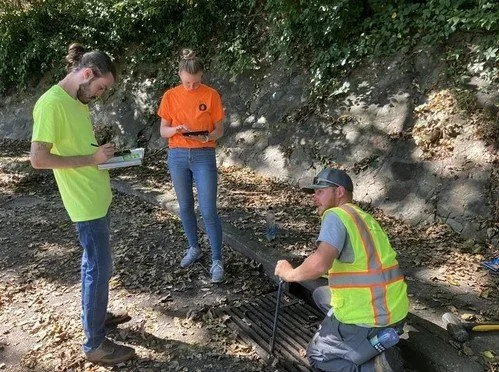
![Three people working outdoors near a storm drain.]()
CSO Inlet Inspection / Peoria, Illinois
The City of Peoria initiated a stormwater inlet inspection project to improve flood management and drainage efficiency. Using ArcGIS Field Maps, inspectors were able to collect real-time data on the condition of stormwater inlets throughout the city. The mobile application enabled field staff to seamlessly capture geolocated photos, assess the structural integrity of inlets, and flag maintenance issues directly from the site. This streamlined process improved data accuracy and ensured that updates were instantly available for city engineers and decision-makers.
The integration of ArcGIS Field Maps with Peoria’s GIS system allowed for the rapid identification of problem areas and facilitated efficient scheduling of repairs. Customized forms within the app enabled inspectors to quickly input specific details such as inlet type, blockage levels, and debris type. This enhanced data collection approach not only helped the city prioritize maintenance efforts but also contributed to long-term stormwater infrastructure planning and improved urban flood prevention strategies.
-
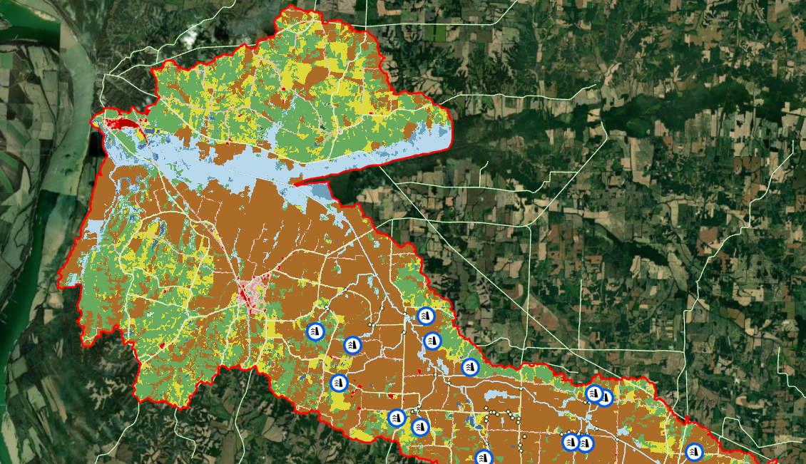
![Color-coded map of land use or zoning within a defined area, with blue icons indicating locations of water facilities or utilities.]()
NRCS Dam Assessments / Kentucky, South Carolina
Maurer-Stutz collaborates with the Natural Resources Conservation Service (NRCS) across multiple states to inspect dams and assess their risk levels based on surrounding features. These assessments provide valuable insights that guide decisions on allocating funding to maintain dams effectively.
The Geospatial team leverages various inputs—including land cover, elevation data, streamlines, and the FEMA 100-year floodplain—to develop precise models. By combining GIS technology with hydraulic modeling, we identify streamline refinement regions, pinpoint Potential Damage Locations (PDLs), and create watershed analyses. This process helps us determine which dams pose the highest risk and require the most maintenance and upkeep.
-
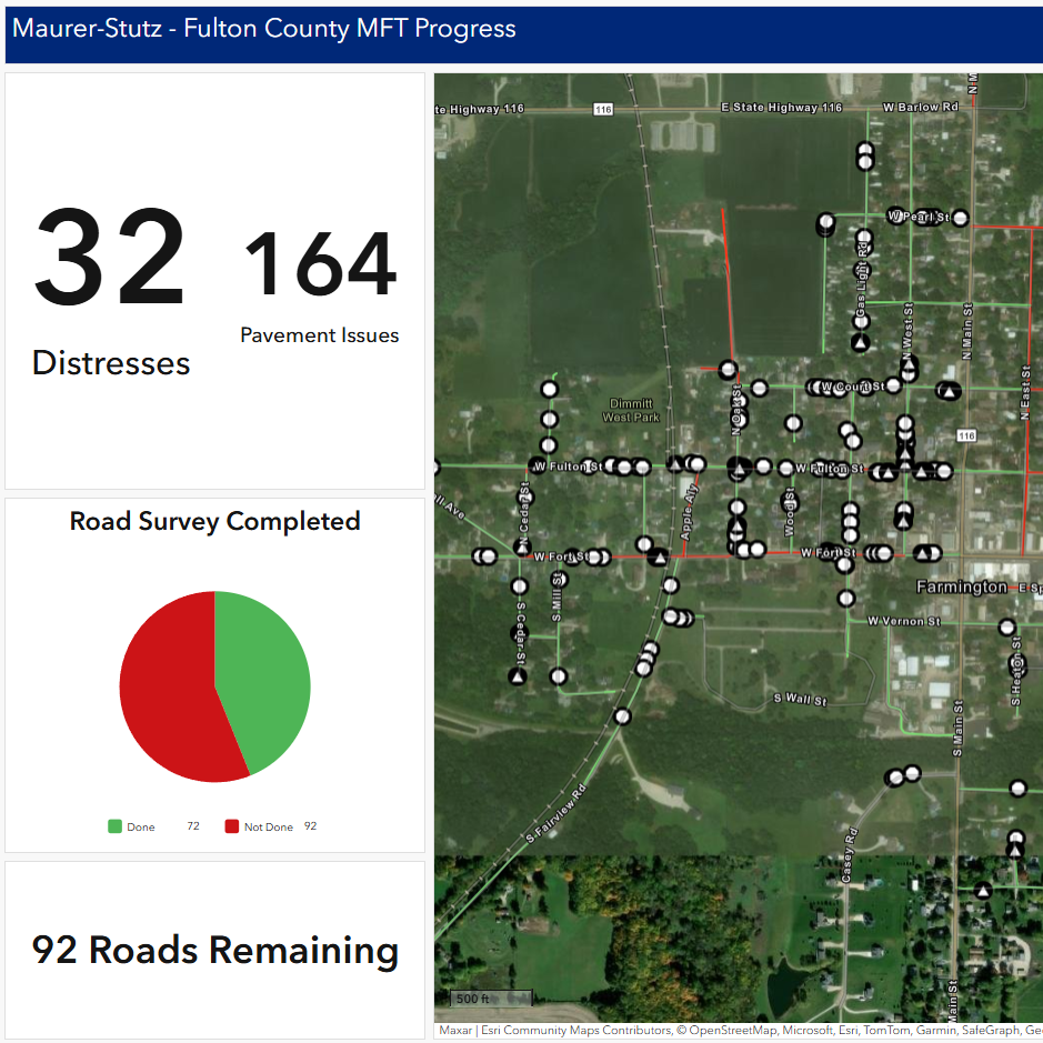
![Map showing road survey progress.]()
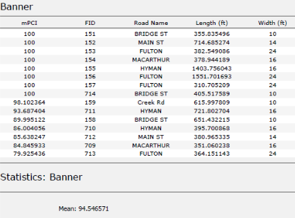
Motor Fuel Tax Assessment / Fulton County, Illinois
Fulton County, IL required a comprehensive pavement assessment to address critical infrastructure needs, and the Maurer-Stutz Geospatial team and Transportation group provided key support. This assessment involved surveying all township roads to document pavement and shoulder types, as well as identifying road distresses. The data collected helps the county develop a data-driven plan for allocating Motor Fuel Tax funding.
The Geospatial team played a crucial role by utilizing ArcGIS Field Maps, Dashboards, and Quick Capture. With Field Maps, transportation engineers accurately identified pavement types and other road features. Quick Capture allowed for the rapid collection of GPS points to mark pavement distresses, while a customized Dashboard was used to monitor progress and track identified issues throughout the project.
-
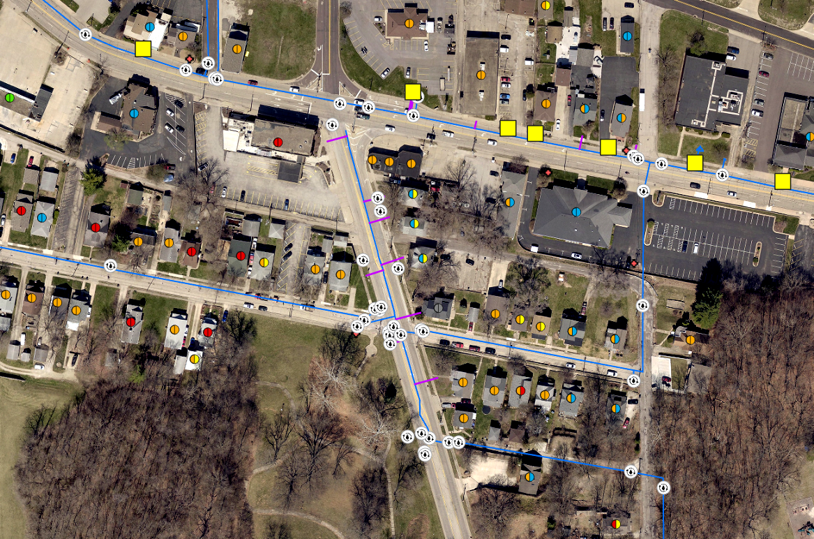
![aerial view of a neighborhood with houses, a parking lot, and a street marked with blue lines and symbols indicating utilities or infrastructure.]()
Utility Networking / Canton, IL
Canton, IL sought to update their utility data to better understand the connectivity of their water lines, automate data analysis, and create a visual representation of their water networks. By applying customized rules and parameters, the Utility Network provides clients with a deeper understanding of their systems while enhancing security and operational efficiency.
Using the Utility Network extension in ArcGIS Pro, we can transform existing utility data into a detailed, interconnected model featuring components such as pipelines and valves. This advanced system allows us to track how water moves through the community and helps mitigate risks, such as water main breaks, by enabling pipe isolation and tracing the issue through upstream or downstream analysis.
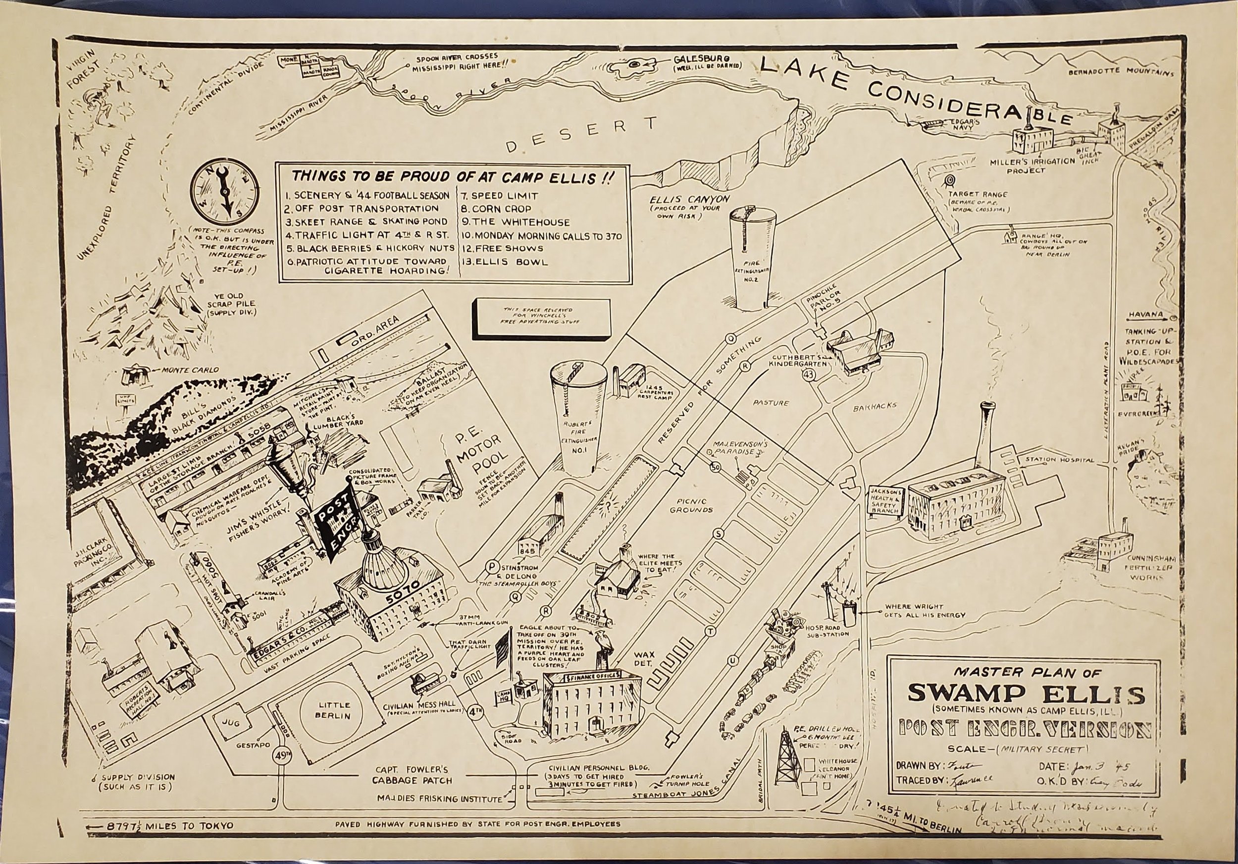

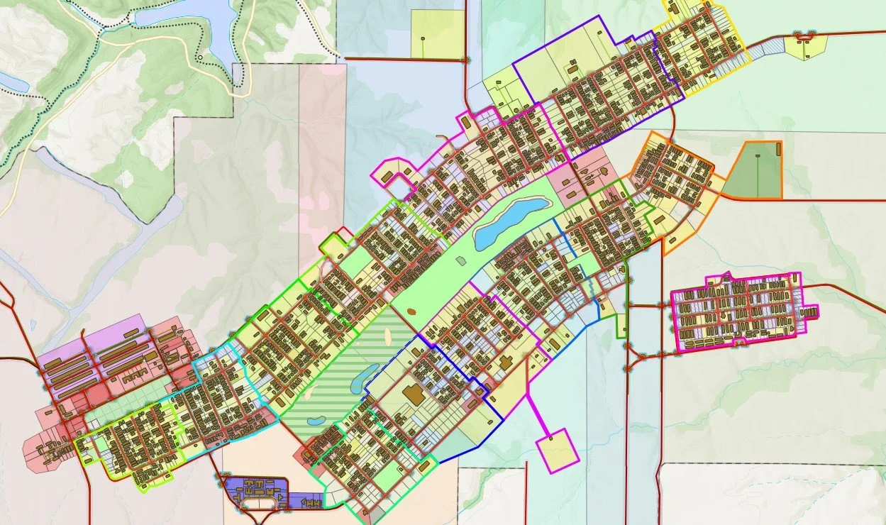
Ellis City Demo
A demonstration city’s GIS that we could use and show off without the fear of exposing sensitive or personal data. Click the button below to visit the Hub site and get a taste of what MSGS offers
Discover a new perspective
Our team of experts leverages cutting-edge geospatial technologies to provide precise, data-driven solutions that transform complex challenges into actionable insights. Whether you’re navigating civil utility asset inventories, environmental monitoring/inspections, infrastructure planning, agricultural facilities management, or any other geospatial challenge, we seamlessly integrate advanced GIS tools to unlock actionable insights for our clients.
At MSGS, we go beyond traditional GIS by integrating innovation with industry-leading expertise. From project inception to completion, our geospatial solutions are designed to streamline processes, enhance decision-making, and ensure your project’s success. Explore how we can help you see your projects from a whole new vantage point.

We turn these Insights into blog posts