
Transportation / Intersections
Intersections
Woodford County Highway 13 / Roanoke, Illinois


As part of a larger Phase I Study for the federally funded (STR and TARP) reconstruction of a 4-mile section of CH 13 south of Roanoke from IL Rte 116 to US Rte 24, Maurer-Stutz performed 2 Intersection Design Studies. The northern intersection involved Woodford CH 13 at Front Street in Roanoke (Woodford CH 4) and the final design resulted in the realignment of CH 13 through the intersection due to the existing 100’ offset between the north and south legs of CH 13. The southern intersection consisted of Woodford CH 13 at US Route 24. The study for the southern intersection was further complicated due to the proximity of the active railroad tracks immediately north of and parallel to US Route 24. Our client was the Woodford County Highway Department
Bottom Road Bridge / Putnam County, Illinois


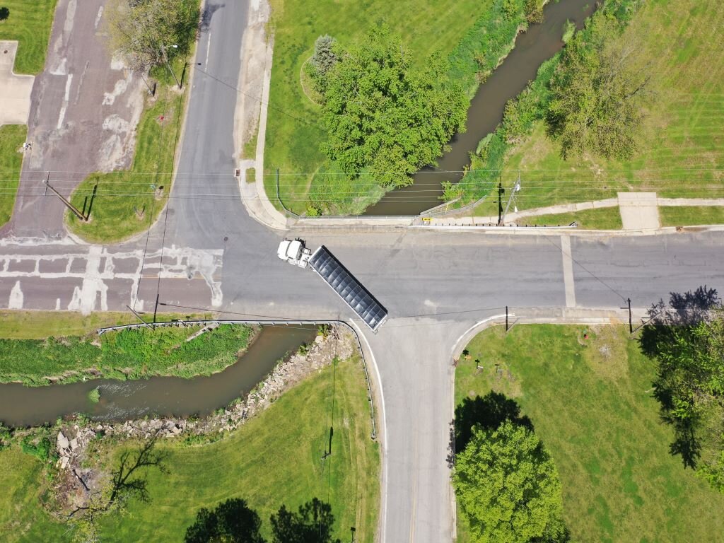
The Putnam County Highway Department reached out to Maurer-Stutz to discuss options for replacing their failing bridge on Bottom Road (CH 16) just east of the intersection with IL Rte 89. The bridge was originally constructed in 1950 and was in such poor condition that the trucks were no longer allowed to use the road. One of the first challenges on the project was to obtain funding assistance. Maurer-Stutz assisted the County with successfully applying for Major Bridge Funding from the FHWA. Putnam County officials and our engineering staff also recognized the poor geometry of the existing offset intersection of IL Rte 89 and the east and west legs of Bottom Road were contributing to unnecessary crashes. Working closely with the County and IDOT, we were able to obtain additional funding to study geometric improvements to the intersection as a part of the structure replacement process. The final solution included a channel realignment with a new structure relocated further back from adjacent IL Rte 89. Additional geometric improvements included realigning the east leg of Bottom Road to eliminate the offset intersection, as well as the addition of turn lanes on both the state highway and Bottom Road.
Design challenges that were expertly addressed by our staff included relocating the channel outside of the IDOT ROW, adding a channel drop structure, realigning the intersection, dealing with potential differential settlement issues, dealing with impacts to the tall backslope, removal and disposal of regulated substances and redesigning and permitting the proposed Spring Valley Boat Club sedimentation basin which conflicted with the proposed Bottom Road realignment.
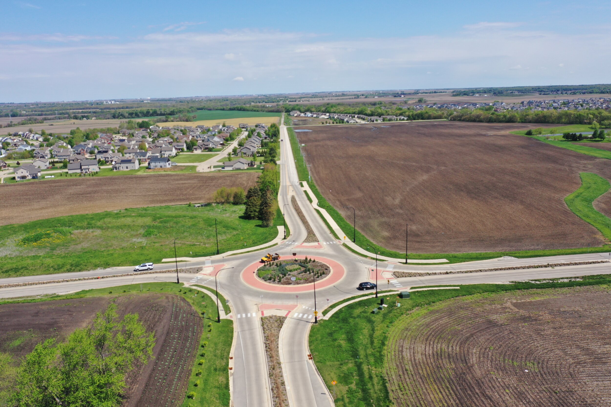
Alta Rd and Allen Rd Roundabout / Peoria, Illinois


This project for the City of Peoria began as an accelerated Phase I planning study with a hydraulic report leading to a Phase II structure and roadway design for the emergency replacement of failed dual 9’ diameter CMPs with a new dual cell 8’ x 10’ concrete box culvert. The Federally funded replacement design included alternate bids for both a cast in place and a precast box culvert to give contractors flexibility in their approach to getting the busy intersection reopened as soon as possible. Planning and Design included complete hydraulic survey, hydraulic analysis that included extensive coordination with IDOT, Peoria County and adjacent property owners, and geotechnical assessments that led to targeted undercutting beneath a portion of the new box culvert. The culvert configuration was developed with consideration given to future major reconstruction of the 4-way stop intersection. Maurer-Stutz also assisted with coordination of Federal Emergency Relief Funding and provided all Phase III construction engineering utilizing IDOT ICORS documentation and material certifications.
Once the roadway was reopened, the next step was to address the ongoing peak-hour delays that were occurring with the combination of 13,000 cars per day trying to get through a four-way stop intersection. The Intersection Design Study resulted in the selection of a modern roundabout. Preliminary engineering work included full design of the modern roundabout, reconstruction of roadway approaches, retaining walls, multi-use paths, roundabout lighting, signing, drainage design with storm sewer, and all necessary right of way documents and coordination.
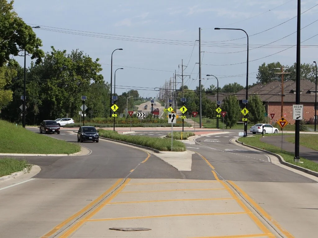
Alta Ln and Radnor Rd Roundabout / Peoria, Illinois


This Maurer-Stutz project for the City of Peoria started with a Phase I Planning Study of the intersection including investigation and presentation of numerous alternatives with a capacity analysis performed for each alternative and, ultimately, an Intersection Design Study with IDOT approval for the selected roundabout option.
Services also included coordination with the City of Peoria, Radnor Township, Peoria County Highway Department and IDOT. There was also significant coordination with utilities and adjacent property owners including developers. Phase I Study included coordination, exhibit and presentation preparation and staffing for two public meetings along with a Project Development Report for the HSIP funded intersection reconstruction.
The Phase II design of the single lane roundabout consisted of geometric design of the entire roundabout roadway including approaches and splitter islands, drainage design with storm sewer and culverts, signing, striping and lighting, drainage design, along with land acquisition and right of way coordination and assistance.
Allen Rd and Alta Ln Intersection / Peoria, IL


The Illinois Department of Transportation selected Maurer-Stutz, to provide Phase I Study and Phase II Design of the reconstruction of the section of Allen Road from Townline Road to Alta Road in north Peoria. The project consisted of 1.1 miles of pavement widening, realignment and reconstruction, five intersection reconstructions, two freeway interchange terminals, reconstruction and widening of a freeway overpass to 5 lanes plus a multi-use path, construction of a new tunnel for a multi-use trail under the roadway, and realignment of a y-intersection to a t-intersection. A total of 4 Intersection Design Studies (IDS’s) were prepared and coordinated with IDOT as part of the Phase I Study that also included preliminary/conceptual design of 2 roundabouts. The study also required Section 4(f) public land coordination due to the adjacent Rock Island Trail.
In addition to the widening and rehabilitation of the IL Route 6 overpass, the structural planning and design work also included a 190 ft. long box culvert tunnel beneath the Allen Road/Alta Lane intersection for the Rock Island Trail State Park Crossing.
New signals were designed at the Townline Road intersection, as well as at both ramp interchange terminals. A storm sewer system was also developed with detention, the needs of which were identified during the Location Drainage Study for the project.