Maurer-Stutz
  • Home
  • Services
    • Agricultural and Livestock Engineering
      • Livestock Facility Planning and Design
    • Conservation and Natural Resources
    • Site Development and Private Civil
      • Transportation
      • Surveying Support
    • Municipal and Public Works
      • Water Systems
      • Wastewater Systems
      • Transportation
      • Construction Engineering and Observation
    • Structural Design and Investigations
    • Surveying and Geospatial
      • GIS / Geospatial Solutions
      • Land Surveying
  • News
  • About Us
    • Licensure and Prequals
  • Careers
  • Contact
  • Click to open the search input field Click to open the search input field Search
  • Menu Menu

It’s Conference Season Already! (PART 1)

September 18, 2024/in MSGS News/by Micah Williamson

Geospatial andgt; The Layer File andgt; It’s Conference Season Already! (PART 1)

it’s September.

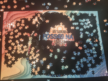
Which means the fall conference season is here. While our young team is still deciding which organizations to support and be a part of, there are a few that are a no brainer: ILGISA, IACE, EPN just to name three. Last week, Baylor and I both visited separate conferences to see if they would be good conferences to attend or even exhibit at in future years. Below is Micah’s summary of FOSS4G NA. Baylor’s Summary of GEOGRAPH will be next.

FOSS4G North America

The 2024 Free and Open Source Software for Geospatial (FOSS4G) North America conference took place in St. Louis, Missouri, from September 9-11. It attracted a wide variety of geospatial professionals, developers, and enthusiasts to collaborate and explore the transformative potential of open-source geospatial technologies. A key focus of the conference was on democratizing access to geospatial tools, emphasizing how open-source solutions can empower individuals, small businesses, and organizations.

I (Micah) actually did my Master’s thesis on FOSS4G software in the Enterprise GIS realm. So, even with spending 90% of my career in Esri software, I have a working knowledge of the players and platforms. Additionally, the STL is too close not to attend such a notable and relevant conference. Aside from the agenda looking great, I wanted to meet a few of the people I saw chatting about the conference online. Unfortunately, due to scheduling issues and family commitments, I could only attend on Wednesday. Still, I wanted to know where FOSS4G as an industry is compared to the proprietary behemoth with whom we are admittedly a part of their partnership network.


Sessions

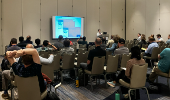
The sessions I leaned towards spoke of web mapping, data, and enterprise systems. I learned that there is a working community group at the the World Wide Web Consortium (W3C) to develop standards and guidelines for creating a new standardized and easy map HTML element for display in modern browsers. The demonstration of MapML showed tiling, full screen, as well as pop-ups interacting with the OGC services from GeoServer via custom CSS. Noting stated about other protocols.

What I did learn about Parquet and GeoParquet is that I should be using it. Not so much Crunchy Bridge analytics, I don’t have that much data and it’s too onerous to port what I do have.

Although, the Overture Map Foundation is of interest, I’m skeptical. My very distilled explanation is that it starts with Open Street Map data, enhances with TomTom data and a dash of Foursquare into it, and provides it to whoever wants to download. I do want to critically look at the data for the small towns that are our clients. Also, this may be a great place to start to learn GeoParquet seeing that is how they deliver the data. Regardless of the quality of data, it was a fantastic presentation by Steven Pousty.

After lunch, and learning that Mapillary is actually owned by Meta now (Hello 2020), I heard the best quote from the developer of startup GeoBlaze during a live demo on Hotel WiFi: “It’s so fast, you think it’s not working”, neat tool, don’t know what it’s for. I tried to learn how to scrape geodata, but was quickly lost in the technical details.

The final presentation I went to was to see the evolution of GeoMoose 4. This fast, lightweight web viewer now works serverless. Dan Little showed the snazzy demo published from a public Google Drive folder. The application has quite the modern ‘feel’ and read geo layers right from within the folder.

Thoughts

Here’s a Hot Take: Linux and other FOSS may run the world during apocalypse, but that's not now.

I believe in the idealism and the core principles of Free and Open Source Software, but I don’t think they’re practical in real life (Insert your token statistic here of what already runs on FOSS). Believe me, as a card-carrying GenXer, I LOVE the idea of going against the grain. I push back whenever I can, I listen to STP on 11, I don’t match my socks, and drive an old jeep because I choose to, don’t you dare tell me what to do. That mentality is all well and good when you are your own boss or there is a principled leadership decision to use FOSS. As a consultant using someone else’s money to build a business that plays nicely with a local governments’ GIS and a DOT’s project requirements, I need to use the proprietary software that they are or tell us to.

Here’s a hard truth, using FOSS, and specifically FOSS4G, is not easy. I still don’t see a complete out-of-the-box FOSS enterprise GIS solution that can compete with ArcGIS Enterprise. This discrepancy is especially accentuated when 99% of your clients use Esri. Do not misunderstand, sometimes Esri is the bane of my existence. I can rant and rail with the best of the trolls, but this is business. I need to prove my excellence in the board room and on proposals in the most efficient way possible. Everyone loves to hate on success while they quietly try and copy it.

I will continue to keep an eye on FOSS4G. I promise to keep my version of QGIS updated. I will not roll my eyes at open-source projects. I will continue to push for open standards and data. I also appreciate the community built around FOSS4G. Everyone loves an underdog.

https://www.mstutz.com/wp-content/uploads/2026/08/Logo-1030x301.webp 0 0 Micah Williamson https://www.mstutz.com/wp-content/uploads/2026/08/Logo-1030x301.webp Micah Williamson2024-09-18 16:01:002026-11-09 16:16:25It’s Conference Season Already! (PART 1)

A Map, a Move, and a Mission

September 9, 2024/in MSGS News/by Baylor Wagehoft

Geospatial andgt; The Layer File andgt; A Map, A Move, and A Mission

During an evening newscast in 1969, Walter Cronkite coined Chattanooga, Tennessee, as the “Dirtiest City in America”. This moniker was probably not that far from the truth, as the City’s historic Iron Foundries (dating back to the Civil War) and industrial sites polluted to air and water. However, since then, the City has completely shed that title. It is consistently ranked as the best place to live in Tennessee and named the “Best Town Ever” by Outdoor Magazine. It’s a hub for insurance giants (BCBS and UNUM), startups (specifically Quantum computing research), electric vehicle manufacturing (Volkswagen North America), and a thriving logistics network along a major interstate junction (I-75 andamp; I-24).

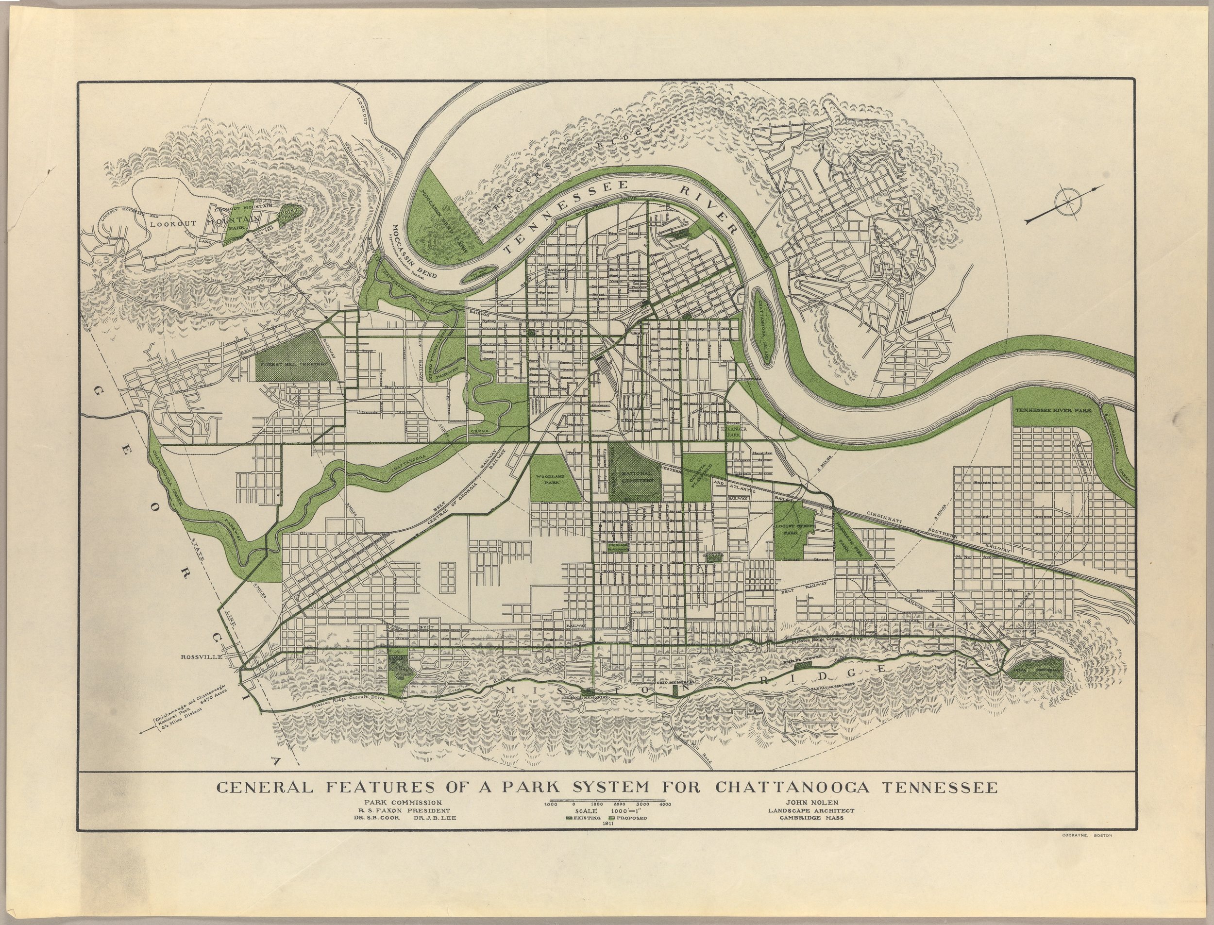
Recently, the City embarked on an ambitious plan to become a National Park City. As part of this initiative, Charlie Hale (GIS Director at the University of Tennessee Chattanooga), was asked to develop an inspiring map that would chart a “vision” for Chattanooga’s Park System. This article is definitely worth a read itself (that map went on to be a winner at the 2023 ESRI UC map contest), but one of the things I found most interesting was actually the 1911 John Nolen Map.

 Credit: John Nolen Papers, #2903. Division of Rare and Manuscript Collections, Cornell University Library.

Credit: John Nolen Papers, #2903. Division of Rare and Manuscript Collections, Cornell University Library.

I think what I love about this map most is how simply it calls the viewer to a vision. There are only two colors: Black cadastral lines and Green for Parks/Greenways. Readers are immediately drawn to the most prominent geologic features of the area (Tennessee River, Lookout/Signal Mountain, and Missionary Ridge) and how the park system can work with them. Upon closer inspection, the designer has connected the larger park areas with Greenways along existing major thoroughfares – a call to the current day Complete Streets movement. Small details – like the map being rotated to the street grid and the hilly, forested areas hatched – enhance the map’s purpose and vision.

This map does one thing really well – it sets a vision for a thriving park system in a town plagued (at the time) by industrial waste and smog. I can put myself in the eyes of a resident and say “yeah, I can get behind this vision”. It may have taken over 100 years (and maybe a few decades more to fully “realize”) but I’d call its mission a success.

If you haven’t guessed already, I love talking about (okay, more like fawning over)andnbsp;the city of Chattanooga, Tennessee. My family and I love this area of the Country and the sense of place that is present here. It’s always been our dream to make the “big move” and raise our family here. Well, that dream officially became a reality 2 weeks ago. Thankfully, the move went very smooth and the only “casualty” was a broke salt-shaker!

Although the move may be a bit bittersweet in some ways (missing those impromptu office chats with the great team at Maurer-Stutz), we see this is a great opportunity to expand the mission and vision of Maurer-Stutz Geospatial Services to clients throughout the Tennessee and the Southeast. I recently attended the GEOGRAPH User Conference in Greenville, South Carolina. Be on the lookout for that blog soon!

The Southeast is booming, and MSGS will be there to help communities, businesses, and stakeholders meet their geospatial needs.

https://www.mstutz.com/wp-content/uploads/2024/09/RMC2015_0023.webp 1905 2500 Baylor Wagehoft https://www.mstutz.com/wp-content/uploads/2026/08/Logo-1030x301.webp Baylor Wagehoft2024-09-09 13:32:002026-11-09 16:31:42A Map, a Move, and a Mission

Advanced GIS Leadership

August 19, 2024/in MSGS News/by Micah Williamson

Geospatial andgt; The Layer File andgt; Advanced GIS Leadership

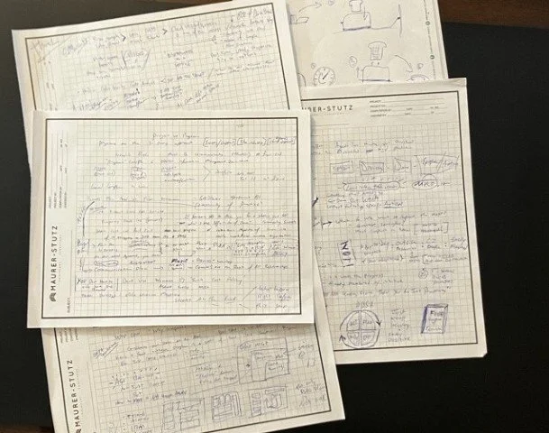
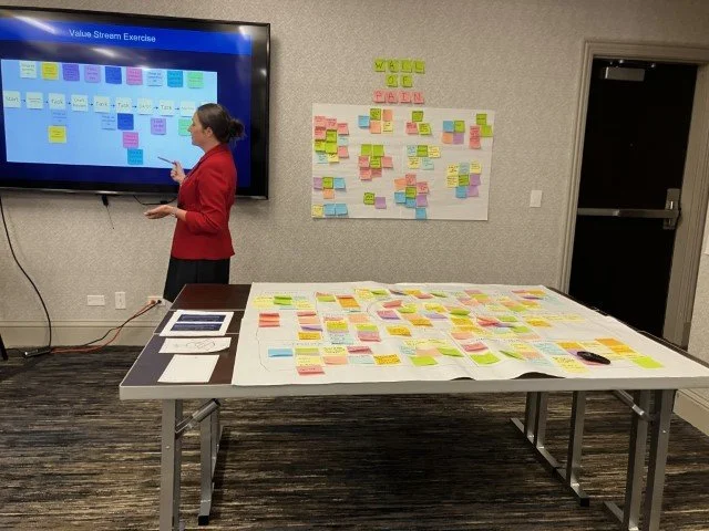
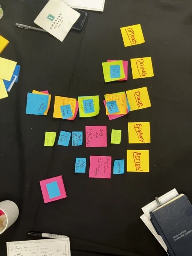
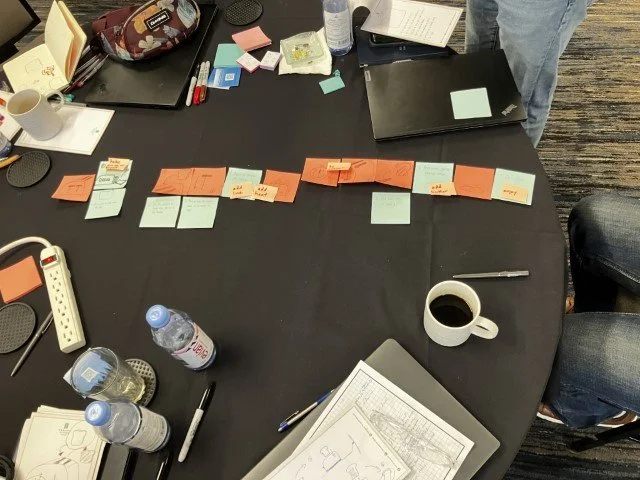
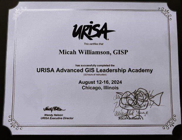
Last week, I had the opportunity to attend the URISA Advanced GIS Leadership Academy in Chicago, and it was a game-changer for how I approach both leadership and GIS. This intensive program brought together GIS professionals from across the country, each of us had unique challenges and insights, but all sharing some common experiences and struggles. It was a bit of therapy really. Among the many sessions, the ones on Value Stream Mapping and Personal Kanban really stood out to me.

Value Stream Mapping

A method that helps visualize and optimize the flow of processes in our projects. It’s a powerful way to identify bottlenecks and streamline our workflows, ensuring that we’re delivering the best results with maximum efficiency. I’m already thinking about how to apply these concepts to enhance our project management at Maurer-Stutz.

Personal Kanban

Another session that really resonated with me was on Personal Kanban. I’ve played with Kanban before (pronounced however you pronounce “pecan”) This approach to managing tasks and workflows is both simple and effective, offering a visual way to prioritize and track work. It’s about finding balance and focus, two things that can be challenging in our fast-paced field. I’m eager to get back to Kanban, not just for myself, but also to encourage my team to use it as a way to stay organized and reduce stress.

Additional highlights focused on:

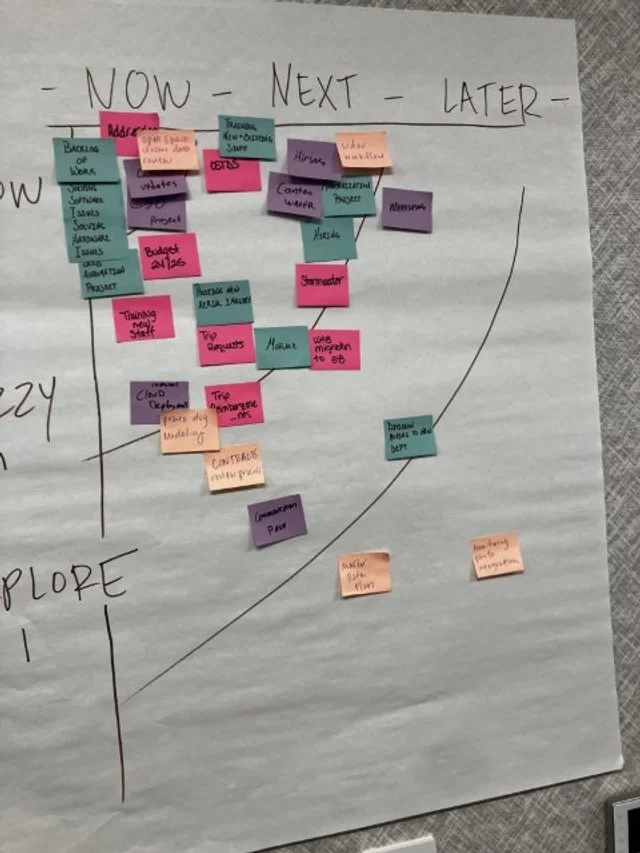
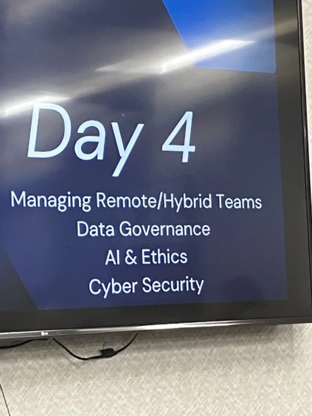
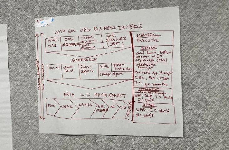
Building and sustaining Effective teams even with remote members. Road-mapping a hypothetical GIS project as a group, providing clear near-term and long-term GIS initiatives. The Data Governance session highlighted the importance of establishing policies and standards regardless the size of the organization. Ans of course we discussed the Ethics of GIS projects emphasizing the impact of decisions on privacy and equity. These sessions reinforced my approach to building the MSGS department at Maurer-Stutz, where we are striving to integrate geospatial solutions seamlessly with our civil and transportation engineering projects as well as our own stream of projects.

It was just a great chance to connect with other GIS professionals and hear about their experiences. The discussions were real, down-to-earth, and incredibly valuable for someone in my role. Overall, the academy left me with fresh ideas and practical strategies that I’m excited to bring back to our team. If you ever get the chance to attend, I highly recommend it—especially if you’re looking to refine your leadership skills and get a better handle on managing your team and projects. I’m looking forward to applying these lessons as we continue to grow and evolve the MSGS department.

https://www.mstutz.com/wp-content/uploads/2024/08/1723815560343.webp 500 800 Micah Williamson https://www.mstutz.com/wp-content/uploads/2026/08/Logo-1030x301.webp Micah Williamson2024-08-19 22:00:392026-11-09 16:16:25Advanced GIS Leadership

Baylor is Back

July 29, 2024/in MSGS News/by Micah Williamson

Geospatial andgt; The Layer File andgt; Baylor is Back

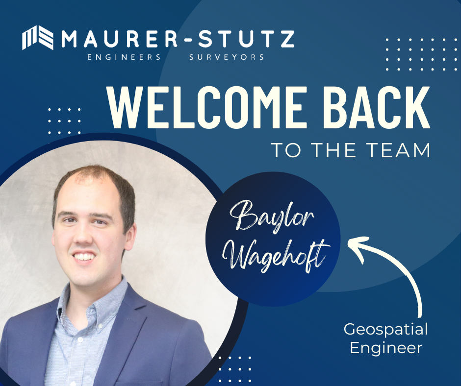
We are very excited and happy to welcome back Baylor Wagehoft as a Geospatial Engineer to the Maurer-Stutz Geospatial Services team.

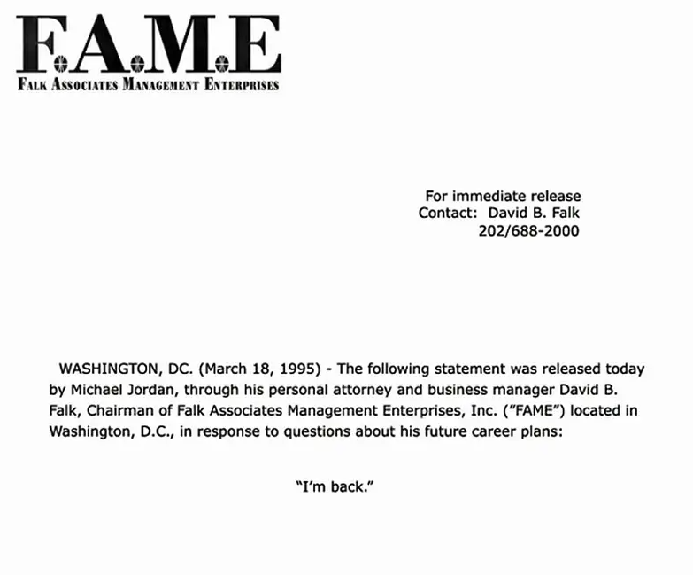
His email to the Maurer-Stutz staff that announced his return was a geospatial take on the 1995 Michael Jordan Announcement of his return to basketball. I’M BACK.

 Baylor’s ‘Fax’ email

Baylor’s ‘Fax’ email

 Copy of Jordan’s actual Fax to several sports outlets

Copy of Jordan’s actual Fax to several sports outlets

Baylor started at MSI in July 2017 as a Transportation Engineer. Then in October 2023 he took a GIS job at i3 Broadband. As we began putting efforts into developing our Maurer-Stutz Geospatial Services group, Baylor stood out as a possible re-acquisition. Thankfully he was open to the idea and we came to an agreement. He finished out June at i3 then took a few weeks off in between to see a sister get married in Spain and will begin his second term at MSI as a Geospatial Engineer on July 30th. We are glad to have him back.andnbsp;

https://www.mstutz.com/wp-content/uploads/2024/07/content.webp 788 940 Micah Williamson https://www.mstutz.com/wp-content/uploads/2026/08/Logo-1030x301.webp Micah Williamson2024-07-29 21:28:002026-11-09 16:32:31Baylor is Back

We’ve got SWAG!

July 12, 2024/in MSGS News/by Micah Williamson

Geospatial andgt; The Layer File andgt; We’ve Got Swag

Not the Jay Z kind, rather the Stuff-We-All-Get kind.

Contrary to popular belief, JayZ didn’t come up with the word swag, he just shortened swagger. In the original Middle-English (according to Google) ‘swag’ is a word of Scandinavian origin meaning ‘bulging bag’. Which is fitting.

Let’s admit it, we all go to conferences to get our own bags of stuff… and training, but really the stuff. Well, thanks to the great marketing strategy already established at Maurer-Stutz, We’ve got a whole storage room filled with SWAG to give away, including a few humorous stress toys from our Agriculture group. While we are not bringing cows or poop-emojis to ILGISA, we are bringing some MSGS-specific stuff: Stickers, Pens, and a few t-shirt for selected clients. We have our own geospatial-related banners and an expanding table-top display. In short, we are ready for the fall conference season.

See you at ILGISA!

https://www.mstutz.com/wp-content/uploads/2024/07/2024-08-0110_38_04-Chat_MicahWilliamson28You29_maurerstutzinc_mjwilliamson40mstutz.com_Micro.webp 467 467 Micah Williamson https://www.mstutz.com/wp-content/uploads/2026/08/Logo-1030x301.webp Micah Williamson2024-07-12 21:31:002026-11-09 16:16:25We’ve got SWAG!

Introducing MSGS

June 10, 2024/in MSGS News, Projects/by Maurer-Stutz

Geospatial andgt; The Layer File andgt; Introducing MSGS

Maurer-Stutz Inc. is excited to announce the launch of Maurer-Stutz Geospatial Services andnbsp;(MSGS), our newly revamped and dedicated geospatial division. With a clear vision and strategic direction, MSGS is set to elevate our geospatial capabilities to new heights. This is not a new bolt-on service, rather the effort is a transformative shift to the geospatial industry.

Your Vision, Our Expertise. Led by Micah Williamson, GISP, a seasoned geospatial professional with extensive GIS and mapping expertise, MSGS is designed to operate like a new company within Maurer-Stutz. This allows us to collaborate closely with our civil, survey, agriculture, and transportation groups while maintaining our unique identity and focus. We’re not just providing maps for engineering projects; we’re offering comprehensive geospatial solutions that drive innovation and enhance project outcomes.

Providing solutions for your GIS problems. Our mission is to bring our clients’ visions to life through our specialized geospatial expertise. We are committed to delivering precise, innovative mapping solutions that offer actionable insights and lead to successful project outcomes. Our vision is to set the benchmark in the geospatial industry by blending unmatched expertise with a strong focus on client needs. We aim to be the go-to partner for organizations seeking exceptional, tailored geospatial solutions that improve the execution of their GIS projects.

Helping You is What We Do. One of the standout features of MSGS is our ‘Block of Hours’ service model. This flexible approach allows clients to purchase a set number of hours in advance, providing the freedom to access our specialized services whenever they are needed. Whether it’s immediate support for ongoing projects or customized assistance for new initiatives, our team is ready to deliver.

We are excited to embark on this journey and look forward to collaborating with you to bring your geospatial projects to fruition. Thank you for your continued support and trust in our capabilities.

https://www.mstutz.com/wp-content/uploads/2026/08/Logo-1030x301.webp 0 0 Maurer-Stutz https://www.mstutz.com/wp-content/uploads/2026/08/Logo-1030x301.webp Maurer-Stutz2024-06-10 21:30:002026-11-09 18:19:49Introducing MSGS

Not Just Maps: Unveiling the New MSGS

June 10, 2024/in MSGS News/by Maurer-Stutz

Maurer-Stutz Inc. is excited to announce the launch of Maurer-Stutz Geospatial Services andnbsp;(MSGS), our newly revamped and dedicated geospatial division. With a clear vision and strategic direction, MSGS is set to elevate our geospatial capabilities to new heights. This is not a new bolt-on service, rather the effort is a transformative shift to the geospatial industry.

Your Vision, Our Expertise. Led by Micah Williamson, GISP, a seasoned geospatial professional with extensive GIS and mapping expertise, MSGS is designed to operate like a new company within Maurer-Stutz. This allows us to collaborate closely with our civil, survey, agriculture, and transportation groups while maintaining our unique identity and focus. We’re not just providing maps for engineering projects; we’re offering comprehensive geospatial solutions that drive innovation and enhance project outcomes.

Providing solutions for your GIS problems. Our mission is to bring our clients’ visions to life through our specialized geospatial expertise. We are committed to delivering precise, innovative mapping solutions that offer actionable insights and lead to successful project outcomes. Our vision is to set the benchmark in the geospatial industry by blending unmatched expertise with a strong focus on client needs. We aim to be the go-to partner for organizations seeking exceptional, tailored geospatial solutions that improve the execution of their GIS projects.

Helping You is What We Do. One of the standout features of MSGS is our ‘Block of Hours’ service model. This flexible approach allows clients to purchase a set number of hours in advance, providing the freedom to access our specialized services whenever they are needed. Whether it’s immediate support for ongoing projects or customized assistance for new initiatives, our team is ready to deliver.

We are excited to embark on this journey and look forward to collaborating with you to bring your geospatial projects to fruition. Thank you for your continued support and trust in our capabilities.

Welcome to the future of mapping. Welcome to MSGS

https://www.mstutz.com/wp-content/uploads/2024/06/Website2BSocial2BPreview2B-Geospatial.webp 621 1366 Maurer-Stutz https://www.mstutz.com/wp-content/uploads/2026/08/Logo-1030x301.webp Maurer-Stutz2024-06-10 17:29:592026-11-09 18:20:09Not Just Maps: Unveiling the New MSGS
Page 2 of 212
Search Search

Categories

  • Community
  • Culture
  • Geospatial Project
  • GIS Industry News
  • Insights
  • MSGS News
  • Projects

Tags

49" Monitor Admin Aerial Services AGLA announcement ArcGIS ArcGIS Earth ArcGIS Online Basic GIS Cartogrpahy Chattanooga Chicago conferences construction Consulting Dell drones East Peoria employee Enterprise GIS Esri Ethics examples Fiber Fulton GEOGRAPH GIS Hiking ILGISA ISU Jelly Belly Kanban Leadership Maps marketing MSI new Parks Partnership Portal Surveying UAS URISA VSM webgis
  • Home
  • Services
  • News
  • About Us
  • Careers
  • Contact
@2026 Maurer-Stutz. All Rights Reserved. | Privacy Policy
Scroll to top Scroll to top Scroll to top