
Maurer-Stutz
  • Home
  • Services
    • Agricultural and Livestock Engineering
      • Livestock Facility Planning and Design
    • Conservation and Natural Resources
    • Site Development and Private Civil
      • Transportation
      • Surveying Support
    • Municipal and Public Works
      • Water Systems
      • Wastewater Systems
      • Transportation
      • Construction Engineering and Observation
    • Structural Design and Investigations
    • Surveying and Geospatial
      • GIS / Geospatial Solutions
      • Land Surveying
  • News
  • About Us
    • Licensure and Prequals
  • Careers
  • Contact
  • Click to open the search input field Click to open the search input field Search
  • Menu Menu

Rolling for Initiative at the ITAG Conference

June 23, 2025/in MSGS News/by Micah Williamson

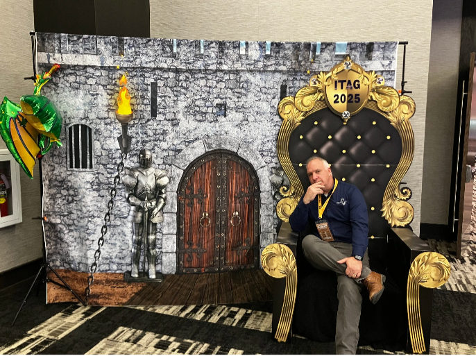
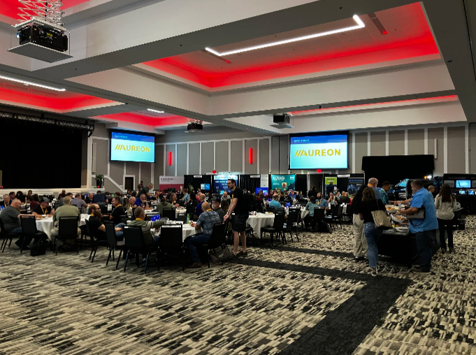
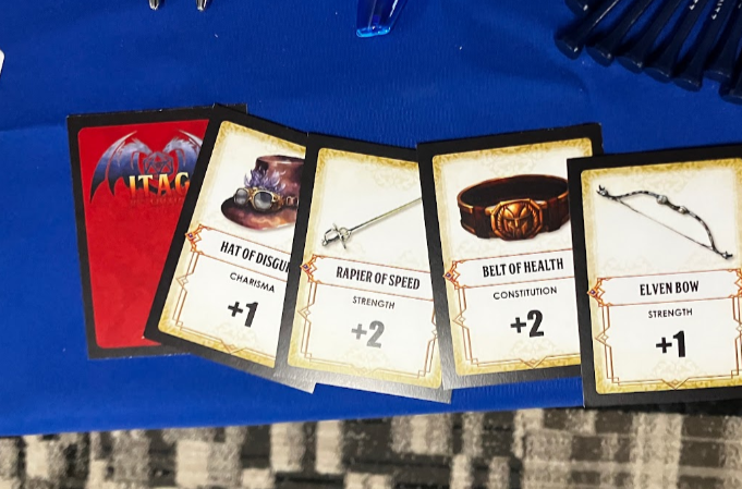
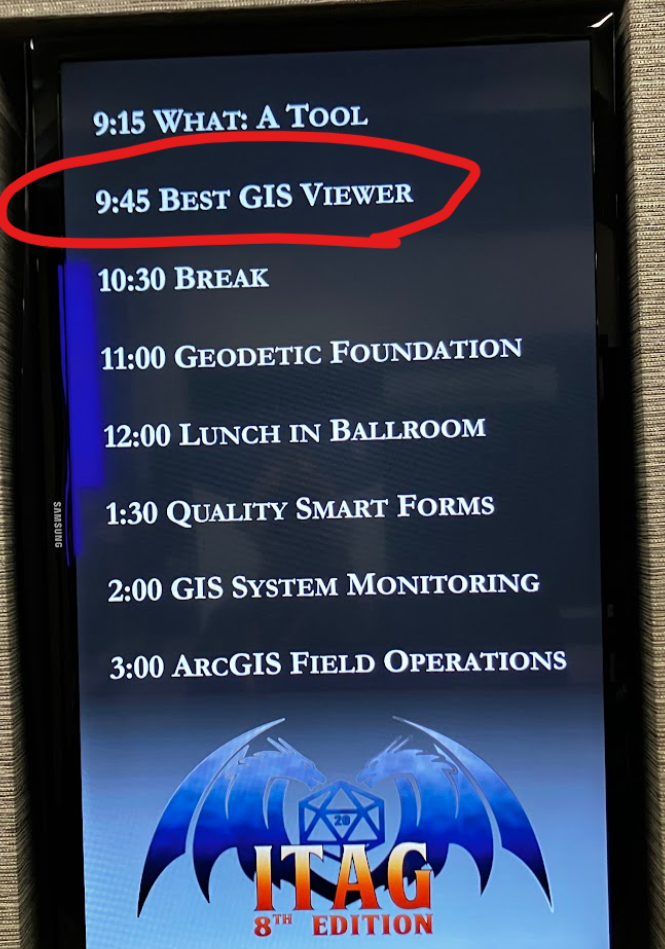
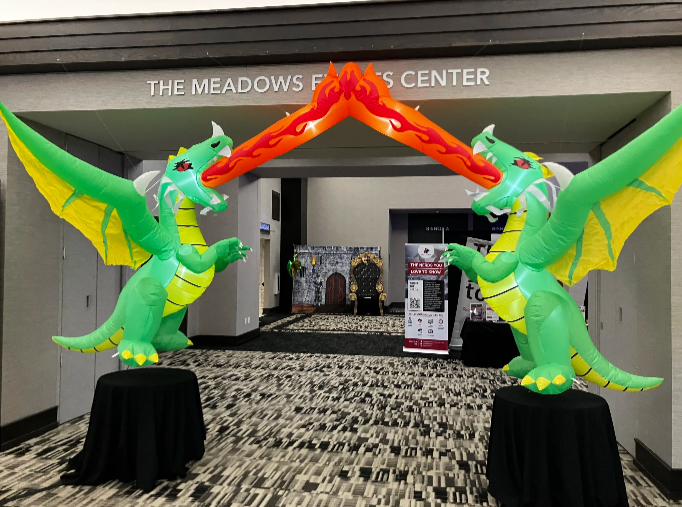
I recently had the incredible opportunity to attend the ITAG Conference from June 3-5, 2025, at The Meadows Events and Conference Center in Altoona, IA. As a first-timer, I was half-expecting the typical tech conference, but the whole Dungeons andamp; Dragons theme was a brilliant touch – it really set the stage for an ‘epic adventure’ in learning and networking, right from the entryway.

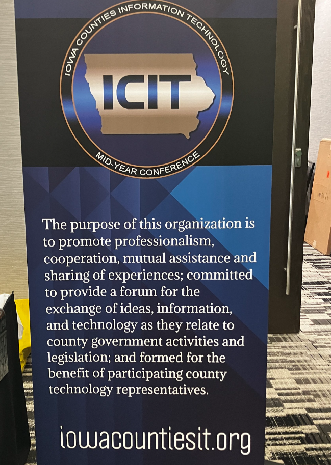
For those unfamiliar with this quest, the ITAG Conference is a collaborative annual event brought to us by the Iowa Geographic Information Council (IGIC) and the Iowa Counties Information Technology (ICIT) organizations. It’s awesome how they combine their individual conferences into one big, comprehensive technology and geospatial event. They really understand the overlap between IT and GIS and celebrate with nerd within.

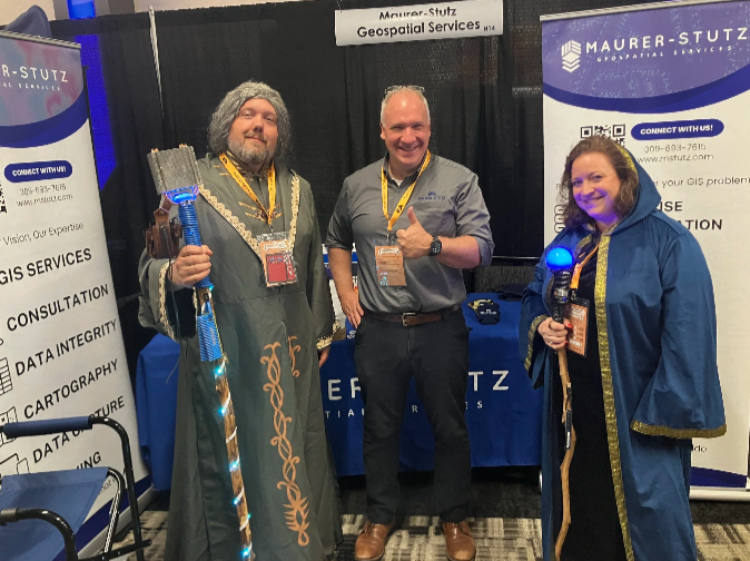
I was there as both an exhibitor and a presenter, which gave me a unique and engaging perspective on the entire event. The conference was packed with valuable insights, offering over 50 hours of diverse educational content. The main conference, spanning from Wednesday, June 4, through Friday, June 6, was thoughtfully structured with five distinct educational tracks. Two of these tracks were specifically dedicated to geospatial technologies, while another two delved deep into essential IT technologies. The fifth track provided a more general focus, ensuring there was something for everyone. This variety allowed attendees to really tailor their experience and dive into the topics most relevant to their skills, strength and charisma.

Beyond the structured learning, the emphasis on networking and the exchange of knowledge and professional practices truly shone through. I loved having the chance to connect with so many talented professionals from various fields, sharing ideas, and hearing about different approaches and best practices. It’s clear that the primary goal of the conference is to promote education, training, and cooperation in both technology and GIS, and they certainly achieved that, even rolling a 20! (OK, last lame joke)

The conference fostered a very welcoming environment, and it was great to see that attendance wasn’t restricted by IGIC or ICIT membership, as I have neither. This inclusivity really broadens the scope of discussions and makes for a richer experience for everyone involved. Plus, the well-organized opportunities for professional networking, combined with pleasant meals and entertainment, added to the overall positive atmosphere, making the entire experience even more enjoyable and memorable.

Whether you’re deeply immersed in GIS, passionate about IT, or simply curious about the latest advancements and collaborations in technology, this conference is definitely for you. I gained so much, both in terms of knowledge and valuable connections, and I wholeheartedly recommend it to anyone in the field and can’t wait to see the theme for next year.

I had such a positive experience and learned an immense amount. I’m already looking forward to next year and can’t wait to see what new insights and connections the next ITAG Conference brings!


https://www.mstutz.com/wp-content/uploads/2025/06/Screenshot2026-01-23111301.webp 500 962 Micah Williamson https://www.mstutz.com/wp-content/uploads/2026/08/Logo-1030x301.webp Micah Williamson2025-06-23 16:11:022026-11-09 16:16:25Rolling for Initiative at the ITAG Conference

One Year With Engineers

April 21, 2025/in MSGS News/by Micah Williamson

One Year at Maurer-Stutz: Building a Geospatial Foundation for the Future

A year ago, I walked into Maurer-Stutz with a mission: to build something new, something purpose-driven, something lasting. That something became Maurer-Stutz Geospatial Services (MSGS). Now, 12 months in, I can confidently say we’re not just building a team—we’re building momentum.

Starting From the Ground Up

When I joined the company on April 29, 2024, the Geospatial Department was more of an idea than an entity. With one GIS Specialist; Katie Kopkowski, who stuck around to be the anchor, we had talent, but we needed direction, structure, and an identity. I knew from the beginning that MSGS couldn’t be “just the map guys” on engineering projects. MSI leadership wanted us be strategic partners, not just a service department. Trusted advisors, not only task-takers.

Beigin at the begining

So, we began with the essentials. Working through the process as if we were starting a new business, but with the advantage of having supporting oversight structure.

  • Conducted a full assessment of existing software, hardware, and workflows.

  • Evaluated team strengths and gaps in a SWOT analysis.

  • What engineering clients existed and which represented low-hanging fruit.

  • Built a business plan with a six-year growth strategy, aligning revenue goals with staffing targets and market segments.

  • Developed mission and vision statements to clarify who we are—and who we are not

Building the Right Team

This work isn’t possible without people. I’m proud to lead a growing team that now includes Geospatial Engineer Baylor Wagehoft, fellow ISU Redbird Ethan Geisler, and Geospatial Intern Michelle Wagehoft. Next month, we will welcome our sixth employee who will focus on the Agricultural market. Each team member brings a unique set of strengths to the table and we’ve focused on creating a collaborative culture built on professionalism, mutual respect, and shared accountability with our Team Operations Manual (T.O.M.)

Growing with Purpose

In just one year, we’ve:

  • Supported multiple infrastructure and fiber deployments with precision GIS solutions.

  • Partnered with our own MSI engineering groups without becoming “support-only” on projects.

  • Initiated the modernization client GIS and database migration and tuning.

  • Established professional partnerships in cloud architecture, economic development, utilities, and broadband.

A key part of our journey has been thoughtfully drawing a line between the way things have traditionally operated at MSI and the direction we’re heading—evolving from a service-oriented support group into a focused, independent, growth-focused team—a shift that will require continued clarity, communication, and collaboration as we grow. We’re becoming a revenue-generating, client-facing, innovation-focused business unit. And our identity is no longer in question—we are MSGS, and we are growing.

Looking Ahead

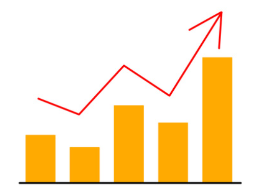
  Up And To The Right!

Up And To The Right!

Year one was about foundations. Year two is about scaling.

We’re focused on:

  • Expanding our managed services offerings.

  • Growing cloud GIS capabilities.

  • Deepening client relationships and building repeatable solutions.

  • Recruiting talent that shares our drive for innovation and excellence.

I’m grateful for the leadership at Maurer-Stutz inc. for supporting this vision, and for my team for embracing the challenge. This isn’t just about GIS—it’s about transformation. At MSGS, our mission is: To transform our clients’ and industry partners’ unique visions into reality through specialized geospatial expertise. Our B.H.A.G. is: By 2030, MSGS will be a recognized leader in geospatial services industry by providing solutions in the broadband, utility infrastructure, and consultant engineering domains.

Here’s to year two—and all the vision, trust, and growth it will bring.

We will accomplish this by delivering quality services with integrity, care, and efficiency. Working with you by design.

Email us for more information:

https://www.mstutz.com/wp-content/uploads/2025/04/Image252B2525281252529.webp 1288 1717 Micah Williamson https://www.mstutz.com/wp-content/uploads/2026/08/Logo-1030x301.webp Micah Williamson2025-04-21 10:00:002026-11-09 16:32:31One Year With Engineers

Reinforced Attendance.

March 24, 2025/in MSGS News/by Micah Williamson

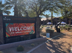
Earlier this March, I had the opportunity to attend the Esri Partner Conference (EPC) and Developer Summit (DevSummit) in Palm Springs, California. This marked my fifth time attending EPC. Every time I go, I’m reminded that while the sessions, product updates, and technical insights are invaluable, the real benefit lies in the connections and networking that happen throughout the event. It’s an experience that extends beyond the formal agenda—one that reinforces why attending these events is essential for any organization leveraging Esri’s technology.

Plenary Session: Setting the Stage for Innovation

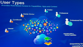
The Plenary Session at EPC is always a highlight, and this year was no different. Jack Dangermond kicked things off with his signature enthusiasm and deep insights about the future of GIS. The session showcased the latest updates to the ArcGIS ecosystem, with a strong emphasis on AI integration, ArcGIS Knowledge Graphs, and real-time geospatial analytics. It was exciting to see demonstrations of how ArcGIS Pro, Enterprise, and Online continue to push the boundaries of what’s possible in geospatial technology.

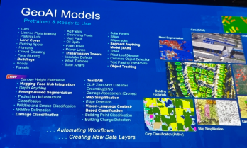
One of the standout demonstrations highlighted how ArcGIS Image Analyst and ArcGIS Pro are leveraging AI to detect and classify objects in imagery at unprecedented speeds. Another session explored how ArcGIS Knowledge Graphs and AI-driven link analysis are transforming how we analyze complex spatial relationships and networks. As AI continues to evolve, it’s clear that Esri is positioning its technology to empower organizations to harness these capabilities for more intelligent, data-driven decision-making.

Technical and Sales Sessions: A Balanced Approach

While the Plenary provided a glimpse into the future, I spent a significant portion of my time attending sales-focused sessions designed to help partners better promote Esri products and effectively sell geospatial services. These sessions were packed with insights on how to align Esri’s technology stack with client needs, demonstrate the value of enterprise GIS, and position services in a way that maximizes impact for clients.

One of the key takeaways was the importance of understanding customer pain points and tailoring solutions that address real-world challenges. Whether it’s highlighting the benefits of migrating to ArcGIS Online for improved collaboration or promoting the power of ArcGIS Enterprise for organizations requiring on-premises control, these sessions emphasized that successful selling is rooted in serving clients better. I also picked up valuable strategies for building long-term relationships with clients by offering managed services and ongoing GIS support—an approach that aligns perfectly with the goals of Maurer-Stutz Geospatial Services (MSGS).

The Real Value: Networking and Collaboration

As much as I enjoy the technical content, the most meaningful part of attending EPC and DevSummit is the networking. Being in Palm Springs with GIS professionals, developers, and partners from around the world creates countless opportunities to exchange ideas, solve challenges, and explore new partnerships. Whether it’s a chance encounter over coffee or a deeper conversation during a breakout session, these connections often lead to collaborations that drive real value long after the event ends.

This year, I had the opportunity to reconnect with old colleagues, meet potential partners, and strengthen relationships with other Esri partners. Conversations ranged from sharing best practices for enterprise GIS management to brainstorming ideas for integrating emerging technologies into our service offerings. These interactions are what make attending EPC and DevSummit more than just a learning experience—they make it an opportunity to build relationships that fuel growth and innovation.

A Minor Perk: Escaping Central Illinois in March😉

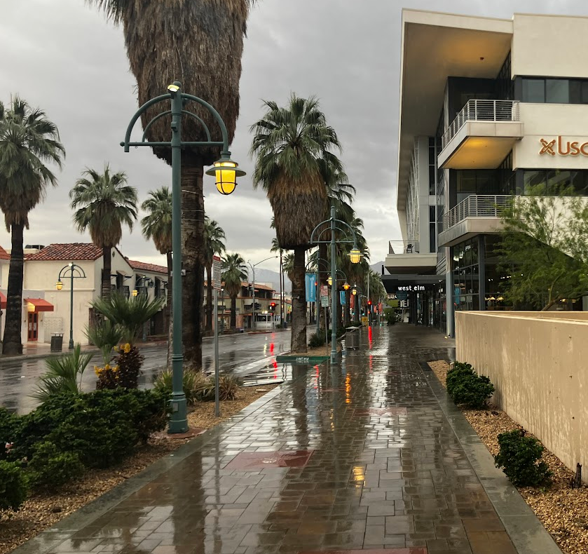
Of course, I’d be remiss if I didn’t mention the minor perk of escaping the unpredictable weather of Central Illinois in early March. Palm Springs provides the perfect backdrop for a week of learning and networking, with its warm sunshine and stunning views of the San Jacinto Mountains. Even though it did rain for a day or two, it’s still a welcome change from the Midwest’s lingering winter, and it certainly adds to the appeal of making the annual trek to EPC and DevSummit.

Why I Keep Coming Back

After five EPCs, I can confidently say that attending is about more than just staying up to date with the latest GIS technology—it’s about being part of a community that’s shaping the future of geospatial innovation. The sessions provide the knowledge, but the connections provide the inspiration and momentum to apply that knowledge in ways that drive real impact.

If you’re considering attending in the future, I can’t recommend it enough. Whether you’re a developer looking to deepen your technical expertise, a business leader focused on expanding your GIS capabilities, or a partner aiming to better serve your clients, EPC and DevSummit offer a unique blend of learning, networking, and inspiration that’s hard to find anywhere else. Plus, a little sunshine in Palm Springs doesn’t hurt either.

Got Questions about this Blog? We can tell you what we know. Fill out the form below and we will get back to you as soon as we can. 

https://www.mstutz.com/wp-content/uploads/2025/03/Screenshot2025-03-28130431.webp 586 1448 Micah Williamson https://www.mstutz.com/wp-content/uploads/2026/08/Logo-1030x301.webp Micah Williamson2025-03-24 11:59:002026-11-09 16:16:25Reinforced Attendance.

GIS for PLS at IPLSA in SPI

February 17, 2025/in MSGS News/by Micah Williamson

Geospatial andgt; The Layer File andgt; GIS for PLS at IPLSA in SPI

Exploring GIS at IPLSA 2025: A Look into the Future of Geospatial Technology

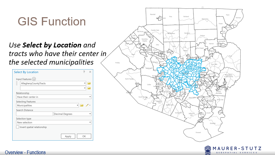
  We covered the basic functions of GIS

We covered the basic functions of GIS

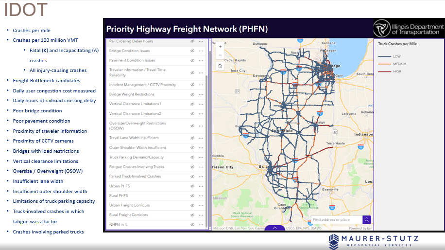
Earlier this month at the 2025 Illinois Professional Land Surveyors Association (IPLSA) conference, I had the opportunity to present What is GIS? in Springfield, Illinois. The session aimed at breaking down the fundamentals of Geographic Information Systems (GIS) and showing just how much this technology does beyond simply making maps. My goal was to help attendees understand the real power of GIS in infrastructure planning, data management, and decision-making across industries.

To start, I walked through the basics of GIS—how spatial data is collected, stored, analyzed, and visualized. We covered coordinate systems, geodatabases, and why data accuracy is crucial in GIS workflows. This foundation set the stage for diving into real-world applications, where GIS helps land surveyors, civil engineers, transportation planners, and public works professionals work more efficiently.

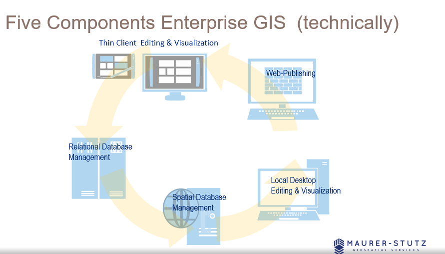
  There are 5 components to make GIS an ‘enterprise GIS’

There are 5 components to make GIS an ‘enterprise GIS’

One of the most exciting parts of the presentation was showing off how GIS is used in municipal projects, transportation networks, and utility management to improve efficiency and accuracy. It was great to see the room engage with examples of how GIS lets us visualize changes over time, analyze trends, and make better decisions—whether it’s tracking road conditions, mapping flood zones, or planning infrastructure upgrades.

We also talked about Enterprise GIS solutions and cloud-based GIS platforms, explaining how organizations use geospatial databases to streamline their operations. Cloud-based systems like ArcGIS Enterprise are game-changers, keeping data accessible and up-to-date for teams across departments.

Looking ahead, I touched on some exciting innovations in GIS, including Artificial Intelligence (AI) and machine learning in spatial analysis, real-time data integration with IoT sensors, and participatory GIS for public engagement. It’s incredible how GIS is evolving to include more automation and real-time data, making it even more valuable for decision-making.

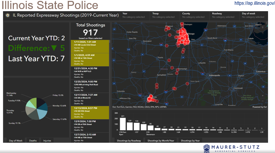
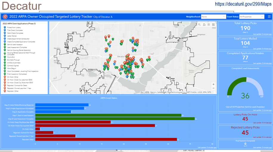
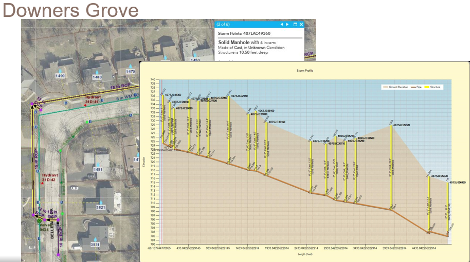
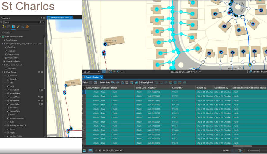
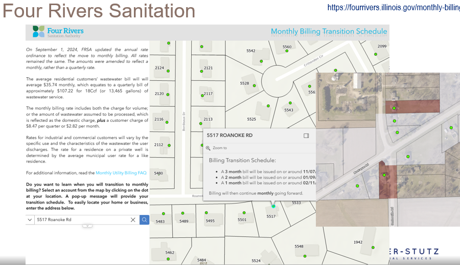
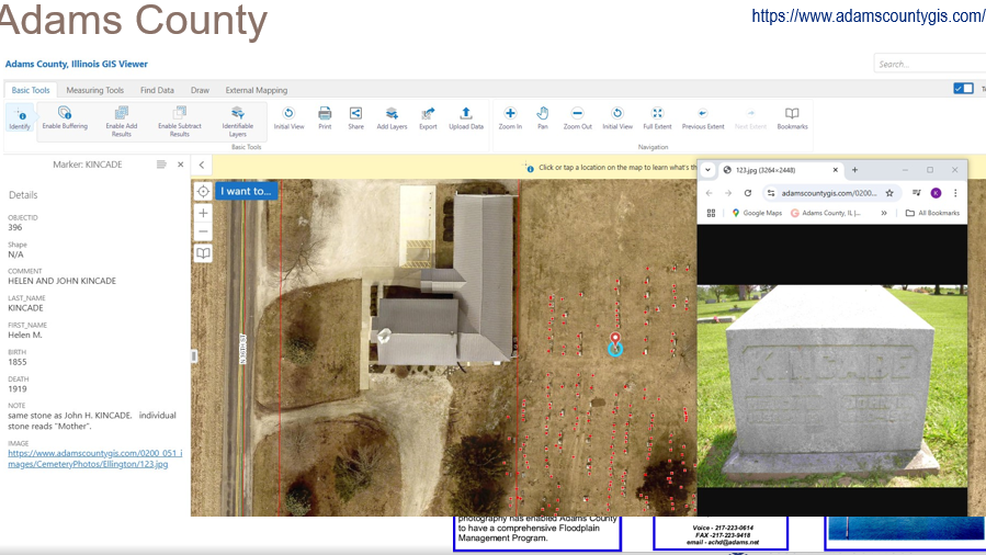
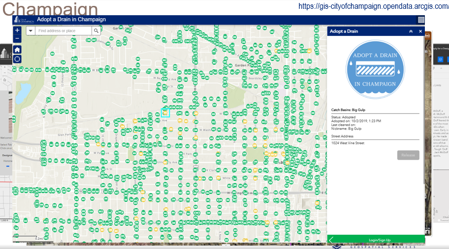
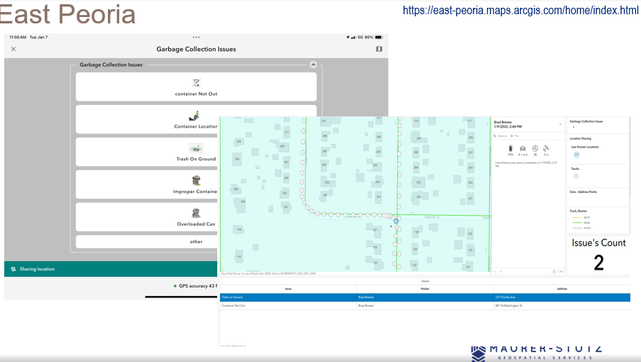
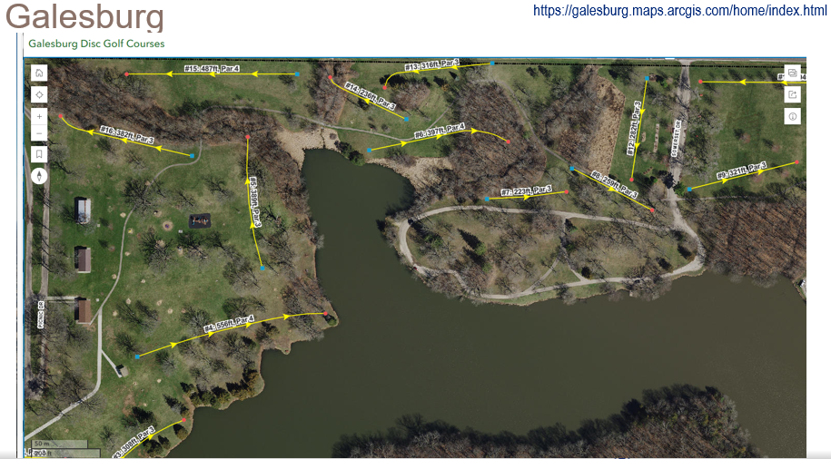
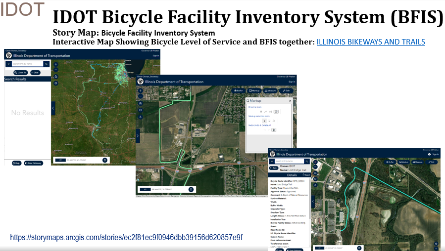
I had some great help from ILGISA friends around the state. I spent most of the time looking at these examples.

The key takeaway from the presentation is that GIS offers a vast range of possibilities, but it also requires a deep understanding of its technical complexities. By appreciating the skill and expertise involved, professionals can develop greater respect for GIS specialists and recognize the value they bring. Ultimately, fostering collaboration rather than opposition will lead to more effective and innovative solutions in the industry.

GIS is constantly evolving, and its impact reaches far beyond mapping—it’s about making smarter, data-driven decisions that shape our communities. Presenting at IPLSA 2025 was a great opportunity to share that message and connect with others who are just as passionate about geospatial technology as I am. The presentation is Here.

https://www.mstutz.com/wp-content/uploads/2025/02/Screenshot2025-02-17161047.webp 281 363 Micah Williamson https://www.mstutz.com/wp-content/uploads/2026/08/Logo-1030x301.webp Micah Williamson2025-02-17 22:06:112026-11-09 16:16:25GIS for PLS at IPLSA in SPI

It’s Official! MSGS and GEOGRAPH Partnership Announcement

February 3, 2025/in MSGS News/by Baylor Wagehoft

Geospatial andgt; The Layer File andgt; MSGS and GEOGRAPH Partnership Announcement

Our Geospatial Services group is thrilled to announce a significant milestone—a strategic partnership with GEOGRAPH Technologies! This collaboration marks a new chapter in delivering cutting-edge geospatial solutions to the fiber broadband industry in alignment with our mission to provide innovative and impactful engineering and consulting GIS services.

Why GEOGRAPH Technologies?

GEOGRAPH Technologies is a leader in the fiber utility geospatial technology sector, known for developing CrescentLink, a powerful software add-in for ArcGIS Pro. CrescentLink is specifically designed to manage telecommunication infrastructure data, with a focus on fiber connectivity networks. Our expertise in Enterprise GIS and consultant GIS services complements their existing product offering, creating a collaboration that will amplify the value they deliver to their customers. Both Micah and Baylor were first introduced to CrescentLink and the GEOGRAPH team during they tenure in the Fiber Broadband industry, and can attest to its ease of use and robust suite of tools for managing fiber broadband connectivity information.

Shared Values and Vision

At the core of this partnership is a shared commitment to innovation, excellence, and client/customer success. Both of our teams are driven by the goal of empowering each organization with the tools and insights needed to solve real-world challenges in the telecommunications industry. GEOGRAPH views this as a “both parties forward” arrangement, with MSI/MSGS branding present on sales media and MSGS staff included in prospective customer meetings.

All work performed by MSGS on behalf of GEOGRAPH will be routed through a subconsultant Master Services Agreement between the two firms. GEOGRAPH and their team of dedicated Account Managers and Professional Services staff will continue to act as the primary point-of-contact for their customers; facilitating all customer quoting, invoicing, as well as project management. This streamlined arrangement helps us focus on delivering high quality GIS consulting services to their customers without administrative burden on either party.

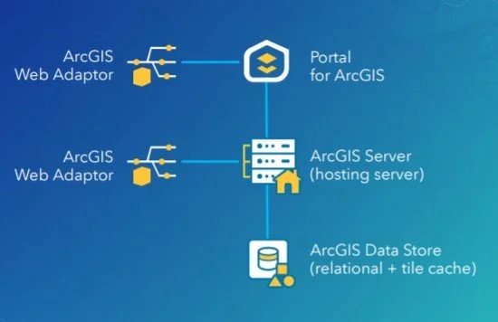
 ArcGIS Enterprise Base Deployment Schematic

ArcGIS Enterprise Base Deployment Schematic

What This Partnership Means for MSGS

Our subconsultant partnership with GEOGRAPH Technologies is mutually beneficial:

  • Tailored Solutions: By combining GEOGRAPH’s robust tools with our industry knowledge in Enterprise GIS, we can develop tailored solutions to meet the unique needs of their clients in the telecommunications industry and beyond!
  • Enterprise GIS: This collaboration will initially focus on completing Enterprise GIS Deployments for GEOGRAPH’s customers, including the implementation and integration of CrescentLink into the customer’s broader GIS/IT ecosystems. These efforts will address a strategic need for their customers, as it is a prerequisite requirement to using their CrescentLink platform.

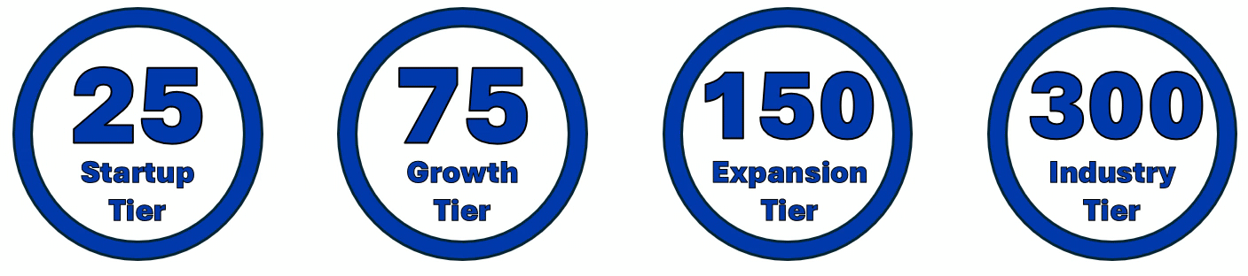
  • Geospatial Solutions Plans (GSPs): In addition to our Enterprise Deployment services, GEOGARPH Customers can purchase prepaid blocks-of-hours on a subscription-based model. These flexible plans can be used for nearly any GIS consulting task, including geodatabase management, basic script development, training, and more. The GSP provides an efficient way to access expert support tailored to the customers unique geospatial consulting needs.

Looking Ahead

The entire MSGS Team is humbled by the trust and relationship that we are developing with GEOGRAPH. We’re already working closely on several smaller pilot projects, with many more in their sales funnel. Stay tuned as we share more about specific projects and successes stemming from this partnership!

https://www.mstutz.com/wp-content/uploads/2025/02/geographsmall.webp 439 439 Baylor Wagehoft https://www.mstutz.com/wp-content/uploads/2026/08/Logo-1030x301.webp Baylor Wagehoft2025-02-03 16:21:002026-11-09 16:31:42It’s Official! MSGS and GEOGRAPH Partnership Announcement

Introducing: Geospatial Solutions Plans

January 20, 2025/in MSGS News/by Baylor Wagehoft

Geospatial andgt; The Layer File andgt; Geospatial Solutions Plans

At Maurer-Stutz, “Working with you by design” is more than just a motto—it’s a promise. We believe every organization’s challenges are unique, and so are the solutions needed to address them. In the consulting world, this has typically meant project-based contracts reign supreme – scopes and costs are defined up-front with little wiggle room for change without renegotiation.

While these types of contracts certainly have their place, what if you don’t know what your needs are in advance? Is a fixed contract the best use of your organization’s time and resources? In some cases, long-term contracts and one-size-fits-all projects can leave you feeling boxed in.

Dynamic organizations deserve a partner that can be dynamic with them. That’s why at MSGS we’ve introduced our Geospatial Solutions Plans (GSPs): a flexible, subscription-based consultant model that delivers high-level GIS expertise through pre-paid blocks of hours.

With our GSPs, you’ll enjoy budget certainty, scalable support, and the peace of mind that comes from having a dedicated partner by your side—one who truly understands your vision and is ready to adapt to your evolving needs. In this blog, we’ll show you how working together by design leads to better, more responsive geospatial solutions, no matter your organization or industry focus.

What Are Our Geospatial Solutions Plans (GSP)?

Our GSPs are contracts designed for clients that need top-tier geospatial expertise without the stringent commitments of traditional, project-based agreements. With our subscription model, you purchase a block of consulting hours that you can use as needed throughout the plan year.andnbsp;

How the Subscription Model Works

When engaging customers on our GSPs, we start with a thorough onboarding process to understand your unique challenges and goals. Here’s what you can expect:

  1. Initial Consultation andamp; Needs Assessment:
    Before anything is signed, we will discuss your objectives and current geospatial challenges. This step ensures that the GSP plan level is tailored to your requirements. Our goal is to “right size” the package to fit your anticipated needs.

  2. Customizing Your Service Package:
    Based on this assessment, we recommend a subscription level (block of hours) that fits your organization’s scope. These hours can be used for a wide variety of GIS consulting services across many different industries (examples below!).

  3. Subscription Check-Ins:

    We schedule regular check-ins to make sure your organization’s needs are being met efficiently and effectively. This iterative process helps us fine-tune our solutions and ensure continuous improvement throughout the life of the subscription. If your organization is finding value in our consulting services, you can move to a higher plan level as needed.

  4. Renewal

    The GSP is an annual subscription. We will never force you to use your consulting hours, and unused hours will roll over to the next subscription plan year. You have the freedom to use them on smaller projects or save them for several years.

Tailored Services That Fit Your Industry

With our Geospatial Solutions Plans, you get full access to our skilled team of dedicated developers, GIS Analysts/Professionals, and Enterprise Administrators who are ready to meet the specific needs of your organization. From Municipal Governments, to Engineering Consultants, to Fiber Broadband Providers, we have the right combination of talent and experience to provide a wide variety of geospatial consulting services.

ESRI Utility Networks

ArcGIS Online Administration

Infrastructure Asset Inventories

Cadastral andamp; Administrative Data Management

Custom Maps, Apps, and Dashboards

ArcGIS Hub Sites and ArcGIS Solutions Deployments

Authoritative Data sourcing andamp; truthing

GIS/CAD/Survey Integrations

JULIE Design Tickets

Geospatial Analysis

Engineering Modelling Inputs

Custom Field Data Applications

Map and Data Report Deliverable Development

ArcGIS Enterprise Deployments

Database Maintenance andamp; Cleanup

Splice Record Imports

Custom Scripting

3rd Party Integrations

Construction Planset Templates

The Benefits of a Block-of-Hours Model

Choosing our subscription-based GSPs means embracing a new level of flexibility and partnership:

  • On-Demand Expertise: No need to commit to a rigid scope-defined contract—use your hours whenever the need arises.

  • Predictable Budgeting: With pre-paid hours, you can manage expenses more effectively without unexpected costs. GSPs are calculated based on a discounted average hourly rate when compared to straight time/material contracts. This translates into savings for your organization over the life of the subscription.

  • Managed Services: For those customers that need ongoing support and maintenance of their GIS deployments, we offer Managed Services within our higher GSP plan levels. This service guarantees weekly check-ins to your infrastructure for performance, maintenance and longevity tasks to keep your GIS deployments running smoothly.

  • Long-Term Partnership: This model fosters a close, ongoing relationship that allows us to develop a deep understanding of your organization and its geospatial needs.

Ready to Transform Your Business?

If you’re looking to harness the full potential of your geospatial data, our Geospatial Solutions Plans offer a smart, flexible alternative to traditional consulting contracts.

Contact us today for a consultation or to schedule a demo, and discover how our tailored, expert support can drive your business forward.

https://www.mstutz.com/wp-content/uploads/2025/01/MSGSlogodraft.webp 454 454 Baylor Wagehoft https://www.mstutz.com/wp-content/uploads/2026/08/Logo-1030x301.webp Baylor Wagehoft2025-01-20 13:15:002026-11-09 16:31:42Introducing: Geospatial Solutions Plans

From Maps to Meaning: Celebrating GIS Day

November 11, 2024/in MSGS News/by Micah Williamson

Geospatial andgt; The Layer File andgt; From Maps to Meaning

Celebrate GIS Day on November 20, 2024, and Explore the Power of Maps!

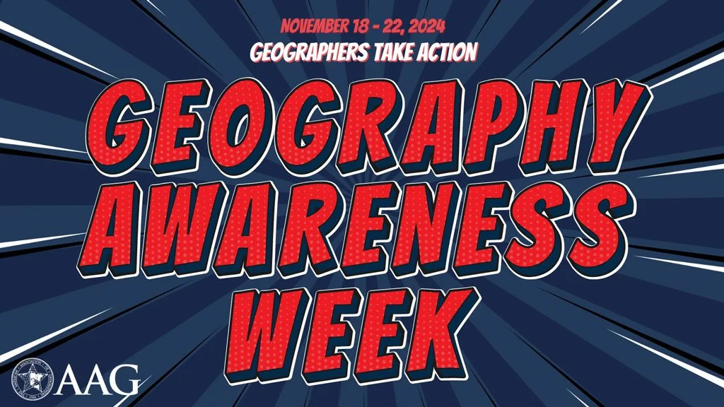
Join us on November 20 for GIS Day, part of American Association of Geographers’ Geography Awareness Week, as we celebrate the impact of Geographic Information Systems in solving real-world challenges! Established by Esri in 1999, GIS Day brings together GIS professionals, students, and curious minds worldwide to showcase how mapping technology helps us understand and improve the world around us. This year, I’m honored to speak at the McLean County GIS Consortium’s event, where we’ll explore the latest in GIS technology, real-life applications, and the future of spatial insights. From interactive exhibits to live demos, the event promises something for everyone, whether you’re a GIS pro or simply fascinated by the world of maps.

GIS Day encourages us all to appreciate geography’s role in our lives and its transformative power, from smart city planning to disaster response. As part of Geography Awareness Week, it’s a perfect chance to learn about GIS and connect with others who are passionate about mapping solutions for a better world. To learn more about the event and register, visit the McLean County GIS Consortium’s page.

Let’s celebrate the role of GIS in building a more connected, informed, and resilient world—see you there!

https://www.mstutz.com/wp-content/uploads/2024/11/Geography-Awareness-Week.webp 576 1024 Micah Williamson https://www.mstutz.com/wp-content/uploads/2026/08/Logo-1030x301.webp Micah Williamson2024-11-11 14:12:002026-11-09 16:16:25From Maps to Meaning: Celebrating GIS Day

ILGISA 2024 Recap

October 28, 2024/in MSGS News/by Micah Williamson

Geospatial andgt; The Layer File andgt; ILGISA 2024 Recap

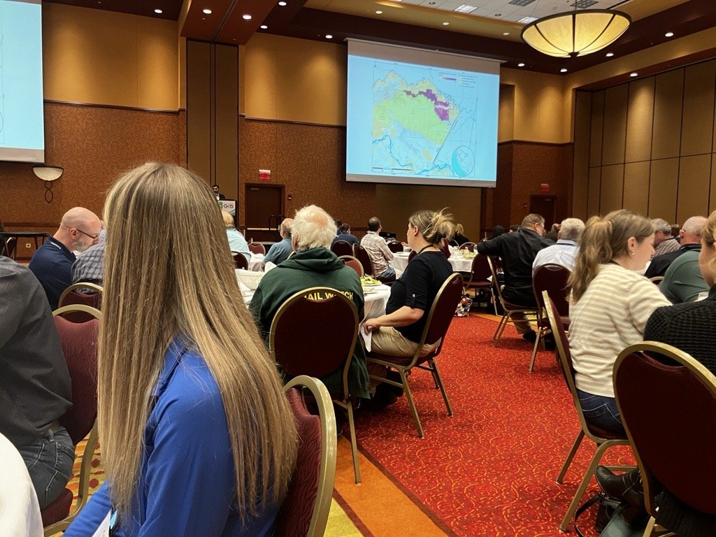
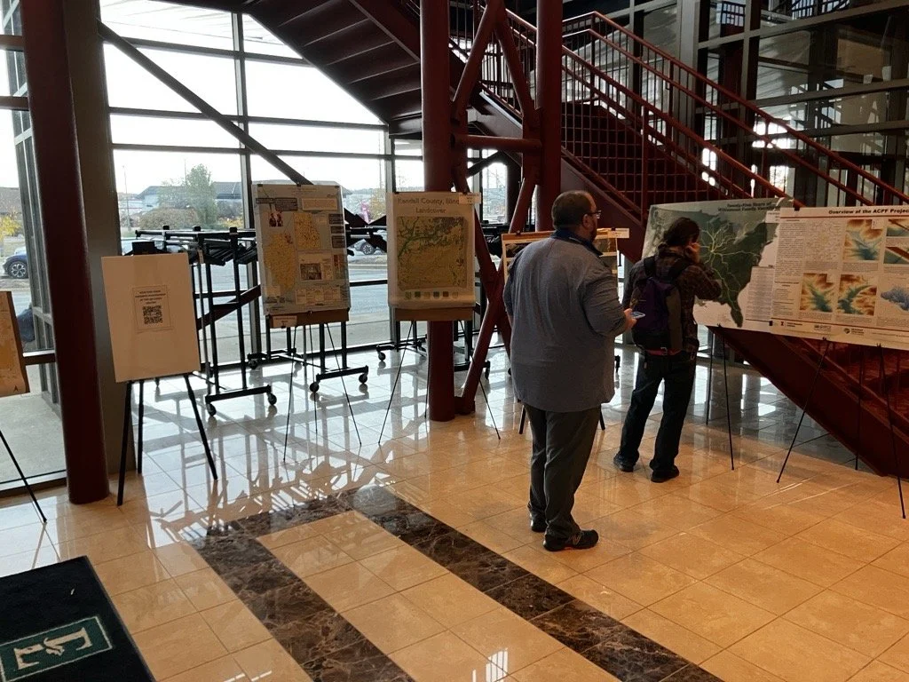
Last week, the entire MSGS staff attended the 2024, Illinois GIS Association annual conference in East Peoria. Attending the ILGISA Annual Conference as a full team provides MSGS with an excellent opportunity for professional growth, networking, and skill enhancement within the Illinois geospatial community. A few days before, we banded together to cover as many of the sessions as we could, some of interest and some to align with projects. Through sessions that cover GIS applications in transportation, utilities, and environmental projects, the team can acquire valuable insights directly applicable to MSGS’s focus areas. See the full agenda Here

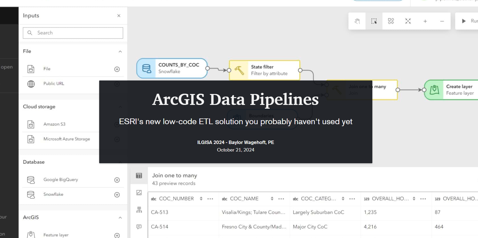
The conference presented a comprehensive slate of sessions, workshops, and panels aimed at advancing GIS practices, tools, and knowledge-sharing for professionals across sectors. As per the norm a significant theme was the usage of how er all use Esri software to address real-world challenges. Some of the most attended sessions were presented by Esri staff themselves, Nate and Anna did great. Some favorite sessions showcased automation and data management within Esri’s platform, covering tools like Microsoft Power Automate andamp; Make.com to streamline repetitive tasks, saving time and reducing error. These sessions highlighted how GIS can enhance community engagement by making spatial data more accessible to the public. Several of our Illinois local government friends showed off very practical examples showed how others could automate data updates and integrate Esri software with enterprise databases using Arcade to keep geospatial information up-to-date across departments. Baylor and Micah both gave presentations on ArcGIS Data Pipelines and ArcGIS Earth respectively. Both were well received even though by Tuesday, Baylor had completely lost his voice. Glad that all the rooms were equipped with microphones.

Not to be one-sided, the open-source sessions underscored the importance of self-sufficiency and scalability in GIS, offering practical takeaways for using these tools to solve real problems. There were several great sessions showcasing FOSS4G-only enterprise GIS deployments. As more organizations turn to open-source GIS, it was great to see the ILGISA community fostering an environment for learning, collaboration, and exploration, empowering professionals with the skills and networks needed to effectively implement open-source solutions.

As an organization, I’m proud to say ILGISA is strong and financially responsible. It is great to see some statewide initiatives gaining traction like the low distortion county projections and even talk (not much else) of a statewide parcel fabric. Chad Sperry received the well deserved Hilton Distinguished Collaboration award and we even gave out the Dahlberg Acheivement award to Cindy Barbra-Brelle for her amazing work on the E911 project.

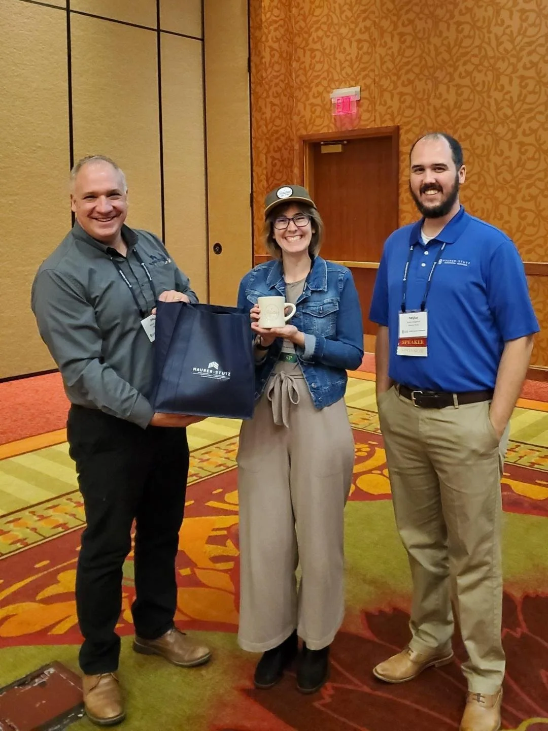
Of course, the social aspect of ILGISA can not be overstated. We enjoyed giving away some MSGS Swag and introducing Ethan and Katie to anyone we could in the Illinois GIS community. Big thanks to our friends from across the river for sponsoring a great social night at Uncle Bucks Bowling. In addition, networking events (just hanging out) facilitated connections between practitioners, enabling them to share their own implementations, discussing common challenges, and explore emerging geospatial technologies together. Through sessions and informal networking, ILGISA 2024 attendees left with valuable insights into how to enhance efficiency, improve data accuracy, and implement innovative solutions within our GIS Industry.

https://www.mstutz.com/wp-content/uploads/2024/10/2024-10-292B11_41_15-logo.webp2B252826225C325971502529.webp 150 262 Micah Williamson https://www.mstutz.com/wp-content/uploads/2026/08/Logo-1030x301.webp Micah Williamson2024-10-28 16:11:002026-11-09 16:16:25ILGISA 2024 Recap

Ethan Geisler Joins Our Geospatial Team

September 23, 2024/in MSGS News/by Micah Williamson

Geospatial andgt; The Layer File andgt; Ethan Geisler Joins Our Geospatial Team

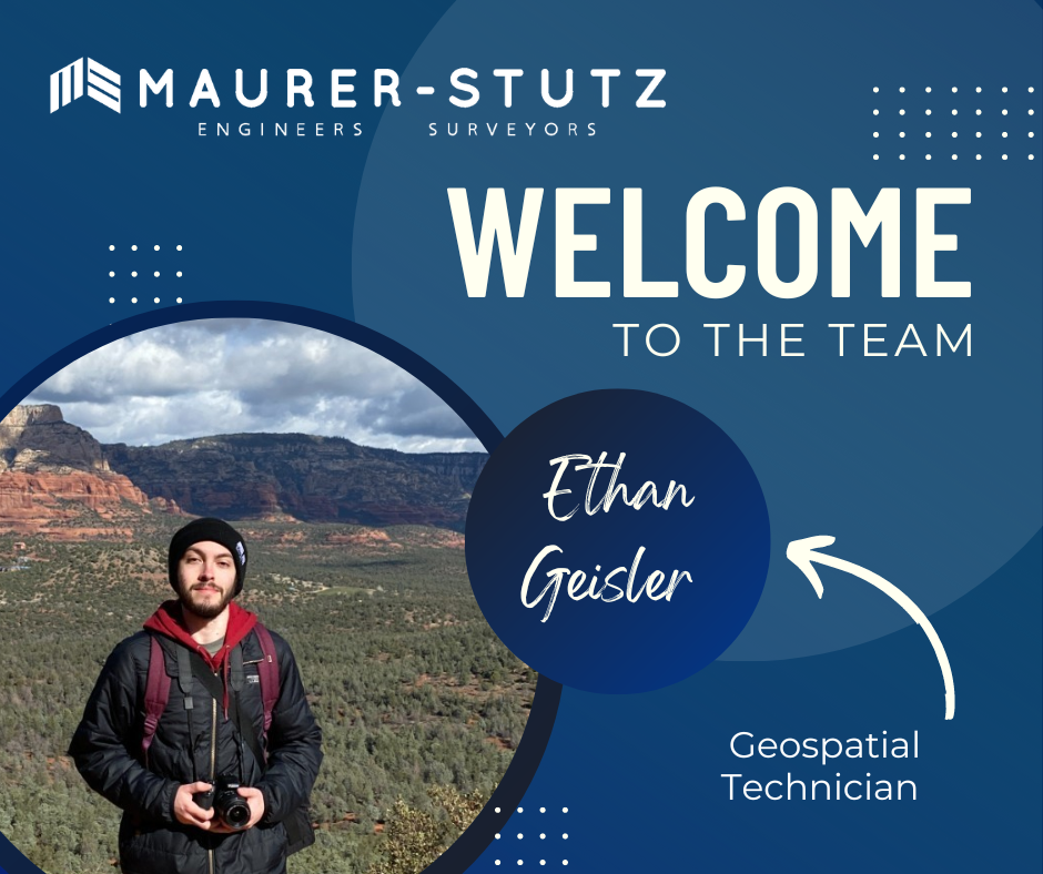
We are thrilled to welcome Ethan Geisler to the Maurer-Stutz Geospatial Services (MSGS) team!

Ethan joins us as a Geospatial Specialist with a fresh degree in Geography from Illinois State University, and he’s eager to hit the ground running. With a background in GIS software like ArcGIS Pro and ArcGIS Online, Ethan brings a well-rounded skill set, honed during his internship with FEMA where he developed a Tornado Awareness dashboard application. This real-world experience will help him seamlessly integrate into our projects, which often involve critical data and mapping needs.

What sets Ethan apart is his passion for using GIS to solve real-world challenges, a trait he demonstrated in his final project at ISU, where he worked on a pedestrian safety study using Survey123. Outside of work, Ethan’s organizational leadership skills shine as the former President of ISU’s Music Business Organization, where he organized events and led a team of fellow students—skills that will serve him well as he collaborates with our team on diverse geospatial projects. He also plays drums and is deeply invested in the Game of Thrones franchise.

Ethan will be working closely with our team to support infrastructure mapping, perform spatial analysis, and contribute to the development of tailored GIS solutions for our clients. We’re excited to see his fresh perspective and strong attention to detail make an impact as we continue to grow our geospatial services.

Welcome aboard, Ethan!

https://www.mstutz.com/wp-content/uploads/2024/09/content.webp 788 940 Micah Williamson https://www.mstutz.com/wp-content/uploads/2026/08/Logo-1030x301.webp Micah Williamson2024-09-23 18:16:492026-11-09 16:32:31Ethan Geisler Joins Our Geospatial Team

It’s Conference Season Already! (PART 2)

September 19, 2024/in MSGS News/by Baylor Wagehoft

Geospatial andgt; The Layer File andgt; It’s Conference Season Already! (PART 2)

it’s September.

Which means the fall conference season is here. While our young team is still deciding which organizations to support and be a part of, there are a few that are a no brainer: ILGISA, IACE, EPN just to name three. Last week, Baylor and I both visited separate conferences to see if they would be good conferences to attend or even exhibit at in future years. Below is Baylor’s Summary of GEOGRAPH and Micah’s summary of FOSS4G NA was earlier this week.

Maurer-Stutz Geospatial Services Attends the 2024 GEOGRAPH User Conference: A New Chapter in Fiber Network Management

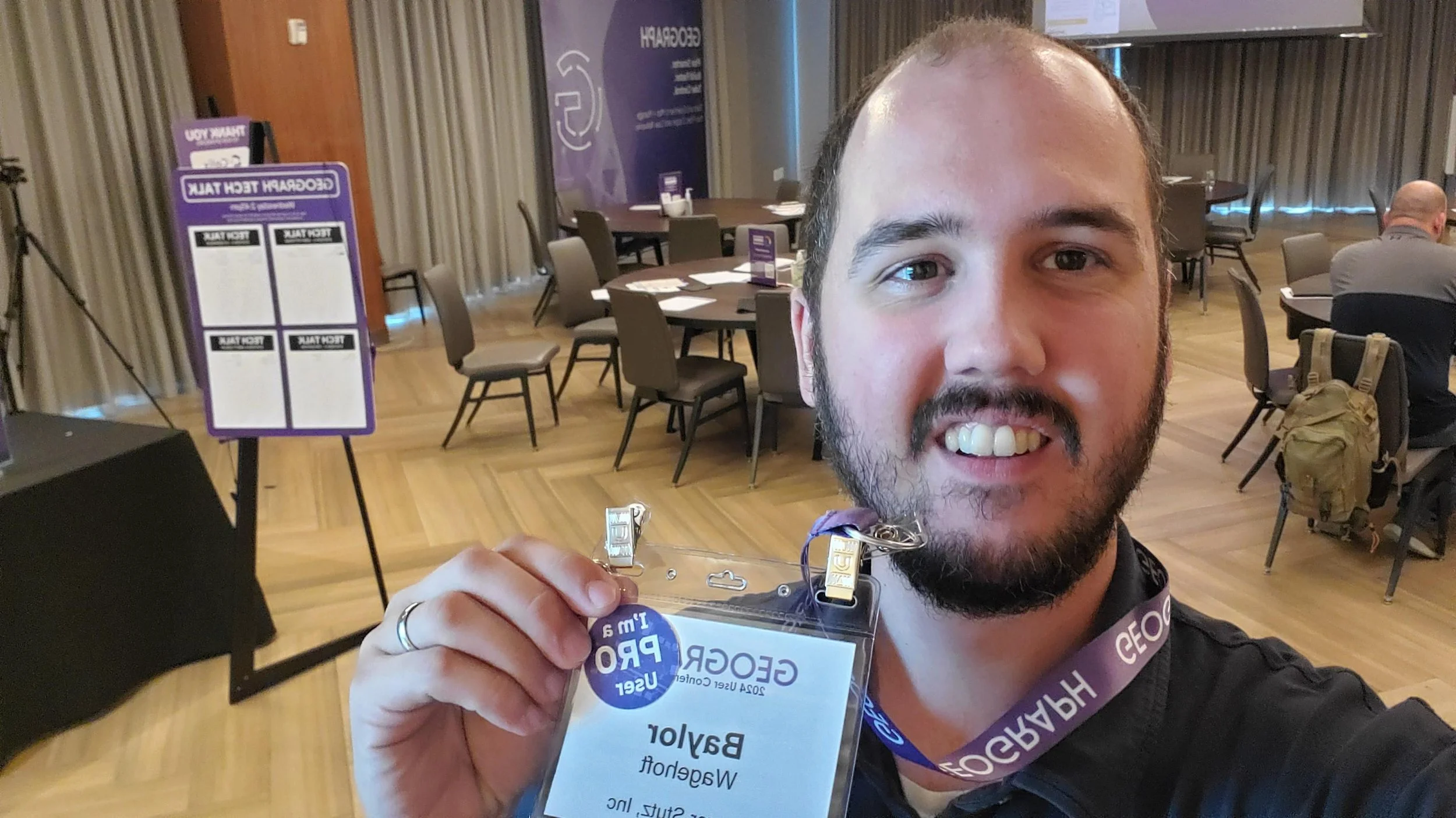
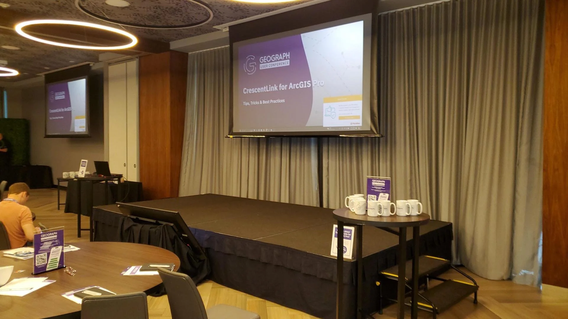
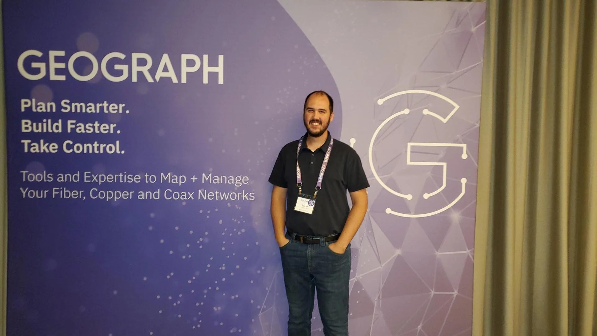
Maurer-Stutz Geospatial Services (MSGS) had the privilege of attending the 2024 GEOGRAPH User Conference in Greenville, SC from September 9-11. This year’s event brought together industry leaders, software developers, and telecommunications experts, providing us with invaluable insights into the latest advancements in fiber network management, broadband mapping, and digital infrastructure planning.

The conference, hosted by GEOGRAPH Technologies, gave us the opportunity to further explore CrescentLink, the powerful fiber network management solution that we’ve been integrating into our geospatial services. Through this collaboration with GEOGRAPH, MSGS is excited to expand our fiber solution offerings, reinforcing our commitment to delivering comprehensive, cutting-edge GIS support for fiber providers.

Highlights from the Event:

  • GEOGRAPH’s Vision for the Future: CEO Bruce Smith shared an exciting update on GEOGRAPH’s growth and future innovations during the opening keynote. With new developments on the horizon for CrescentLink, we look forward to continuing our partnership, enhancing our service offerings to ensure our clients can take full advantage of the CrescentLink platform.

  • Broadband Mapping and Digital Divide Solutions: One of the most impactful sessions featured Jim Stritzinger, the South Carolina Broadband Director, who shared how their state is leading the way in broadband mapping and BEAD fund management to bridge the digital divide. This insight fuels our passion for working with underserved fiber providers, ensuring communities across Illinois and beyond benefit from the same cutting-edge fiber management tools.

  • CrescentLink for ArcGIS Pro: With CrescentLink’s move from desktop to ArcGIS Pro, MSGS is eager to help our clients transition smoothly. Sessions led by Grey Pittman and DJ Henrique offered best practices and valuable tips on how to fully leverage CrescentLink within ArcGIS Pro. With MSGS’s expertise in enterprise GIS, we are well-positioned to support our clients in making this shift and maximizing the benefits of this next-generation software.

  • Engaging One-on-One with GEOGRAPH Experts: A unique feature of this year’s conference was the GEOGRAPH Tech Talk, where we had the opportunity to engage in in-depth, one-on-one conversations with the CrescentLink development team. Our team was able to discuss current and future needs for our clients, planning how we can continue to innovate and provide exceptional geospatial services in fiber network management.

Looking Ahead:

At MSGS, our focus has always been on providing specialized geospatial solutions that turn our clients’ visions into reality. Partnering with GEOGRAPH Technologies allows us to expand our offerings to include enhanced fiber network deployment, conversion, and ongoing management services—ensuring our clients can optimize their fiber networks from the ground up.

The 2024 GEOGRAPH User Conference affirmed that fiber networks are the digital backbone of tomorrow’s infrastructure. By combining MSGS’s deep expertise in GIS with CrescentLink’s powerful tools, we’re setting a new standard for fiber management, particularly for small and mid-sized providers who may lack access to these advanced solutions.

As we look ahead, we’re excited to continue working closely with GEOGRAPH, offering a seamless experience for our clients in deploying and managing fiber networks. This collaboration allows us to deliver tailored, scalable solutions, empowering providers to expand their network capabilities, enhance customer satisfaction, and ultimately stay ahead in the rapidly evolving telecommunications industry.

For more information on how MSGS and CrescentLink can transform your fiber network management, visit our website or schedule a call with one of our experts today.

https://www.mstutz.com/wp-content/uploads/2024/09/2024-09-2515_37_05-GEOGRAPHUserConference_GEOGRAPH.webp 654 716 Baylor Wagehoft https://www.mstutz.com/wp-content/uploads/2026/08/Logo-1030x301.webp Baylor Wagehoft2024-09-19 18:36:002026-11-09 16:31:42It’s Conference Season Already! (PART 2)
Page 1 of 212
Search Search

Categories

  • Community
  • Culture
  • Geospatial Project
  • GIS Industry News
  • Insights
  • MSGS News
  • Projects

Tags

49" Monitor Admin Aerial Services AGLA announcement ArcGIS ArcGIS Earth ArcGIS Online Basic GIS Cartogrpahy Chattanooga Chicago conferences construction Consulting Dell drones East Peoria employee Enterprise GIS Esri Ethics examples Fiber Fulton GEOGRAPH GIS Hiking ILGISA ISU Jelly Belly Kanban Leadership Maps marketing MSI new Parks Partnership Portal Surveying UAS URISA VSM webgis
  • Home
  • Services
  • News
  • About Us
  • Careers
  • Contact
@2026 Maurer-Stutz. All Rights Reserved. | Privacy Policy
Scroll to top Scroll to top Scroll to top