

Rolling for Initiative at the ITAG Conference
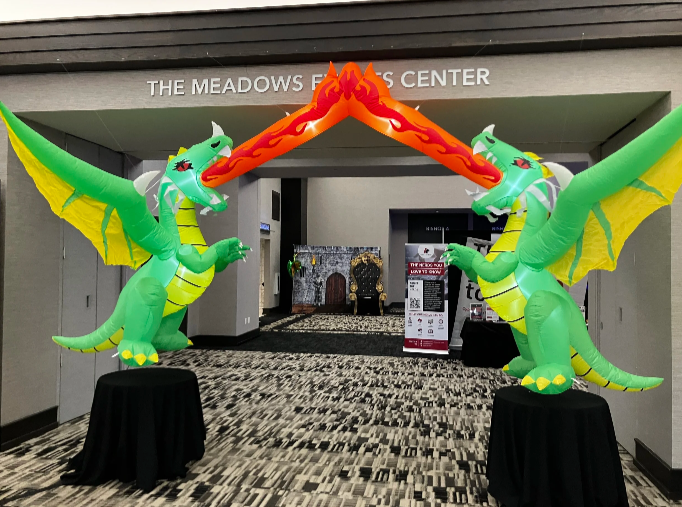
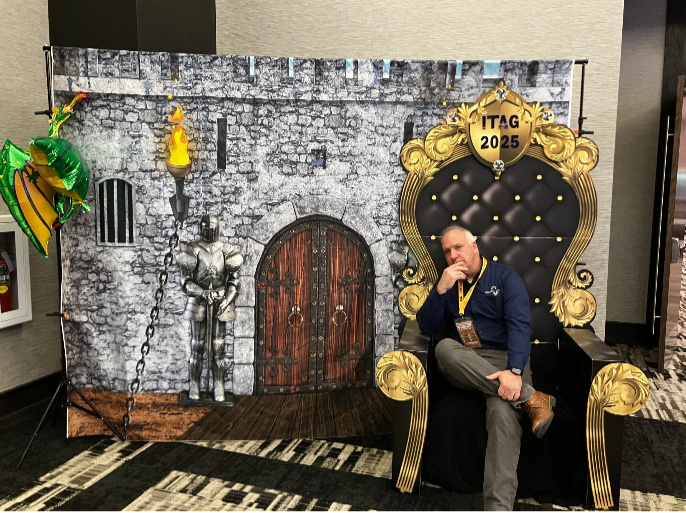
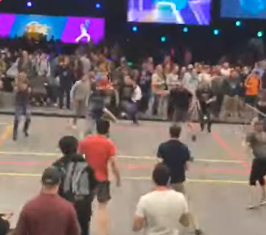
I recently had the incredible opportunity to attend the ITAG Conference from June 3-5, 2025, at The Meadows Events and Conference Center in Altoona, IA. As a first-timer, I was half-expecting the typical tech conference, but the whole Dungeons & Dragons theme was a brilliant touch – it really set the stage for an ‘epic adventure’ in learning and networking, right from the entryway.
I recently had the incredible opportunity to attend the ITAG Conference from June 3-5, 2025, at The Meadows Events and Conference Center in Altoona, IA. As a first-timer, I was half-expecting the typical tech conference, but the whole Dungeons & Dragons theme was a brilliant touch – it really set the stage for an ‘epic adventure’ in learning and networking, right from the entryway.
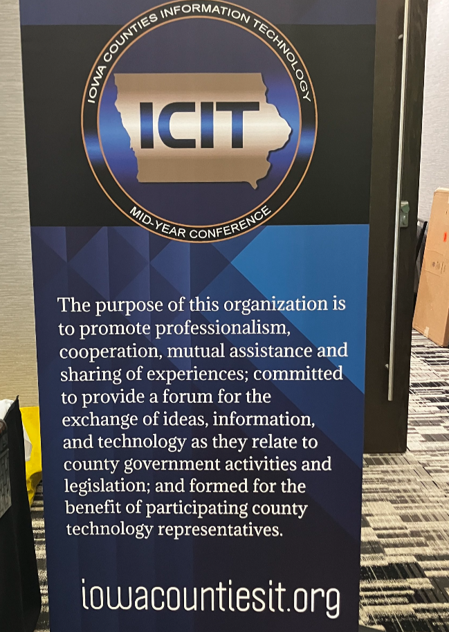
For those unfamiliar with this quest, the ITAG Conference is a collaborative annual event brought to us by the Iowa Geographic Information Council (IGIC) and the Iowa Counties Information Technology (ICIT) organizations. It's awesome how they combine their individual conferences into one big, comprehensive technology and geospatial event. They really understand the overlap between IT and GIS and celebrate with nerd within.
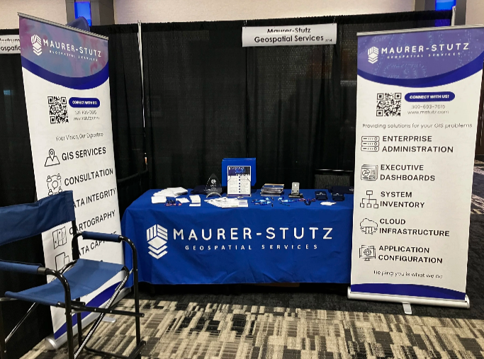
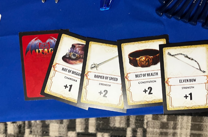
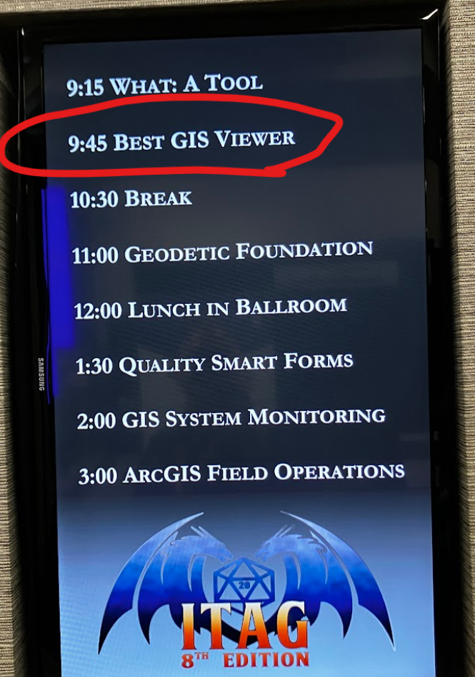
I was there as both an exhibitor and a presenter, which gave me a unique and engaging perspective on the entire event. The conference was packed with valuable insights, offering over 50 hours of diverse educational content. The main conference, spanning from Wednesday, June 4, through Friday, June 6, was thoughtfully structured with five distinct educational tracks. Two of these tracks were specifically dedicated to geospatial technologies, while another two delved deep into essential IT technologies. The fifth track provided a more general focus, ensuring there was something for everyone. This variety allowed attendees to really tailor their experience and dive into the topics most relevant to their skills, strength and charisma.
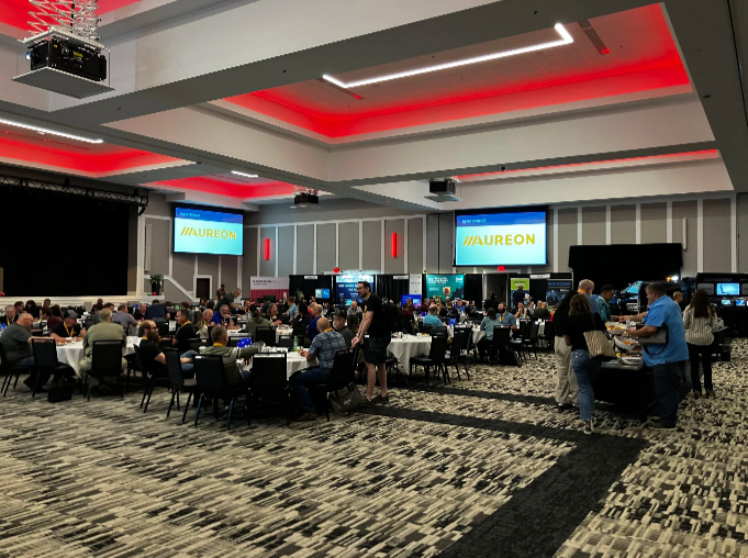
Beyond the structured learning, the emphasis on networking and the exchange of knowledge and professional practices truly shone through. I loved having the chance to connect with so many talented professionals from various fields, sharing ideas, and hearing about different approaches and best practices. It's clear that the primary goal of the conference is to promote education, training, and cooperation in both technology and GIS, and they certainly achieved that, even rolling a 20! (OK, last lame joke)
The conference fostered a very welcoming environment, and it was great to see that attendance wasn't restricted by IGIC or ICIT membership, as I have neither. This inclusivity really broadens the scope of discussions and makes for a richer experience for everyone involved. Plus, the well-organized opportunities for professional networking, combined with pleasant meals and entertainment, added to the overall positive atmosphere, making the entire experience even more enjoyable and memorable.
Whether you're deeply immersed in GIS, passionate about IT, or simply curious about the latest advancements and collaborations in technology, this conference is definitely for you. I gained so much, both in terms of knowledge and valuable connections, and I wholeheartedly recommend it to anyone in the field and can’t wait to see the theme for next year.
I had such a positive experience and learned an immense amount. I'm already looking forward to next year and can't wait to see what new insights and connections the next ITAG Conference brings!
Reinforced Attendance.
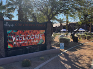
Earlier this March, I had the opportunity to attend the Esri Partner Conference (EPC) and Developer Summit (DevSummit) in Palm Springs, California. This marked my fifth time attending EPC. Every time I go, I’m reminded that while the sessions, product updates, and technical insights are invaluable, the real benefit lies in the connections and networking that happen throughout the event. It’s an experience that extends beyond the formal agenda—one that reinforces why attending these events is essential for any organization leveraging Esri’s technology.
Earlier this March, I had the opportunity to attend the Esri Partner Conference (EPC) and Developer Summit (DevSummit) in Palm Springs, California. This marked my fifth time attending EPC. Every time I go, I’m reminded that while the sessions, product updates, and technical insights are invaluable, the real benefit lies in the connections and networking that happen throughout the event. It’s an experience that extends beyond the formal agenda—one that reinforces why attending these events is essential for any organization leveraging Esri’s technology.
Plenary Session: Setting the Stage for Innovation
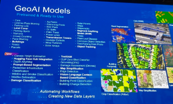
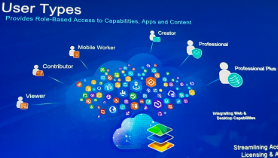
The Plenary Session at EPC is always a highlight, and this year was no different. Jack Dangermond kicked things off with his signature enthusiasm and deep insights about the future of GIS. The session showcased the latest updates to the ArcGIS ecosystem, with a strong emphasis on AI integration, ArcGIS Knowledge Graphs, and real-time geospatial analytics. It was exciting to see demonstrations of how ArcGIS Pro, Enterprise, and Online continue to push the boundaries of what’s possible in geospatial technology.
One of the standout demonstrations highlighted how ArcGIS Image Analyst and ArcGIS Pro are leveraging AI to detect and classify objects in imagery at unprecedented speeds. Another session explored how ArcGIS Knowledge Graphs and AI-driven link analysis are transforming how we analyze complex spatial relationships and networks. As AI continues to evolve, it’s clear that Esri is positioning its technology to empower organizations to harness these capabilities for more intelligent, data-driven decision-making.

Technical and Sales Sessions: A Balanced Approach
While the Plenary provided a glimpse into the future, I spent a significant portion of my time attending sales-focused sessions designed to help partners better promote Esri products and effectively sell geospatial services. These sessions were packed with insights on how to align Esri’s technology stack with client needs, demonstrate the value of enterprise GIS, and position services in a way that maximizes impact for clients.
One of the key takeaways was the importance of understanding customer pain points and tailoring solutions that address real-world challenges. Whether it’s highlighting the benefits of migrating to ArcGIS Online for improved collaboration or promoting the power of ArcGIS Enterprise for organizations requiring on-premises control, these sessions emphasized that successful selling is rooted in serving clients better. I also picked up valuable strategies for building long-term relationships with clients by offering managed services and ongoing GIS support—an approach that aligns perfectly with the goals of Maurer-Stutz Geospatial Services (MSGS).
The Real Value: Networking and Collaboration
As much as I enjoy the technical content, the most meaningful part of attending EPC and DevSummit is the networking. Being in Palm Springs with GIS professionals, developers, and partners from around the world creates countless opportunities to exchange ideas, solve challenges, and explore new partnerships. Whether it’s a chance encounter over coffee or a deeper conversation during a breakout session, these connections often lead to collaborations that drive real value long after the event ends.
This year, I had the opportunity to reconnect with old colleagues, meet potential partners, and strengthen relationships with other Esri partners. Conversations ranged from sharing best practices for enterprise GIS management to brainstorming ideas for integrating emerging technologies into our service offerings. These interactions are what make attending EPC and DevSummit more than just a learning experience—they make it an opportunity to build relationships that fuel growth and innovation.
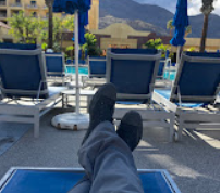
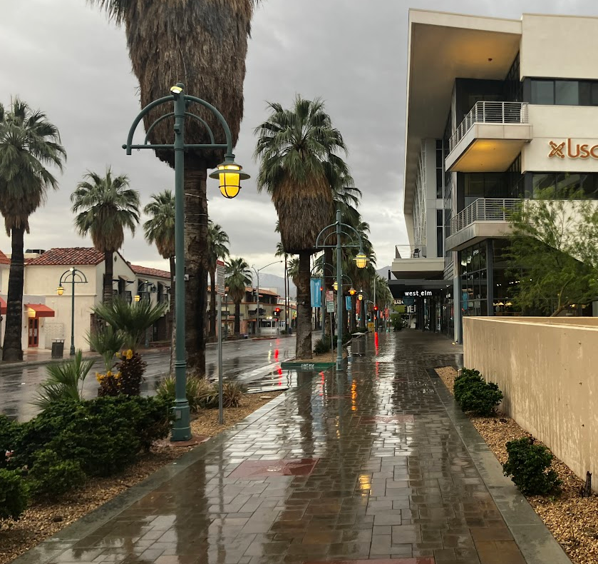
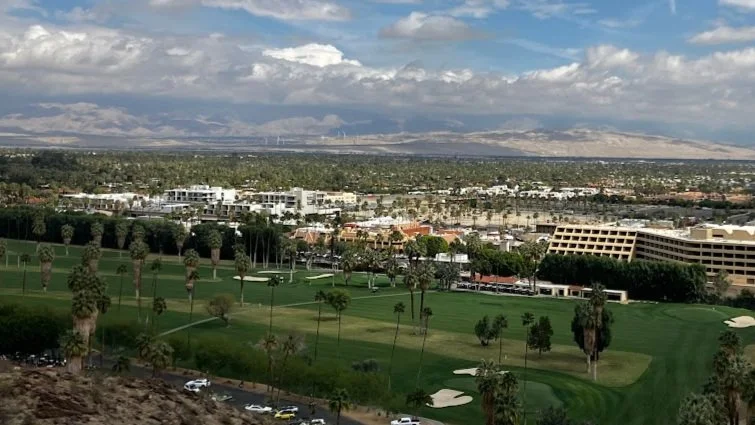
A Minor Perk: Escaping Central Illinois in March😉
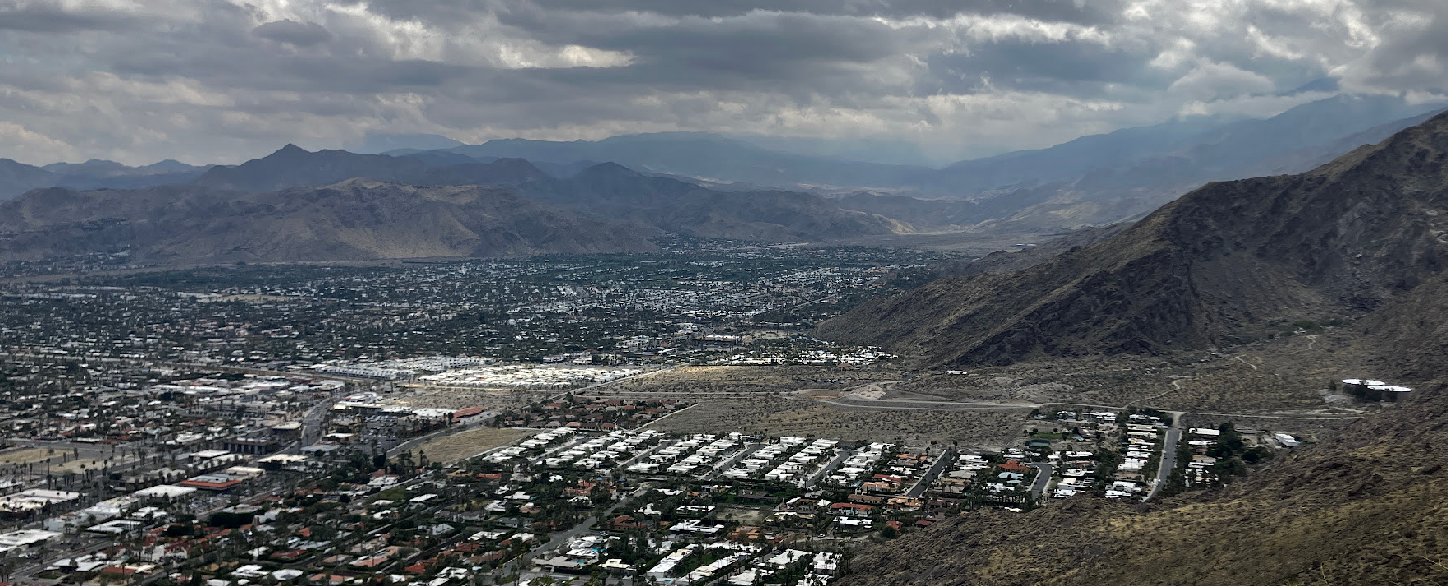
Of course, I’d be remiss if I didn’t mention the minor perk of escaping the unpredictable weather of Central Illinois in early March. Palm Springs provides the perfect backdrop for a week of learning and networking, with its warm sunshine and stunning views of the San Jacinto Mountains. Even though it did rain for a day or two, it’s still a welcome change from the Midwest’s lingering winter, and it certainly adds to the appeal of making the annual trek to EPC and DevSummit.
Why I Keep Coming Back
After five EPCs, I can confidently say that attending is about more than just staying up to date with the latest GIS technology—it’s about being part of a community that’s shaping the future of geospatial innovation. The sessions provide the knowledge, but the connections provide the inspiration and momentum to apply that knowledge in ways that drive real impact.
If you’re considering attending in the future, I can’t recommend it enough. Whether you’re a developer looking to deepen your technical expertise, a business leader focused on expanding your GIS capabilities, or a partner aiming to better serve your clients, EPC and DevSummit offer a unique blend of learning, networking, and inspiration that’s hard to find anywhere else. Plus, a little sunshine in Palm Springs doesn’t hurt either.
Got Questions about this Blog? We can tell you what we know. Fill out the form below and we will get back to you as soon as we can. 
GIS for PLS at IPLSA in SPI
Earlier this month at the 2025 Illinois Professional Land Surveyors Association (IPLSA) conference, I had the opportunity to present What is GIS? in Springfield, Illinois. The session aimed at breaking down the fundamentals of Geographic Information Systems (GIS) and showing just how much this technology does beyond simply making maps. My goal was to help attendees understand the real power of GIS in infrastructure planning, data management, and decision-making across industries.
Geospatial > The Layer File > GIS for PLS at IPLSA in SPI
Exploring GIS at IPLSA 2025: A Look into the Future of Geospatial Technology
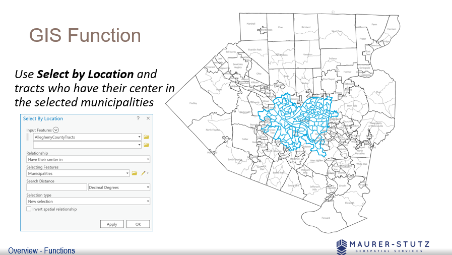
We covered the basic functions of GIS
Earlier this month at the 2025 Illinois Professional Land Surveyors Association (IPLSA) conference, I had the opportunity to present What is GIS? in Springfield, Illinois. The session aimed at breaking down the fundamentals of Geographic Information Systems (GIS) and showing just how much this technology does beyond simply making maps. My goal was to help attendees understand the real power of GIS in infrastructure planning, data management, and decision-making across industries.
To start, I walked through the basics of GIS—how spatial data is collected, stored, analyzed, and visualized. We covered coordinate systems, geodatabases, and why data accuracy is crucial in GIS workflows. This foundation set the stage for diving into real-world applications, where GIS helps land surveyors, civil engineers, transportation planners, and public works professionals work more efficiently.
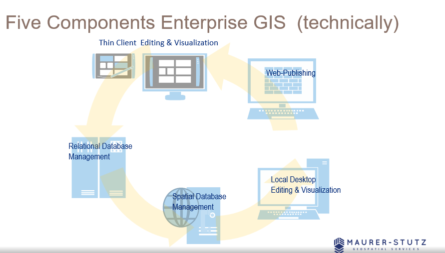
There are 5 components to make GIS an ‘enterprise GIS’
One of the most exciting parts of the presentation was showing off how GIS is used in municipal projects, transportation networks, and utility management to improve efficiency and accuracy. It was great to see the room engage with examples of how GIS lets us visualize changes over time, analyze trends, and make better decisions—whether it's tracking road conditions, mapping flood zones, or planning infrastructure upgrades.
We also talked about Enterprise GIS solutions and cloud-based GIS platforms, explaining how organizations use geospatial databases to streamline their operations. Cloud-based systems like ArcGIS Enterprise are game-changers, keeping data accessible and up-to-date for teams across departments.
Looking ahead, I touched on some exciting innovations in GIS, including Artificial Intelligence (AI) and machine learning in spatial analysis, real-time data integration with IoT sensors, and participatory GIS for public engagement. It’s incredible how GIS is evolving to include more automation and real-time data, making it even more valuable for decision-making.
I had some great help from ILGISA friends around the state. I spent most of the time looking at these examples.
The key takeaway from the presentation is that GIS offers a vast range of possibilities, but it also requires a deep understanding of its technical complexities. By appreciating the skill and expertise involved, professionals can develop greater respect for GIS specialists and recognize the value they bring. Ultimately, fostering collaboration rather than opposition will lead to more effective and innovative solutions in the industry.
GIS is constantly evolving, and its impact reaches far beyond mapping—it’s about making smarter, data-driven decisions that shape our communities. Presenting at IPLSA 2025 was a great opportunity to share that message and connect with others who are just as passionate about geospatial technology as I am. The presentation is Here.
From Maps to Meaning: Celebrating GIS Day
Join us on November 20 for GIS Day, part of American Association of Geographers’ Geography Awareness Week, as we celebrate the impact of Geographic Information Systems in solving real-world challenges! Established by Esri in 1999, GIS Day brings together GIS professionals, students, and curious minds worldwide to showcase how mapping technology helps us understand and improve the world around us.
Geospatial > The Layer File > From Maps to Meaning
Celebrate GIS Day on November 20, 2024, and Explore the Power of Maps!

Join us on November 20 for GIS Day, part of American Association of Geographers’ Geography Awareness Week, as we celebrate the impact of Geographic Information Systems in solving real-world challenges! Established by Esri in 1999, GIS Day brings together GIS professionals, students, and curious minds worldwide to showcase how mapping technology helps us understand and improve the world around us. This year, I'm honored to speak at the McLean County GIS Consortium’s event, where we’ll explore the latest in GIS technology, real-life applications, and the future of spatial insights. From interactive exhibits to live demos, the event promises something for everyone, whether you're a GIS pro or simply fascinated by the world of maps.
GIS Day encourages us all to appreciate geography's role in our lives and its transformative power, from smart city planning to disaster response. As part of Geography Awareness Week, it's a perfect chance to learn about GIS and connect with others who are passionate about mapping solutions for a better world. To learn more about the event and register, visit the McLean County GIS Consortium’s page.
Let's celebrate the role of GIS in building a more connected, informed, and resilient world—see you there!
ILGISA 2024 Recap
The ILGISA 2024 Conference presented a comprehensive slate of sessions, workshops, and panels aimed at advancing GIS practices, tools, and knowledge-sharing for professionals across sectors. A significant theme was the usage of Esri software to address real-world challenges in local government, environmental management, utilities, transportation, and infrastructure.
Geospatial > The Layer File > ILGISA 2024 Recap
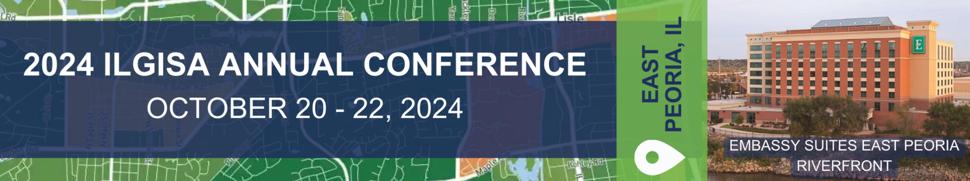
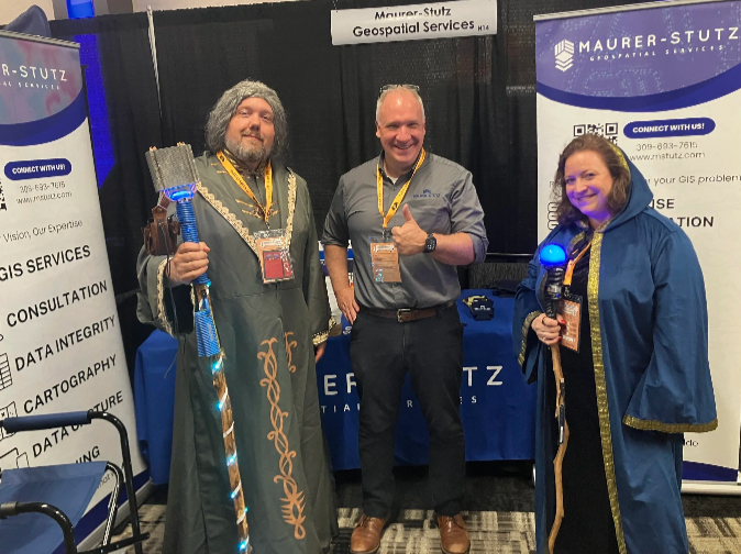
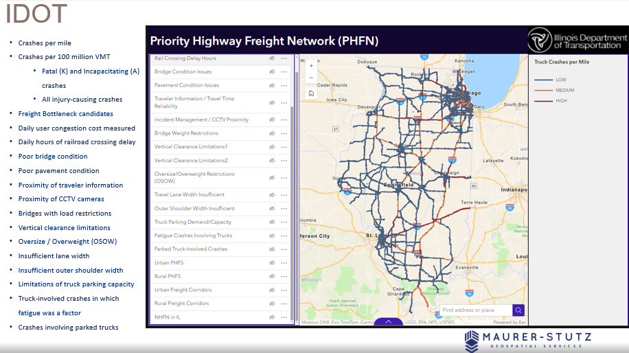
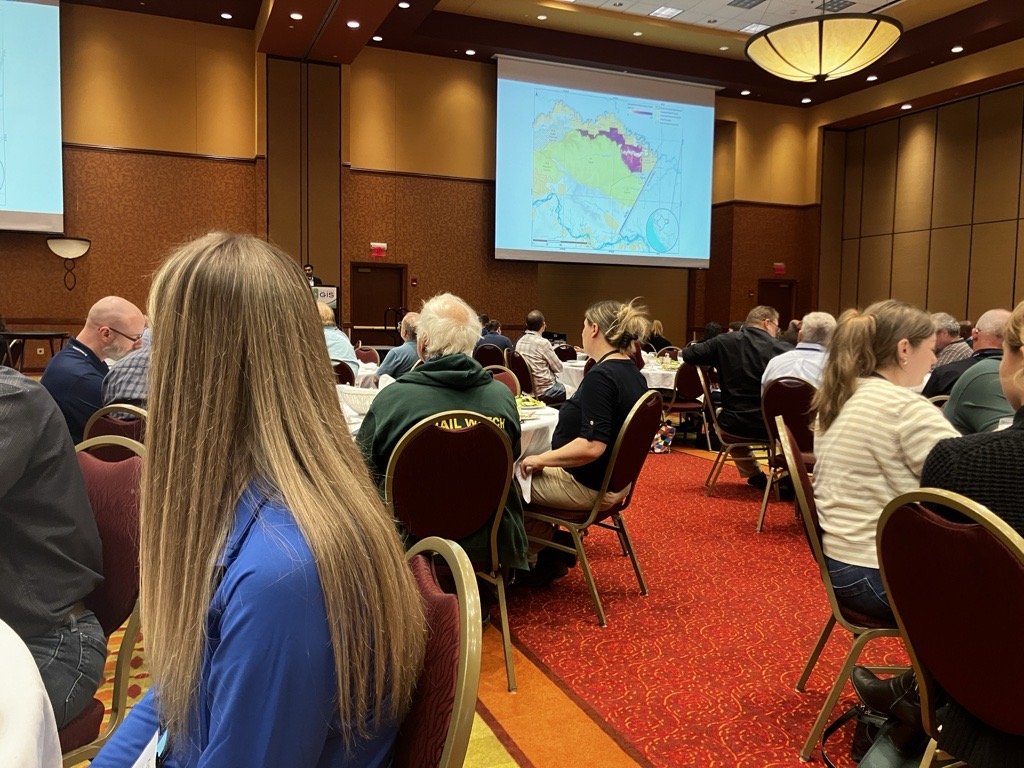
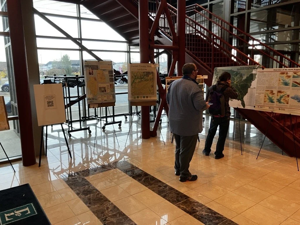
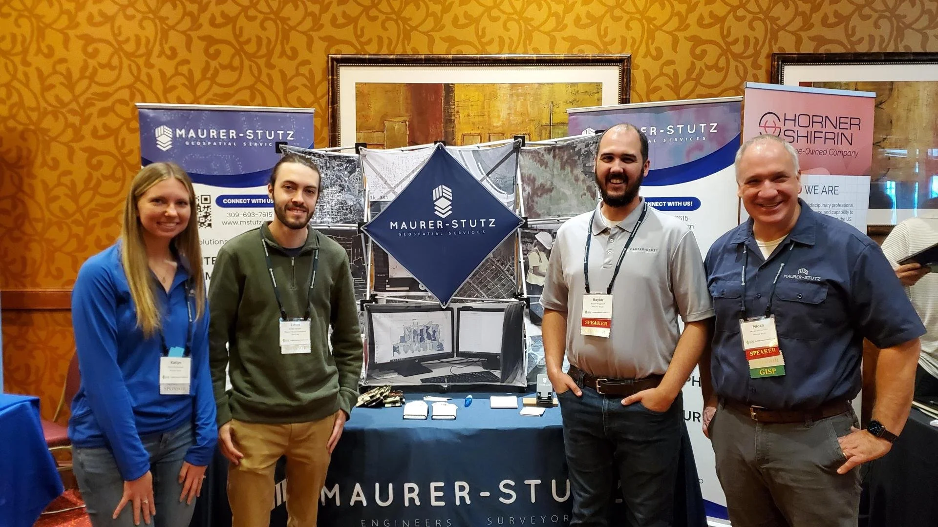
Last week, the entire MSGS staff attended the 2024, Illinois GIS Association annual conference in East Peoria. Attending the ILGISA Annual Conference as a full team provides MSGS with an excellent opportunity for professional growth, networking, and skill enhancement within the Illinois geospatial community. A few days before, we banded together to cover as many of the sessions as we could, some of interest and some to align with projects. Through sessions that cover GIS applications in transportation, utilities, and environmental projects, the team can acquire valuable insights directly applicable to MSGS’s focus areas. See the full agenda Here

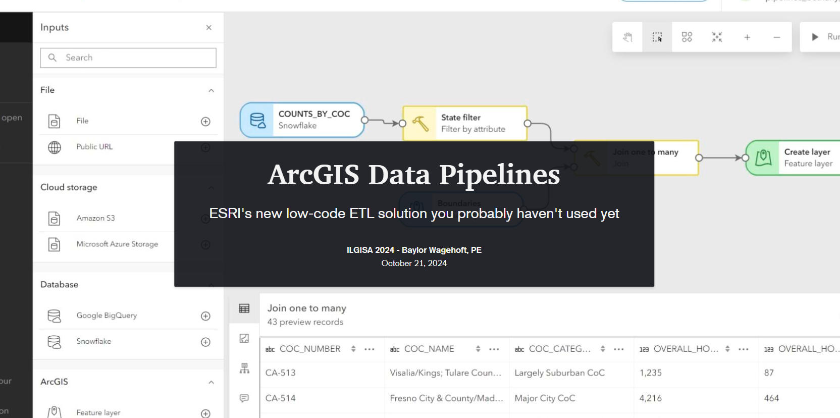
The conference presented a comprehensive slate of sessions, workshops, and panels aimed at advancing GIS practices, tools, and knowledge-sharing for professionals across sectors. As per the norm a significant theme was the usage of how er all use Esri software to address real-world challenges. Some of the most attended sessions were presented by Esri staff themselves, Nate and Anna did great. Some favorite sessions showcased automation and data management within Esri’s platform, covering tools like Microsoft Power Automate & Make.com to streamline repetitive tasks, saving time and reducing error. These sessions highlighted how GIS can enhance community engagement by making spatial data more accessible to the public. Several of our Illinois local government friends showed off very practical examples showed how others could automate data updates and integrate Esri software with enterprise databases using Arcade to keep geospatial information up-to-date across departments. Baylor and Micah both gave presentations on ArcGIS Data Pipelines and ArcGIS Earth respectively. Both were well received even though by Tuesday, Baylor had completely lost his voice. Glad that all the rooms were equipped with microphones.
Not to be one-sided, the open-source sessions underscored the importance of self-sufficiency and scalability in GIS, offering practical takeaways for using these tools to solve real problems. There were several great sessions showcasing FOSS4G-only enterprise GIS deployments. As more organizations turn to open-source GIS, it was great to see the ILGISA community fostering an environment for learning, collaboration, and exploration, empowering professionals with the skills and networks needed to effectively implement open-source solutions.
As an organization, I’m proud to say ILGISA is strong and financially responsible. It is great to see some statewide initiatives gaining traction like the low distortion county projections and even talk (not much else) of a statewide parcel fabric. Chad Sperry received the well deserved Hilton Distinguished Collaboration award and we even gave out the Dahlberg Acheivement award to Cindy Barbra-Brelle for her amazing work on the E911 project.
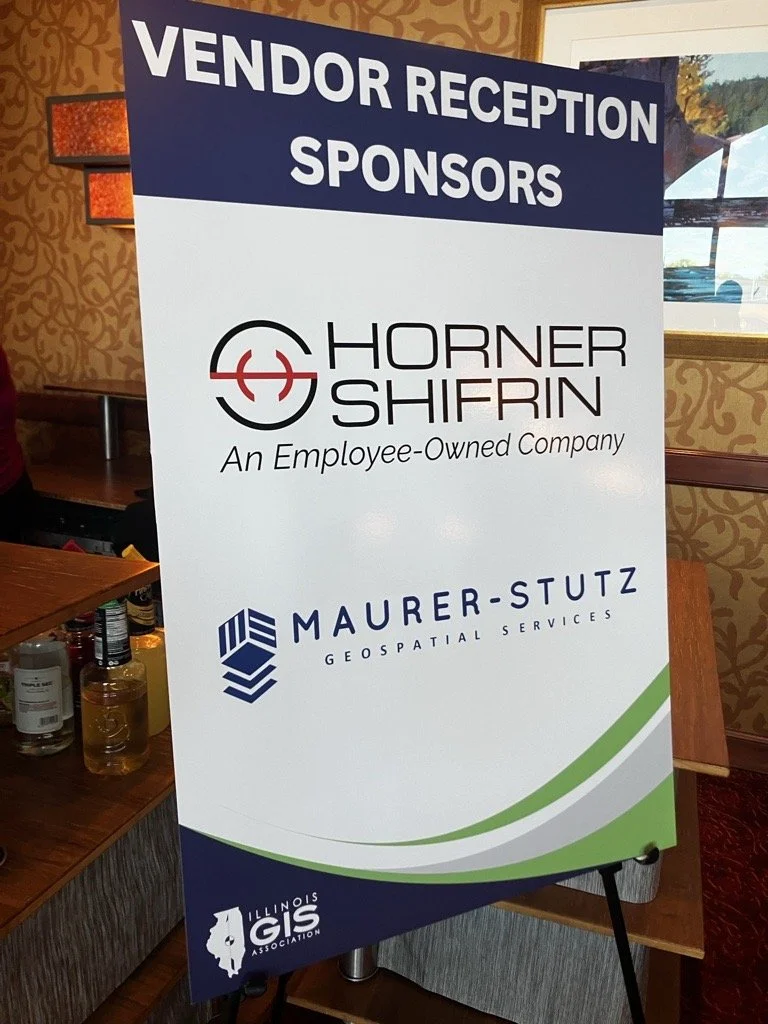
Of course, the social aspect of ILGISA can not be overstated. We enjoyed giving away some MSGS Swag and introducing Ethan and Katie to anyone we could in the Illinois GIS community. Big thanks to our friends from across the river for sponsoring a great social night at Uncle Bucks Bowling. In addition, networking events (just hanging out) facilitated connections between practitioners, enabling them to share their own implementations, discussing common challenges, and explore emerging geospatial technologies together. Through sessions and informal networking, ILGISA 2024 attendees left with valuable insights into how to enhance efficiency, improve data accuracy, and implement innovative solutions within our GIS Industry.
It's Conference Season Already! (PART 2)
It’s September, which means the fall conference season is here. While our young team is still deciding which organizations to support and be a part of, there are a few that are a no brainer: ILGISA, IACE, EPN just to name three. Last week, Baylor and I both visited separate conferences to see if they would be good conferences to attend or even exhibit at in future years.
Geospatial > The Layer File > It's Conference Season Already! (PART 2)
it’s September.
Which means the fall conference season is here. While our young team is still deciding which organizations to support and be a part of, there are a few that are a no brainer: ILGISA, IACE, EPN just to name three. Last week, Baylor and I both visited separate conferences to see if they would be good conferences to attend or even exhibit at in future years. Below is Baylor’s Summary of GEOGRAPH and Micah’s summary of FOSS4G NA was earlier this week.
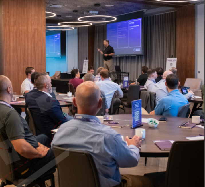
Maurer-Stutz Geospatial Services Attends the 2024 GEOGRAPH User Conference: A New Chapter in Fiber Network Management
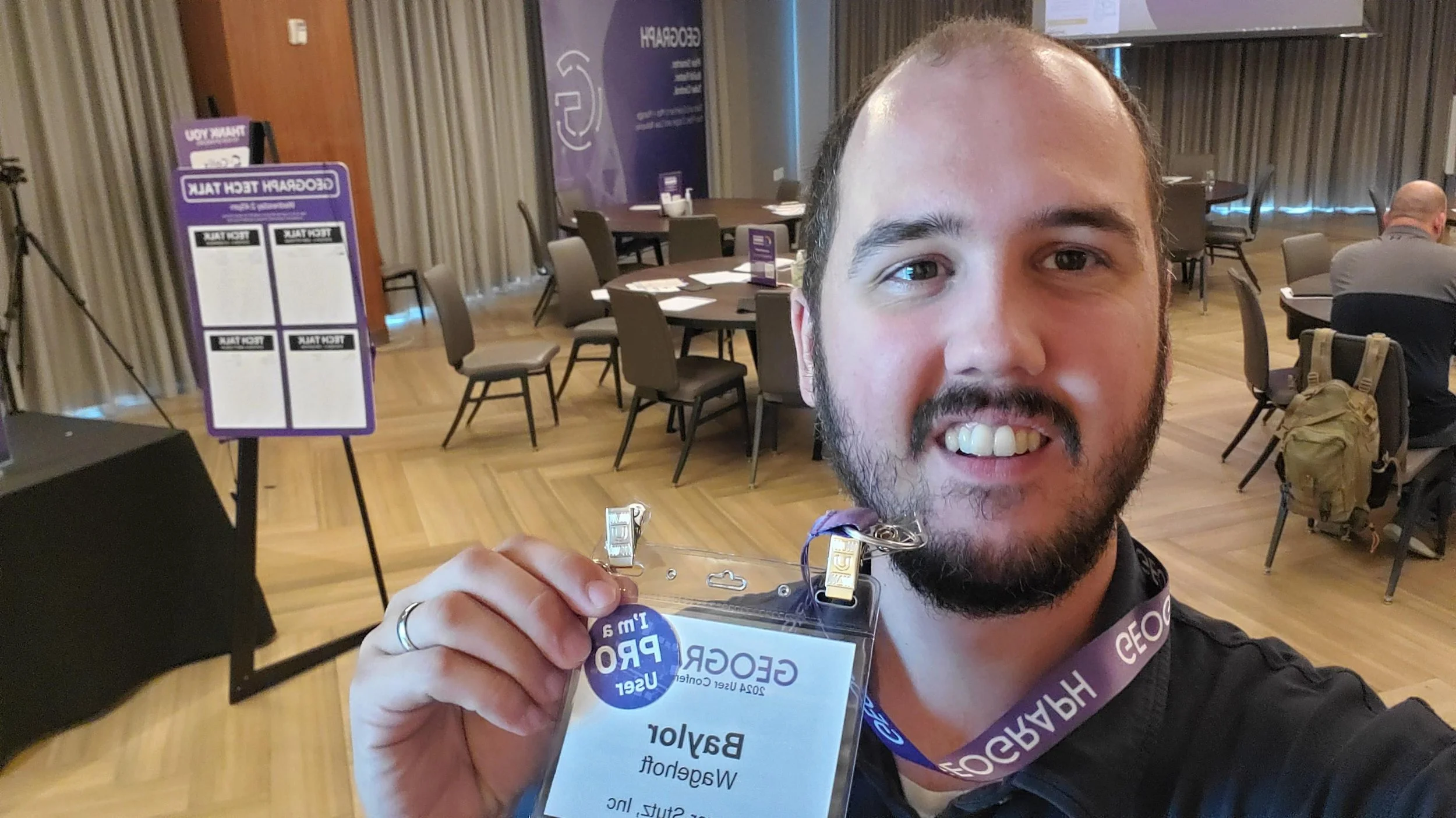
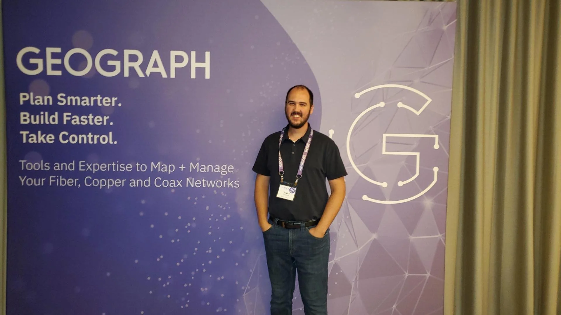
Maurer-Stutz Geospatial Services (MSGS) had the privilege of attending the 2024 GEOGRAPH User Conference in Greenville, SC from September 9-11. This year’s event brought together industry leaders, software developers, and telecommunications experts, providing us with invaluable insights into the latest advancements in fiber network management, broadband mapping, and digital infrastructure planning.
The conference, hosted by GEOGRAPH Technologies, gave us the opportunity to further explore CrescentLink, the powerful fiber network management solution that we’ve been integrating into our geospatial services. Through this collaboration with GEOGRAPH, MSGS is excited to expand our fiber solution offerings, reinforcing our commitment to delivering comprehensive, cutting-edge GIS support for fiber providers.
Highlights from the Event:
GEOGRAPH’s Vision for the Future: CEO Bruce Smith shared an exciting update on GEOGRAPH's growth and future innovations during the opening keynote. With new developments on the horizon for CrescentLink, we look forward to continuing our partnership, enhancing our service offerings to ensure our clients can take full advantage of the CrescentLink platform.
Broadband Mapping and Digital Divide Solutions: One of the most impactful sessions featured Jim Stritzinger, the South Carolina Broadband Director, who shared how their state is leading the way in broadband mapping and BEAD fund management to bridge the digital divide. This insight fuels our passion for working with underserved fiber providers, ensuring communities across Illinois and beyond benefit from the same cutting-edge fiber management tools.
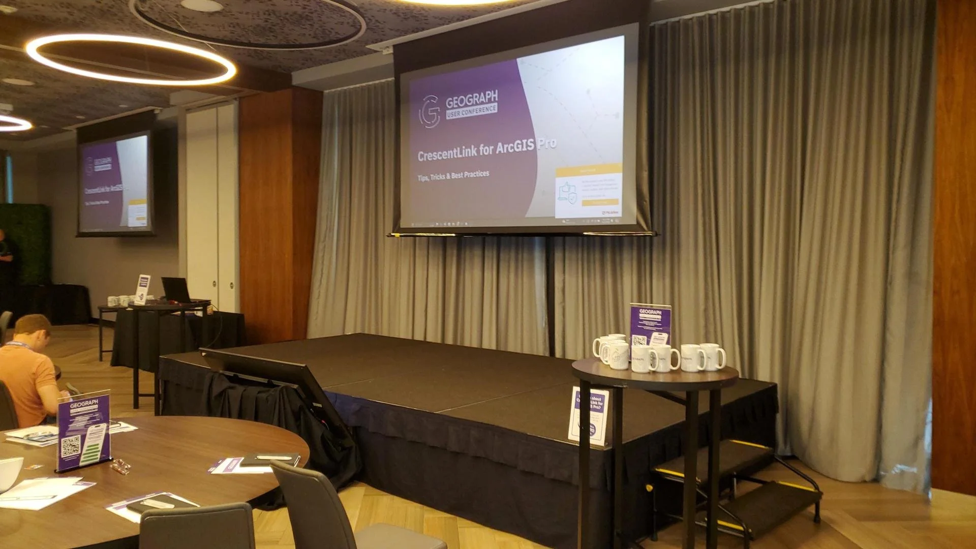
CrescentLink for ArcGIS Pro: With CrescentLink’s move from desktop to ArcGIS Pro, MSGS is eager to help our clients transition smoothly. Sessions led by Grey Pittman and DJ Henrique offered best practices and valuable tips on how to fully leverage CrescentLink within ArcGIS Pro. With MSGS’s expertise in enterprise GIS, we are well-positioned to support our clients in making this shift and maximizing the benefits of this next-generation software.
Engaging One-on-One with GEOGRAPH Experts: A unique feature of this year’s conference was the GEOGRAPH Tech Talk, where we had the opportunity to engage in in-depth, one-on-one conversations with the CrescentLink development team. Our team was able to discuss current and future needs for our clients, planning how we can continue to innovate and provide exceptional geospatial services in fiber network management.
Looking Ahead:
At MSGS, our focus has always been on providing specialized geospatial solutions that turn our clients’ visions into reality. Partnering with GEOGRAPH Technologies allows us to expand our offerings to include enhanced fiber network deployment, conversion, and ongoing management services—ensuring our clients can optimize their fiber networks from the ground up.
The 2024 GEOGRAPH User Conference affirmed that fiber networks are the digital backbone of tomorrow’s infrastructure. By combining MSGS’s deep expertise in GIS with CrescentLink’s powerful tools, we’re setting a new standard for fiber management, particularly for small and mid-sized providers who may lack access to these advanced solutions.
As we look ahead, we’re excited to continue working closely with GEOGRAPH, offering a seamless experience for our clients in deploying and managing fiber networks. This collaboration allows us to deliver tailored, scalable solutions, empowering providers to expand their network capabilities, enhance customer satisfaction, and ultimately stay ahead in the rapidly evolving telecommunications industry.
For more information on how MSGS and CrescentLink can transform your fiber network management, visit our website or schedule a call with one of our experts today.
It's Conference Season Already! (PART 1)
It’s September, which means the fall conference season is here. While our young team is still deciding which organizations to support and be a part of, there are a few that are a no brainer: ILGISA, IACE, EPN just to name three. Last week, Baylor and I both visited separate conferences to see if they would be good conferences to attend or even exhibit at in future years.
Geospatial > The Layer File > It's Conference Season Already! (PART 1)
it’s September.
Which means the fall conference season is here. While our young team is still deciding which organizations to support and be a part of, there are a few that are a no brainer: ILGISA, IACE, EPN just to name three. Last week, Baylor and I both visited separate conferences to see if they would be good conferences to attend or even exhibit at in future years. Below is Micah’s summary of FOSS4G NA. Baylor’s Summary of GEOGRAPH will be next.
FOSS4G North America
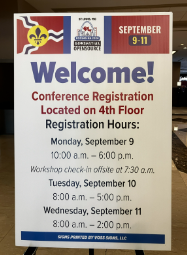
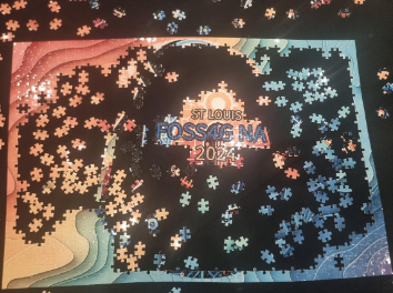
The 2024 Free and Open Source Software for Geospatial (FOSS4G) North America conference took place in St. Louis, Missouri, from September 9-11. It attracted a wide variety of geospatial professionals, developers, and enthusiasts to collaborate and explore the transformative potential of open-source geospatial technologies. A key focus of the conference was on democratizing access to geospatial tools, emphasizing how open-source solutions can empower individuals, small businesses, and organizations.
I (Micah) actually did my Master’s thesis on FOSS4G software in the Enterprise GIS realm. So, even with spending 90% of my career in Esri software, I have a working knowledge of the players and platforms. Additionally, the STL is too close not to attend such a notable and relevant conference. Aside from the agenda looking great, I wanted to meet a few of the people I saw chatting about the conference online. Unfortunately, due to scheduling issues and family commitments, I could only attend on Wednesday. Still, I wanted to know where FOSS4G as an industry is compared to the proprietary behemoth with whom we are admittedly a part of their partnership network.

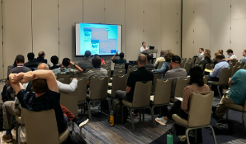

Sessions
The sessions I leaned towards spoke of web mapping, data, and enterprise systems. I learned that there is a working community group at the the World Wide Web Consortium (W3C) to develop standards and guidelines for creating a new standardized and easy map HTML element for display in modern browsers. The demonstration of MapML showed tiling, full screen, as well as pop-ups interacting with the OGC services from GeoServer via custom CSS. Noting stated about other protocols.
What I did learn about Parquet and GeoParquet is that I should be using it. Not so much Crunchy Bridge analytics, I don’t have that much data and it’s too onerous to port what I do have.
Although, the Overture Map Foundation is of interest, I’m skeptical. My very distilled explanation is that it starts with Open Street Map data, enhances with TomTom data and a dash of Foursquare into it, and provides it to whoever wants to download. I do want to critically look at the data for the small towns that are our clients. Also, this may be a great place to start to learn GeoParquet seeing that is how they deliver the data. Regardless of the quality of data, it was a fantastic presentation by Steven Pousty.
After lunch, and learning that Mapillary is actually owned by Meta now (Hello 2020), I heard the best quote from the developer of startup GeoBlaze during a live demo on Hotel WiFi: “It’s so fast, you think it’s not working”, neat tool, don’t know what it’s for. I tried to learn how to scrape geodata, but was quickly lost in the technical details.
The final presentation I went to was to see the evolution of GeoMoose 4. This fast, lightweight web viewer now works serverless. Dan Little showed the snazzy demo published from a public Google Drive folder. The application has quite the modern ‘feel’ and read geo layers right from within the folder.
Thoughts
Here’s a Hot Take: Linux and other FOSS may run the world during apocalypse, but that's not now.I believe in the idealism and the core principles of Free and Open Source Software, but I don’t think they’re practical in real life (Insert your token statistic here of what already runs on FOSS). Believe me, as a card-carrying GenXer, I LOVE the idea of going against the grain. I push back whenever I can, I listen to STP on 11, I don’t match my socks, and drive an old jeep because I choose to, don’t you dare tell me what to do. That mentality is all well and good when you are your own boss or there is a principled leadership decision to use FOSS. As a consultant using someone else’s money to build a business that plays nicely with a local governments' GIS and a DOT’s project requirements, I need to use the proprietary software that they are or tell us to.
Here's a hard truth, using FOSS, and specifically FOSS4G, is not easy. I still don’t see a complete out-of-the-box FOSS enterprise GIS solution that can compete with ArcGIS Enterprise. This discrepancy is especially accentuated when 99% of your clients use Esri. Do not misunderstand, sometimes Esri is the bane of my existence. I can rant and rail with the best of the trolls, but this is business. I need to prove my excellence in the board room and on proposals in the most efficient way possible. Everyone loves to hate on success while they quietly try and copy it.
I will continue to keep an eye on FOSS4G. I promise to keep my version of QGIS updated. I will not roll my eyes at open-source projects. I will continue to push for open standards and data. I also appreciate the community built around FOSS4G. Everyone loves an underdog.

Advanced GIS Leadership
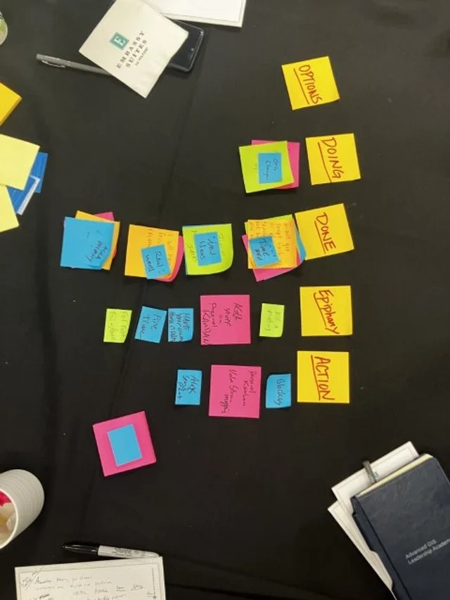
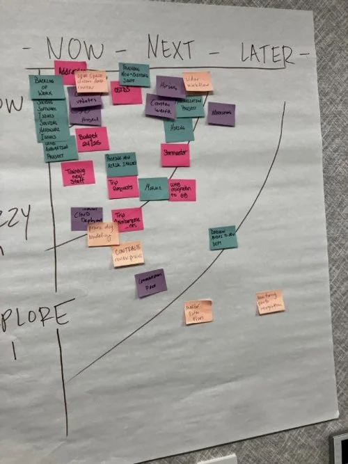
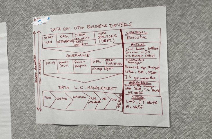
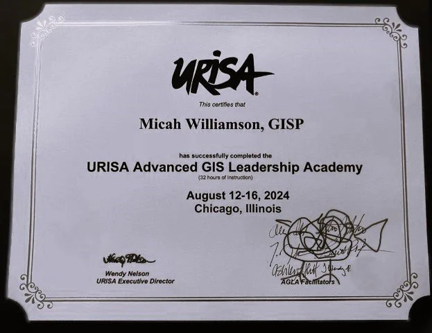
Last week, I had the opportunity to attend the URISA Advanced GIS Leadership Academy in Chicago, and it was a game-changer for how I approach both leadership and GIS. This intensive program brought together GIS professionals from across the country, each of us had unique challenges and insights, but all sharing some common experiences and struggles. It was a bit of therapy really. Among the many sessions, the ones on Value Stream Mapping and Personal Kanban really stood out to me.
Geospatial > The Layer File > Advanced GIS Leadership
Last week, I had the opportunity to attend the URISA Advanced GIS Leadership Academy in Chicago, and it was a game-changer for how I approach both leadership and GIS. This intensive program brought together GIS professionals from across the country, each of us had unique challenges and insights, but all sharing some common experiences and struggles. It was a bit of therapy really. Among the many sessions, the ones on Value Stream Mapping and Personal Kanban really stood out to me.
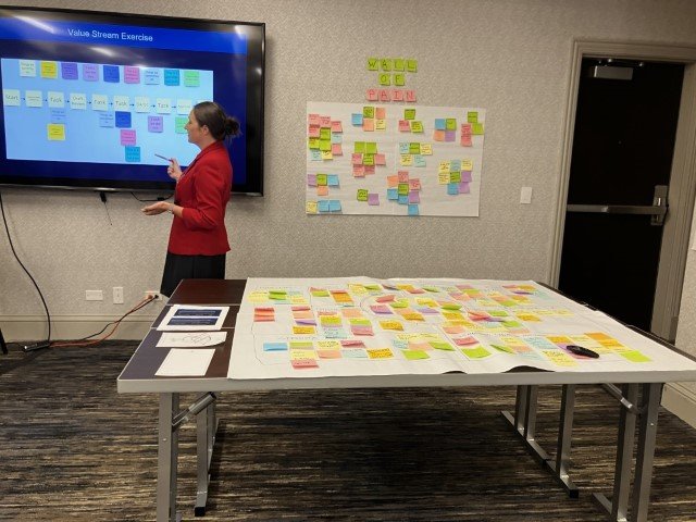

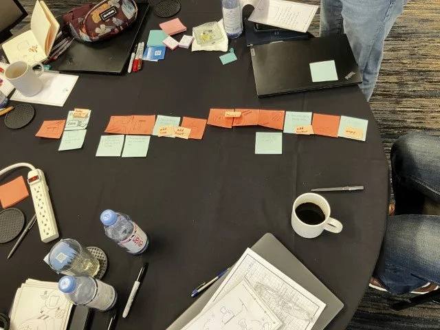


Value Stream Mapping
A method that helps visualize and optimize the flow of processes in our projects. It’s a powerful way to identify bottlenecks and streamline our workflows, ensuring that we’re delivering the best results with maximum efficiency. I’m already thinking about how to apply these concepts to enhance our project management at Maurer-Stutz.
Personal Kanban
Another session that really resonated with me was on Personal Kanban. I’ve played with Kanban before (pronounced however you pronounce “pecan”) This approach to managing tasks and workflows is both simple and effective, offering a visual way to prioritize and track work. It's about finding balance and focus, two things that can be challenging in our fast-paced field. I’m eager to get back to Kanban, not just for myself, but also to encourage my team to use it as a way to stay organized and reduce stress.
Additional highlights focused on:
Building and sustaining Effective teams even with remote members. Road-mapping a hypothetical GIS project as a group, providing clear near-term and long-term GIS initiatives. The Data Governance session highlighted the importance of establishing policies and standards regardless the size of the organization. Ans of course we discussed the Ethics of GIS projects emphasizing the impact of decisions on privacy and equity. These sessions reinforced my approach to building the MSGS department at Maurer-Stutz, where we are striving to integrate geospatial solutions seamlessly with our civil and transportation engineering projects as well as our own stream of projects.
It was just a great chance to connect with other GIS professionals and hear about their experiences. The discussions were real, down-to-earth, and incredibly valuable for someone in my role. Overall, the academy left me with fresh ideas and practical strategies that I’m excited to bring back to our team. If you ever get the chance to attend, I highly recommend it—especially if you’re looking to refine your leadership skills and get a better handle on managing your team and projects. I’m looking forward to applying these lessons as we continue to grow and evolve the MSGS department.

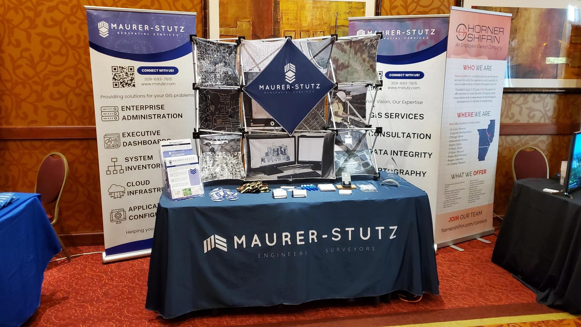
We've got SWAG!
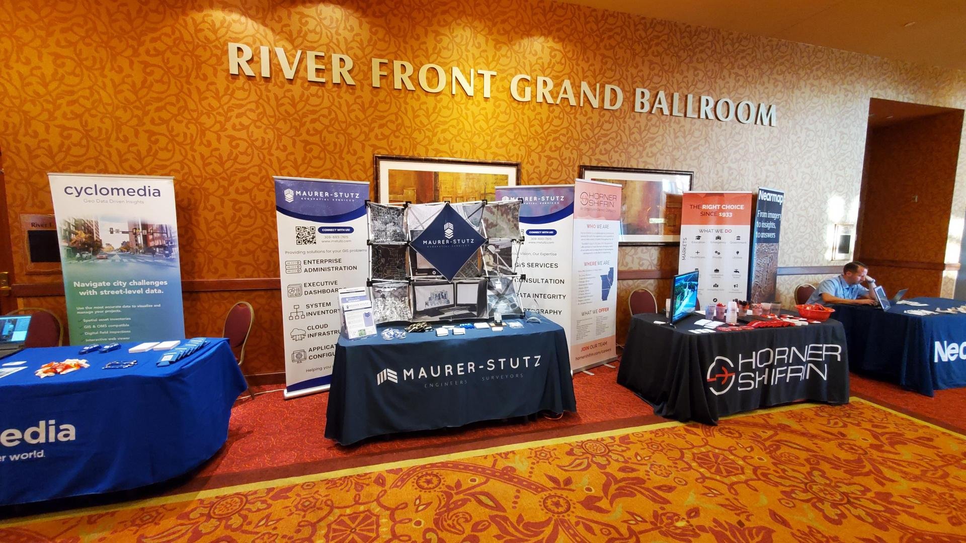
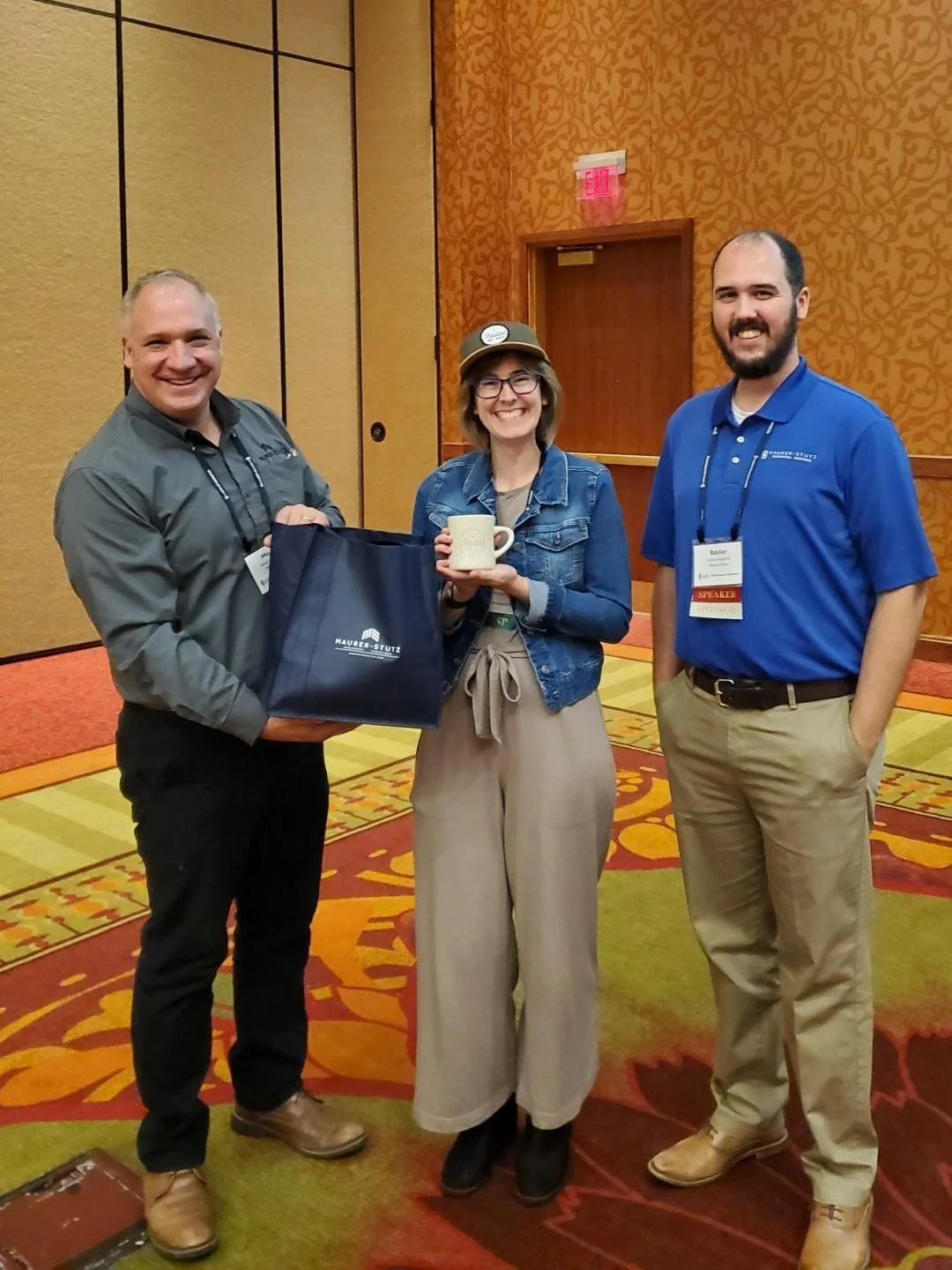
Lets admit it, we all go to conferences to get our own bags of stuff… and training, but really the stuff. Well, thanks to the great marketing strategy already established at Maurer-Stutz INC, We’ve got a whole storage room filled with SWAG to give away Plus some of our own.
Geospatial > The Layer File > We’ve Got Swag
Not the Jay Z kind, rather the Stuff-We-All-Get kind.
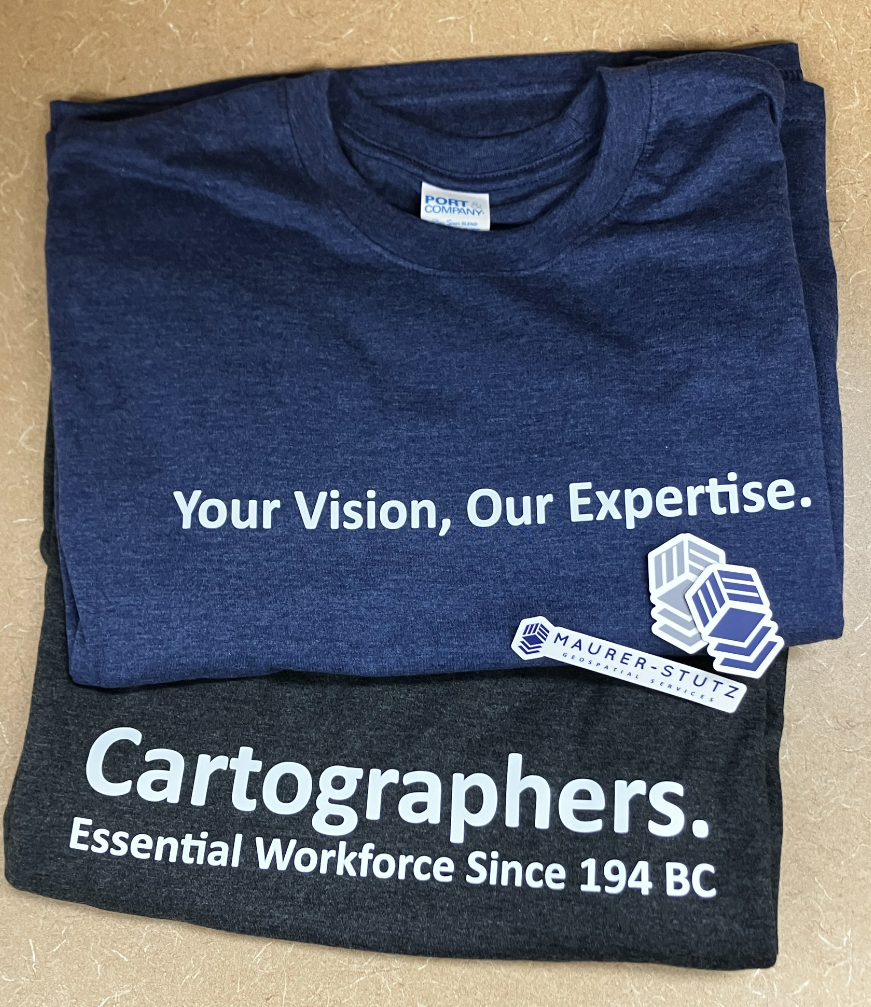
Contrary to popular belief, JayZ didn’t come up with the word swag, he just shortened swagger. In the original Middle-English (according to Google) ‘swag’ is a word of Scandinavian origin meaning ‘bulging bag’. Which is fitting.
Let’s admit it, we all go to conferences to get our own bags of stuff… and training, but really the stuff. Well, thanks to the great marketing strategy already established at Maurer-Stutz, We’ve got a whole storage room filled with SWAG to give away, including a few humorous stress toys from our Agriculture group. While we are not bringing cows or poop-emojis to ILGISA, we are bringing some MSGS-specific stuff: Stickers, Pens, and a few t-shirt for selected clients. We have our own geospatial-related banners and an expanding table-top display. In short, we are ready for the fall conference season.


