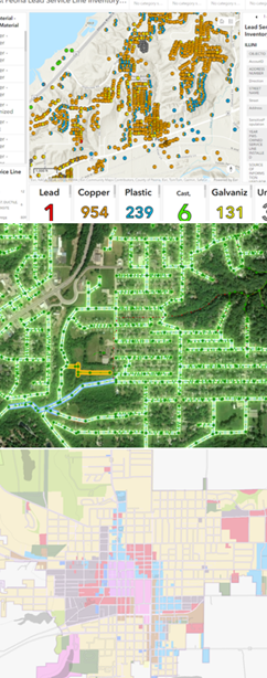
One Year With Engineers
A year ago, I walked into Maurer-Stutz with a mission: to build something new, something purpose-driven, something lasting. That something became Maurer-Stutz Geospatial Services (MSGS). Now, 12 months in, I can confidently say we’re not just building a team—we’re building momentum
One Year at Maurer-Stutz: Building a Geospatial Foundation for the Future
A year ago, I walked into Maurer-Stutz with a mission: to build something new, something purpose-driven, something lasting. That something became Maurer-Stutz Geospatial Services (MSGS). Now, 12 months in, I can confidently say we’re not just building a team—we’re building momentum.

Starting From the Ground Up
When I joined the company on April 29, 2024, the Geospatial Department was more of an idea than an entity. With one GIS Specialist; Katie Kopkowski, who stuck around to be the anchor, we had talent, but we needed direction, structure, and an identity. I knew from the beginning that MSGS couldn’t be “just the map guys” on engineering projects. MSI leadership wanted us be strategic partners, not just a service department. Trusted advisors, not only task-takers.
Beigin at the begining
So, we began with the essentials. Working through the process as if we were starting a new business, but with the advantage of having supporting oversight structure.
Conducted a full assessment of existing software, hardware, and workflows.
Evaluated team strengths and gaps in a SWOT analysis.
What engineering clients existed and which represented low-hanging fruit.
Built a business plan with a six-year growth strategy, aligning revenue goals with staffing targets and market segments.
Developed mission and vision statements to clarify who we are—and who we are not
Building the Right Team
This work isn’t possible without people. I’m proud to lead a growing team that now includes Geospatial Engineer Baylor Wagehoft, fellow ISU Redbird Ethan Geisler, and Geospatial Intern Michelle Wagehoft. Next month, we will welcome our sixth employee who will focus on the Agricultural market. Each team member brings a unique set of strengths to the table and we’ve focused on creating a collaborative culture built on professionalism, mutual respect, and shared accountability with our Team Operations Manual (T.O.M.)

Growing with Purpose
In just one year, we’ve:
Supported multiple infrastructure and fiber deployments with precision GIS solutions.
Partnered with our own MSI engineering groups without becoming “support-only” on projects.
Initiated the modernization client GIS and database migration and tuning.
Established professional partnerships in cloud architecture, economic development, utilities, and broadband.
A key part of our journey has been thoughtfully drawing a line between the way things have traditionally operated at MSI and the direction we're heading—evolving from a service-oriented support group into a focused, independent, growth-focused team—a shift that will require continued clarity, communication, and collaboration as we grow. We’re becoming a revenue-generating, client-facing, innovation-focused business unit. And our identity is no longer in question—we are MSGS, and we are growing.
Looking Ahead

Up And To The Right!
Year one was about foundations. Year two is about scaling.
We’re focused on:
Expanding our managed services offerings.
Growing cloud GIS capabilities.
Deepening client relationships and building repeatable solutions.
Recruiting talent that shares our drive for innovation and excellence.
I’m grateful for the leadership at Maurer-Stutz inc. for supporting this vision, and for my team for embracing the challenge. This isn’t just about GIS—it’s about transformation. At MSGS, our mission is: To transform our clients' and industry partners' unique visions into reality through specialized geospatial expertise. Our B.H.A.G. is: By 2030, MSGS will be a recognized leader in geospatial services industry by providing solutions in the broadband, utility infrastructure, and consultant engineering domains.
Here’s to year two—and all the vision, trust, and growth it will bring.
We will accomplish this by delivering quality services with integrity, care, and efficiency. Working with you by design.
Email us for more information:
It's Official! MSGS and GEOGRAPH Partnership Announcement
Our Geospatial Services group is thrilled to announce a significant milestone—a strategic partnership with GEOGRAPH Technologies! GEOGRAPH Technologies is a leader in the fiber utility geospatial technology sector, known for developing CrescentLink, a powerful telecommunications asset management software add-in for ArcGIS Pro. Our expertise in Enterprise GIS and consultant GIS services complements their product, creating a collaboration that will amplify the value they deliver to their customers. Stay tuned as we share more about specific projects and successes stemming from this partnership!
Geospatial > The Layer File > MSGS and GEOGRAPH Partnership Announcement

Our Geospatial Services group is thrilled to announce a significant milestone—a strategic partnership with GEOGRAPH Technologies! This collaboration marks a new chapter in delivering cutting-edge geospatial solutions to the fiber broadband industry in alignment with our mission to provide innovative and impactful engineering and consulting GIS services.
Why GEOGRAPH Technologies?
GEOGRAPH Technologies is a leader in the fiber utility geospatial technology sector, known for developing CrescentLink, a powerful software add-in for ArcGIS Pro. CrescentLink is specifically designed to manage telecommunication infrastructure data, with a focus on fiber connectivity networks. Our expertise in Enterprise GIS and consultant GIS services complements their existing product offering, creating a collaboration that will amplify the value they deliver to their customers. Both Micah and Baylor were first introduced to CrescentLink and the GEOGRAPH team during they tenure in the Fiber Broadband industry, and can attest to its ease of use and robust suite of tools for managing fiber broadband connectivity information.
Shared Values and Vision
At the core of this partnership is a shared commitment to innovation, excellence, and client/customer success. Both of our teams are driven by the goal of empowering each organization with the tools and insights needed to solve real-world challenges in the telecommunications industry. GEOGRAPH views this as a "both parties forward" arrangement, with MSI/MSGS branding present on sales media and MSGS staff included in prospective customer meetings.
All work performed by MSGS on behalf of GEOGRAPH will be routed through a subconsultant Master Services Agreement between the two firms. GEOGRAPH and their team of dedicated Account Managers and Professional Services staff will continue to act as the primary point-of-contact for their customers; facilitating all customer quoting, invoicing, as well as project management. This streamlined arrangement helps us focus on delivering high quality GIS consulting services to their customers without administrative burden on either party.
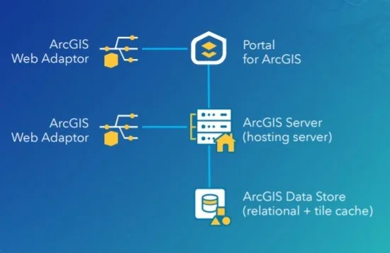
ArcGIS Enterprise Base Deployment Schematic
What This Partnership Means for MSGS
Our subconsultant partnership with GEOGRAPH Technologies is mutually beneficial:
Tailored Solutions: By combining GEOGRAPH’s robust tools with our industry knowledge in Enterprise GIS, we can develop tailored solutions to meet the unique needs of their clients in the telecommunications industry and beyond!
Enterprise GIS: This collaboration will initially focus on completing Enterprise GIS Deployments for GEOGRAPH’s customers, including the implementation and integration of CrescentLink into the customer’s broader GIS/IT ecosystems. These efforts will address a strategic need for their customers, as it is a prerequisite requirement to using their CrescentLink platform.
Geospatial Solutions Plans (GSPs): In addition to our Enterprise Deployment services, GEOGARPH Customers can purchase prepaid blocks-of-hours on a subscription-based model. These flexible plans can be used for nearly any GIS consulting task, including geodatabase management, basic script development, training, and more. The GSP provides an efficient way to access expert support tailored to the customers unique geospatial consulting needs.
“The team at GEOGRAPH is nothing short of fantastic to work with. They care deeply about their customers and have an exceptional product [CrescentLink] for managing telecommunication plant assets and connectivity information. We look forward to working closing with them to help their customers get the most out of the CrescentLink deployments. ”
Looking Ahead
The entire MSGS Team is humbled by the trust and relationship that we are developing with GEOGRAPH. We’re already working closely on several smaller pilot projects, with many more in their sales funnel. Stay tuned as we share more about specific projects and successes stemming from this partnership!
Introducing: Geospatial Solutions Plans
Maurer-Stutz Geospatial Services is excited to introduce our newest contracting solution, Geospatial Solutions Plans! These subscription-based, block-of-hours contracts are idea for organizations large and small that need the flexibility of a top tier geospatial consultant on demand.
Geospatial > The Layer File > Geospatial Solutions Plans

At Maurer-Stutz, “Working with you by design” is more than just a motto—it’s a promise. We believe every organization’s challenges are unique, and so are the solutions needed to address them. In the consulting world, this has typically meant project-based contracts reign supreme – scopes and costs are defined up-front with little wiggle room for change without renegotiation.
While these types of contracts certainly have their place, what if you don’t know what your needs are in advance? Is a fixed contract the best use of your organization’s time and resources? In some cases, long-term contracts and one-size-fits-all projects can leave you feeling boxed in.
Dynamic organizations deserve a partner that can be dynamic with them. That’s why at MSGS we’ve introduced our Geospatial Solutions Plans (GSPs): a flexible, subscription-based consultant model that delivers high-level GIS expertise through pre-paid blocks of hours.
With our GSPs, you’ll enjoy budget certainty, scalable support, and the peace of mind that comes from having a dedicated partner by your side—one who truly understands your vision and is ready to adapt to your evolving needs. In this blog, we’ll show you how working together by design leads to better, more responsive geospatial solutions, no matter your organization or industry focus.
What Are Our Geospatial Solutions Plans (GSP)?
Our GSPs are contracts designed for clients that need top-tier geospatial expertise without the stringent commitments of traditional, project-based agreements. With our subscription model, you purchase a block of consulting hours that you can use as needed throughout the plan year.

This means:
Flexible Support: Access expert advice and technical support on demand.
Cost Predictability: Know your expenses upfront with a pre-paid block of hours.
Scalable Engagement: Adjust the level of support as your project needs evolve.
How the Subscription Model Works
When engaging customers on our GSPs, we start with a thorough onboarding process to understand your unique challenges and goals. Here’s what you can expect:
Initial Consultation & Needs Assessment:
Before anything is signed, we will discuss your objectives and current geospatial challenges. This step ensures that the GSP plan level is tailored to your requirements. Our goal is to “right size” the package to fit your anticipated needs.Customizing Your Service Package:
Based on this assessment, we recommend a subscription level (block of hours) that fits your organization’s scope. These hours can be used for a wide variety of GIS consulting services across many different industries (examples below!).Subscription Check-Ins:
We schedule regular check-ins to make sure your organization’s needs are being met efficiently and effectively. This iterative process helps us fine-tune our solutions and ensure continuous improvement throughout the life of the subscription. If your organization is finding value in our consulting services, you can move to a higher plan level as needed.
Renewal
The GSP is an annual subscription. We will never force you to use your consulting hours, and unused hours will roll over to the next subscription plan year. You have the freedom to use them on smaller projects or save them for several years.

Tailored Services That Fit Your Industry
With our Geospatial Solutions Plans, you get full access to our skilled team of dedicated developers, GIS Analysts/Professionals, and Enterprise Administrators who are ready to meet the specific needs of your organization. From Municipal Governments, to Engineering Consultants, to Fiber Broadband Providers, we have the right combination of talent and experience to provide a wide variety of geospatial consulting services.


ESRI Utility Networks
ArcGIS Online Administration
Infrastructure Asset Inventories
Cadastral & Administrative Data Management
Custom Maps, Apps, and Dashboards
ArcGIS Hub Sites and ArcGIS Solutions Deployments
Authoritative Data sourcing & truthing
GIS/CAD/Survey Integrations
JULIE Design Tickets
Geospatial Analysis
Engineering Modelling Inputs
Custom Field Data Applications
Map and Data Report Deliverable Development
ArcGIS Enterprise Deployments
Database Maintenance & Cleanup
Splice Record Imports
Custom Scripting
3rd Party Integrations
Construction Planset Templates
The Benefits of a Block-of-Hours Model
Choosing our subscription-based GSPs means embracing a new level of flexibility and partnership:

On-Demand Expertise: No need to commit to a rigid scope-defined contract—use your hours whenever the need arises.
Predictable Budgeting: With pre-paid hours, you can manage expenses more effectively without unexpected costs. GSPs are calculated based on a discounted average hourly rate when compared to straight time/material contracts. This translates into savings for your organization over the life of the subscription.
Managed Services: For those customers that need ongoing support and maintenance of their GIS deployments, we offer Managed Services within our higher GSP plan levels. This service guarantees weekly check-ins to your infrastructure for performance, maintenance and longevity tasks to keep your GIS deployments running smoothly.
Long-Term Partnership: This model fosters a close, ongoing relationship that allows us to develop a deep understanding of your organization and its geospatial needs.
Ready to Transform Your Business?
If you’re looking to harness the full potential of your geospatial data, our Geospatial Solutions Plans offer a smart, flexible alternative to traditional consulting contracts.
Contact us today for a consultation or to schedule a demo, and discover how our tailored, expert support can drive your business forward.
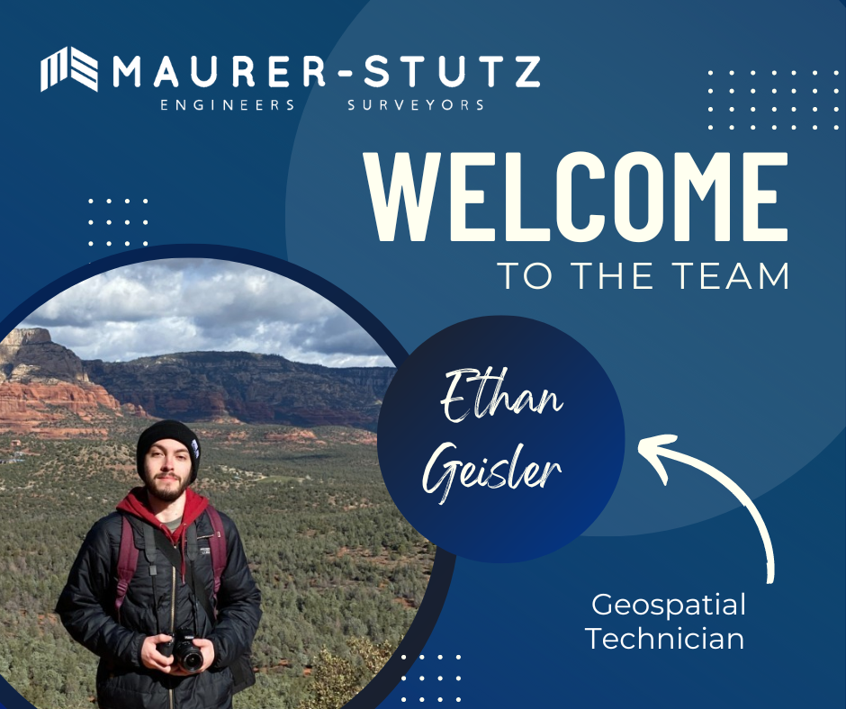
Ethan Geisler Joins Our Geospatial Team
We are thrilled to welcome Ethan Geisler to the Maurer-Stutz Geospatial Services (MSGS) team. Ethan joins us as a Geospatial Specialist with a fresh degree in Geography from Illinois State University, and he's eager to hit the ground running. With a background in GIS software like ArcGIS Pro and ArcGIS Online, Ethan brings a well-rounded skill set.
Geospatial > The Layer File > Ethan Geisler Joins Our Geospatial Team
We are thrilled to welcome Ethan Geisler to the Maurer-Stutz Geospatial Services (MSGS) team!

Ethan joins us as a Geospatial Specialist with a fresh degree in Geography from Illinois State University, and he's eager to hit the ground running. With a background in GIS software like ArcGIS Pro and ArcGIS Online, Ethan brings a well-rounded skill set, honed during his internship with FEMA where he developed a Tornado Awareness dashboard application. This real-world experience will help him seamlessly integrate into our projects, which often involve critical data and mapping needs.
What sets Ethan apart is his passion for using GIS to solve real-world challenges, a trait he demonstrated in his final project at ISU, where he worked on a pedestrian safety study using Survey123. Outside of work, Ethan’s organizational leadership skills shine as the former President of ISU's Music Business Organization, where he organized events and led a team of fellow students—skills that will serve him well as he collaborates with our team on diverse geospatial projects. He also plays drums and is deeply invested in the Game of Thrones franchise.
Ethan will be working closely with our team to support infrastructure mapping, perform spatial analysis, and contribute to the development of tailored GIS solutions for our clients. We’re excited to see his fresh perspective and strong attention to detail make an impact as we continue to grow our geospatial services.
Welcome aboard, Ethan!

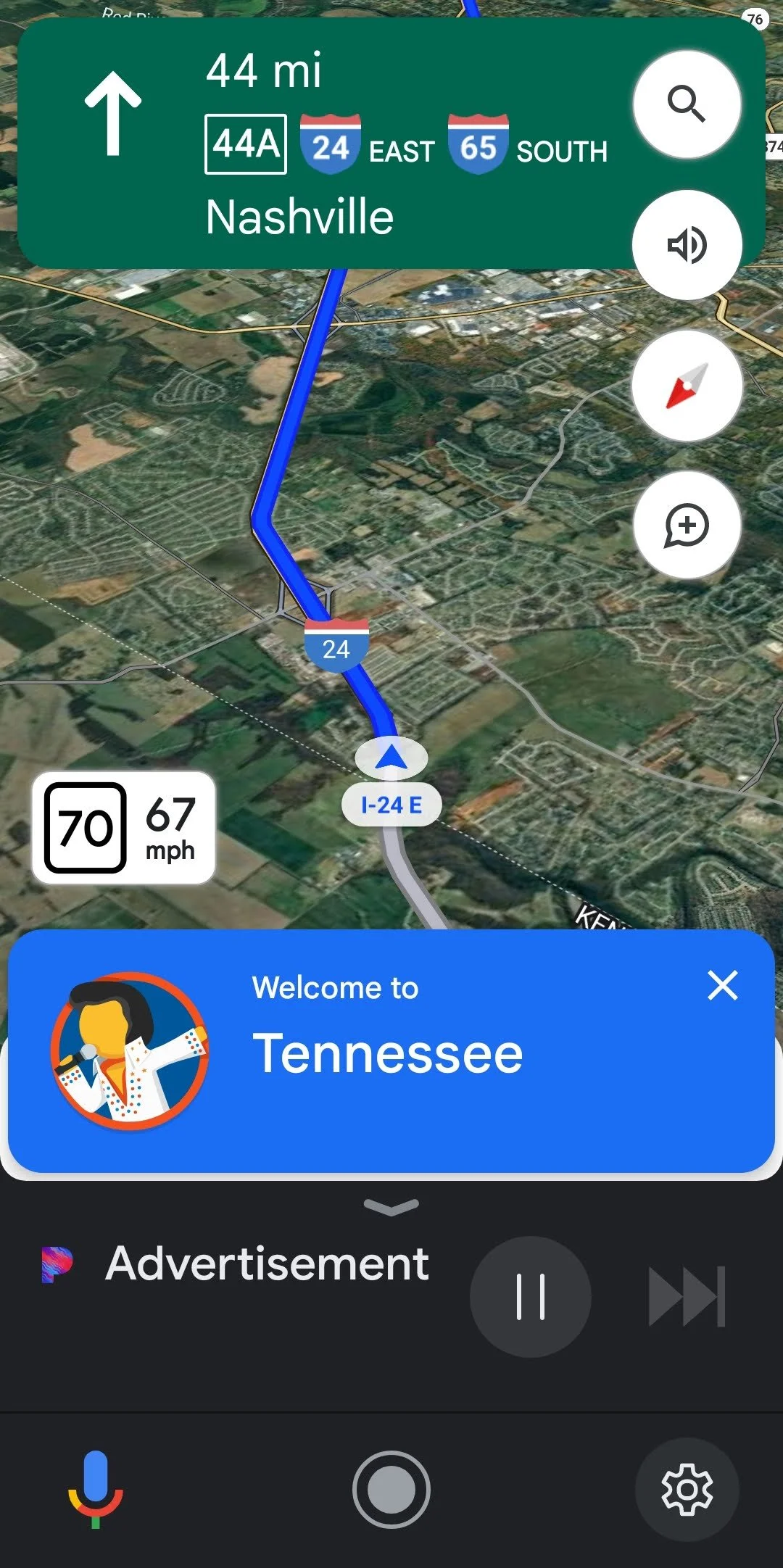
A Map, a Move, and a Mission
A map, a move, and a mission: MSGS Geospatial Engineer, Baylor Wagehoft, comments on the City of Chattanooga Tennessee and gives his thoughts on a historic, visionary map for the City's Park System.
Geospatial > The Layer File > A Map, A Move, and A Mission
During an evening newscast in 1969, Walter Cronkite coined Chattanooga, Tennessee, as the “Dirtiest City in America”. This moniker was probably not that far from the truth, as the City’s historic Iron Foundries (dating back to the Civil War) and industrial sites polluted to air and water. However, since then, the City has completely shed that title. It is consistently ranked as the best place to live in Tennessee and named the “Best Town Ever” by Outdoor Magazine. It’s a hub for insurance giants (BCBS and UNUM), startups (specifically Quantum computing research), electric vehicle manufacturing (Volkswagen North America), and a thriving logistics network along a major interstate junction (I-75 & I-24).
Recently, the City embarked on an ambitious plan to become a National Park City. As part of this initiative, Charlie Hale (GIS Director at the University of Tennessee Chattanooga), was asked to develop an inspiring map that would chart a “vision” for Chattanooga’s Park System. This article is definitely worth a read itself (that map went on to be a winner at the 2023 ESRI UC map contest), but one of the things I found most interesting was actually the 1911 John Nolen Map.
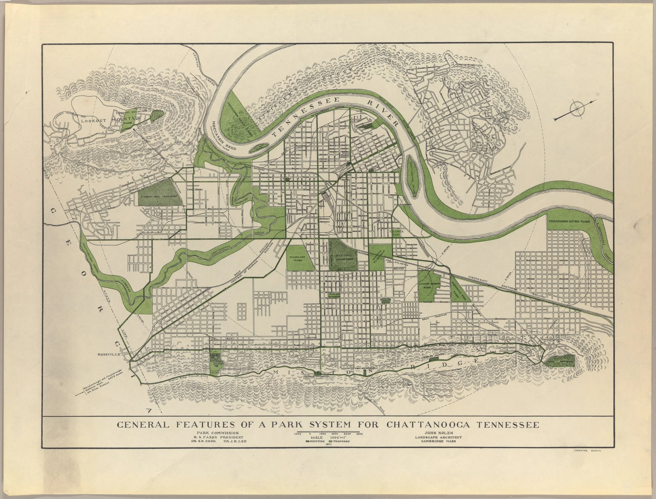
Credit: John Nolen Papers, #2903. Division of Rare and Manuscript Collections, Cornell University Library.
I think what I love about this map most is how simply it calls the viewer to a vision. There are only two colors: Black cadastral lines and Green for Parks/Greenways. Readers are immediately drawn to the most prominent geologic features of the area (Tennessee River, Lookout/Signal Mountain, and Missionary Ridge) and how the park system can work with them. Upon closer inspection, the designer has connected the larger park areas with Greenways along existing major thoroughfares - a call to the current day Complete Streets movement. Small details – like the map being rotated to the street grid and the hilly, forested areas hatched – enhance the map’s purpose and vision.
This map does one thing really well – it sets a vision for a thriving park system in a town plagued (at the time) by industrial waste and smog. I can put myself in the eyes of a resident and say “yeah, I can get behind this vision”. It may have taken over 100 years (and maybe a few decades more to fully “realize”) but I’d call its mission a success.
If you haven’t guessed already, I love talking about (okay, more like fawning over) the city of Chattanooga, Tennessee. My family and I love this area of the Country and the sense of place that is present here. It’s always been our dream to make the “big move” and raise our family here. Well, that dream officially became a reality 2 weeks ago. Thankfully, the move went very smooth and the only “casualty” was a broke salt-shaker!
Although the move may be a bit bittersweet in some ways (missing those impromptu office chats with the great team at Maurer-Stutz), we see this is a great opportunity to expand the mission and vision of Maurer-Stutz Geospatial Services to clients throughout the Tennessee and the Southeast. I recently attended the GEOGRAPH User Conference in Greenville, South Carolina. Be on the lookout for that blog soon!
The Southeast is booming, and MSGS will be there to help communities, businesses, and stakeholders meet their geospatial needs.

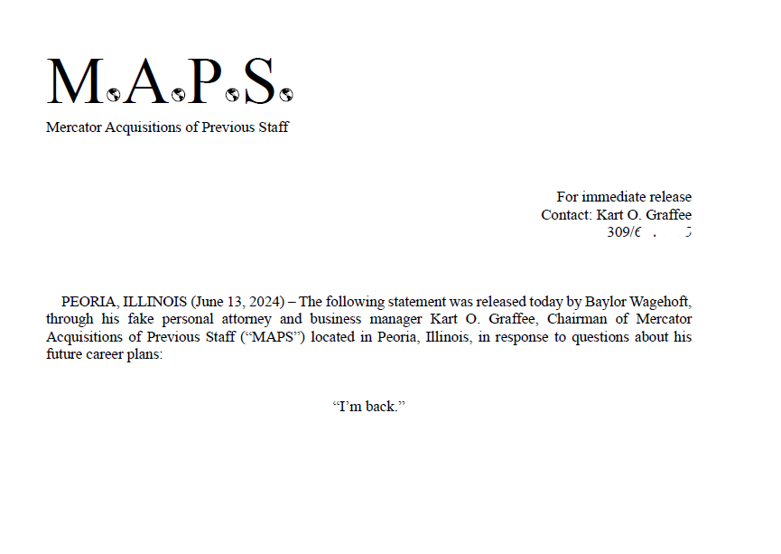
Baylor is Back
PEORIA, ILLINOIS (June 13, 2024) – The following statement was released today by Baylor Wagehoft, through his fake personal attorney and business manager Kart O. Graffee, Chairman of Mercator Acquisitions of Previous Staff (“MAPS”) located in Peoria, Illinois, in response to questions about his future career plans:
“I’m back.”
Geospatial > The Layer File > Baylor is Back
We are very excited and happy to welcome back Baylor Wagehoft as a Geospatial Engineer to the Maurer-Stutz Geospatial Services team.
His email to the Maurer-Stutz staff that announced his return was a geospatial take on the 1995 Michael Jordan Announcement of his return to basketball. I'M BACK.
Baylor’s ‘Fax’ email
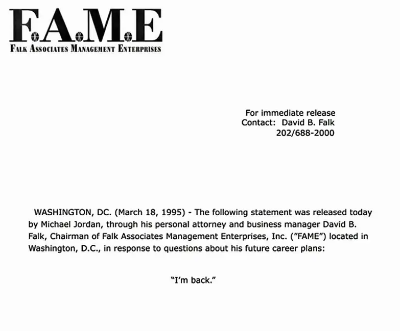
Copy of Jordan’s actual Fax to several sports outlets
Baylor started at MSI in July 2017 as a Transportation Engineer. Then in October 2023 he took a GIS job at i3 Broadband. As we began putting efforts into developing our Maurer-Stutz Geospatial Services group, Baylor stood out as a possible re-acquisition. Thankfully he was open to the idea and we came to an agreement. He finished out June at i3 then took a few weeks off in between to see a sister get married in Spain and will begin his second term at MSI as a Geospatial Engineer on July 30th. We are glad to have him back.
Introducing MSGS
Maurer-Stutz Inc. is excited to announce the launch of Maurer-Stutz Geospatial Services (MSGS), our newly revamped and dedicated geospatial division. With a clear vision and strategic direction, MSGS is set to elevate our geospatial capabilities to new heights. This is not a new bolt-on service, rather the effort is a transformative shift to the geospatial industry.
Geospatial > The Layer File > Introducing MSGS
Maurer-Stutz Inc. is excited to announce the launch of Maurer-Stutz Geospatial Services (MSGS), our newly revamped and dedicated geospatial division. With a clear vision and strategic direction, MSGS is set to elevate our geospatial capabilities to new heights. This is not a new bolt-on service, rather the effort is a transformative shift to the geospatial industry.
Your Vision, Our Expertise. Led by Micah Williamson, GISP, a seasoned geospatial professional with extensive GIS and mapping expertise, MSGS is designed to operate like a new company within Maurer-Stutz. This allows us to collaborate closely with our civil, survey, agriculture, and transportation groups while maintaining our unique identity and focus. We're not just providing maps for engineering projects; we're offering comprehensive geospatial solutions that drive innovation and enhance project outcomes.
Providing solutions for your GIS problems. Our mission is to bring our clients' visions to life through our specialized geospatial expertise. We are committed to delivering precise, innovative mapping solutions that offer actionable insights and lead to successful project outcomes. Our vision is to set the benchmark in the geospatial industry by blending unmatched expertise with a strong focus on client needs. We aim to be the go-to partner for organizations seeking exceptional, tailored geospatial solutions that improve the execution of their GIS projects.
Helping You is What We Do. One of the standout features of MSGS is our ‘Block of Hours’ service model. This flexible approach allows clients to purchase a set number of hours in advance, providing the freedom to access our specialized services whenever they are needed. Whether it's immediate support for ongoing projects or customized assistance for new initiatives, our team is ready to deliver.
We are excited to embark on this journey and look forward to collaborating with you to bring your geospatial projects to fruition. Thank you for your continued support and trust in our capabilities.