One Year With Engineers
A year ago, I walked into Maurer-Stutz with a mission: to build something new, something purpose-driven, something lasting. That something became Maurer-Stutz Geospatial Services (MSGS). Now, 12 months in, I can confidently say we’re not just building a team—we’re building momentum
One Year at Maurer-Stutz: Building a Geospatial Foundation for the Future
A year ago, I walked into Maurer-Stutz with a mission: to build something new, something purpose-driven, something lasting. That something became Maurer-Stutz Geospatial Services (MSGS). Now, 12 months in, I can confidently say we’re not just building a team—we’re building momentum.

Starting From the Ground Up
When I joined the company on April 29, 2024, the Geospatial Department was more of an idea than an entity. With one GIS Specialist; Katie Kopkowski, who stuck around to be the anchor, we had talent, but we needed direction, structure, and an identity. I knew from the beginning that MSGS couldn’t be “just the map guys” on engineering projects. MSI leadership wanted us be strategic partners, not just a service department. Trusted advisors, not only task-takers.
Beigin at the begining
So, we began with the essentials. Working through the process as if we were starting a new business, but with the advantage of having supporting oversight structure.
Conducted a full assessment of existing software, hardware, and workflows.
Evaluated team strengths and gaps in a SWOT analysis.
What engineering clients existed and which represented low-hanging fruit.
Built a business plan with a six-year growth strategy, aligning revenue goals with staffing targets and market segments.
Developed mission and vision statements to clarify who we are—and who we are not
Building the Right Team
This work isn’t possible without people. I’m proud to lead a growing team that now includes Geospatial Engineer Baylor Wagehoft, fellow ISU Redbird Ethan Geisler, and Geospatial Intern Michelle Wagehoft. Next month, we will welcome our sixth employee who will focus on the Agricultural market. Each team member brings a unique set of strengths to the table and we’ve focused on creating a collaborative culture built on professionalism, mutual respect, and shared accountability with our Team Operations Manual (T.O.M.)

Growing with Purpose
In just one year, we’ve:
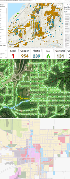
Supported multiple infrastructure and fiber deployments with precision GIS solutions.
Partnered with our own MSI engineering groups without becoming “support-only” on projects.
Initiated the modernization client GIS and database migration and tuning.
Established professional partnerships in cloud architecture, economic development, utilities, and broadband.
A key part of our journey has been thoughtfully drawing a line between the way things have traditionally operated at MSI and the direction we're heading—evolving from a service-oriented support group into a focused, independent, growth-focused team—a shift that will require continued clarity, communication, and collaboration as we grow. We’re becoming a revenue-generating, client-facing, innovation-focused business unit. And our identity is no longer in question—we are MSGS, and we are growing.
Looking Ahead

Up And To The Right!
Year one was about foundations. Year two is about scaling.
We’re focused on:
Expanding our managed services offerings.
Growing cloud GIS capabilities.
Deepening client relationships and building repeatable solutions.
Recruiting talent that shares our drive for innovation and excellence.
I’m grateful for the leadership at Maurer-Stutz inc. for supporting this vision, and for my team for embracing the challenge. This isn’t just about GIS—it’s about transformation. At MSGS, our mission is: To transform our clients' and industry partners' unique visions into reality through specialized geospatial expertise. Our B.H.A.G. is: By 2030, MSGS will be a recognized leader in geospatial services industry by providing solutions in the broadband, utility infrastructure, and consultant engineering domains.
Here’s to year two—and all the vision, trust, and growth it will bring.
We will accomplish this by delivering quality services with integrity, care, and efficiency. Working with you by design.
Email us for more information:
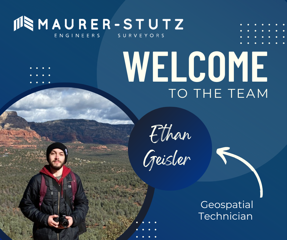
Ethan Geisler Joins Our Geospatial Team
We are thrilled to welcome Ethan Geisler to the Maurer-Stutz Geospatial Services (MSGS) team. Ethan joins us as a Geospatial Specialist with a fresh degree in Geography from Illinois State University, and he's eager to hit the ground running. With a background in GIS software like ArcGIS Pro and ArcGIS Online, Ethan brings a well-rounded skill set.
Geospatial > The Layer File > Ethan Geisler Joins Our Geospatial Team
We are thrilled to welcome Ethan Geisler to the Maurer-Stutz Geospatial Services (MSGS) team!

Ethan joins us as a Geospatial Specialist with a fresh degree in Geography from Illinois State University, and he's eager to hit the ground running. With a background in GIS software like ArcGIS Pro and ArcGIS Online, Ethan brings a well-rounded skill set, honed during his internship with FEMA where he developed a Tornado Awareness dashboard application. This real-world experience will help him seamlessly integrate into our projects, which often involve critical data and mapping needs.
What sets Ethan apart is his passion for using GIS to solve real-world challenges, a trait he demonstrated in his final project at ISU, where he worked on a pedestrian safety study using Survey123. Outside of work, Ethan’s organizational leadership skills shine as the former President of ISU's Music Business Organization, where he organized events and led a team of fellow students—skills that will serve him well as he collaborates with our team on diverse geospatial projects. He also plays drums and is deeply invested in the Game of Thrones franchise.
Ethan will be working closely with our team to support infrastructure mapping, perform spatial analysis, and contribute to the development of tailored GIS solutions for our clients. We’re excited to see his fresh perspective and strong attention to detail make an impact as we continue to grow our geospatial services.
Welcome aboard, Ethan!
Introducing MSGS
Maurer-Stutz Inc. is excited to announce the launch of Maurer-Stutz Geospatial Services (MSGS), our newly revamped and dedicated geospatial division. With a clear vision and strategic direction, MSGS is set to elevate our geospatial capabilities to new heights. This is not a new bolt-on service, rather the effort is a transformative shift to the geospatial industry.
Geospatial > The Layer File > Introducing MSGS
Maurer-Stutz Inc. is excited to announce the launch of Maurer-Stutz Geospatial Services (MSGS), our newly revamped and dedicated geospatial division. With a clear vision and strategic direction, MSGS is set to elevate our geospatial capabilities to new heights. This is not a new bolt-on service, rather the effort is a transformative shift to the geospatial industry.
Your Vision, Our Expertise. Led by Micah Williamson, GISP, a seasoned geospatial professional with extensive GIS and mapping expertise, MSGS is designed to operate like a new company within Maurer-Stutz. This allows us to collaborate closely with our civil, survey, agriculture, and transportation groups while maintaining our unique identity and focus. We're not just providing maps for engineering projects; we're offering comprehensive geospatial solutions that drive innovation and enhance project outcomes.
Providing solutions for your GIS problems. Our mission is to bring our clients' visions to life through our specialized geospatial expertise. We are committed to delivering precise, innovative mapping solutions that offer actionable insights and lead to successful project outcomes. Our vision is to set the benchmark in the geospatial industry by blending unmatched expertise with a strong focus on client needs. We aim to be the go-to partner for organizations seeking exceptional, tailored geospatial solutions that improve the execution of their GIS projects.
Helping You is What We Do. One of the standout features of MSGS is our ‘Block of Hours’ service model. This flexible approach allows clients to purchase a set number of hours in advance, providing the freedom to access our specialized services whenever they are needed. Whether it's immediate support for ongoing projects or customized assistance for new initiatives, our team is ready to deliver.
We are excited to embark on this journey and look forward to collaborating with you to bring your geospatial projects to fruition. Thank you for your continued support and trust in our capabilities.