
Mapping for a Cause
At Maurer-Stutz, Inc., we believe in using our expertise to give back to the community. One of our on-going relationships is with Camp Big Sky, a nonprofit in Fairview, IL, dedicated to providing outdoor experiences for individuals with disabilities.
Mapping for a Cause: Supporting Camp Big Sky with GIS
At Maurer-Stutz, Inc., we believe in using our expertise to give back to the community. One of our on-going relationships is with Camp Big Sky, a nonprofit in Fairview, IL, dedicated to providing outdoor experiences for individuals with disabilities.
“We’d Like a Map”
Camp Big Sky recently inquired about the possibility of having Mauer-Stutz Geospatial create a large display map to provide visitors with a clear overview of the camp - similar to maps found at theme parks or the beginning of a hiking trail. That request for a single map began a series of conversations.
Through our discussions with Camp Big Sky, a robust GIS solution developed allowing for the creation of a whole variety of customized maps. We discussed their need for duplicatable, day-use maps, maps specifically tailored for grant applications, online maps, etc.— all of which can easily be created from the GIS that was already being built!
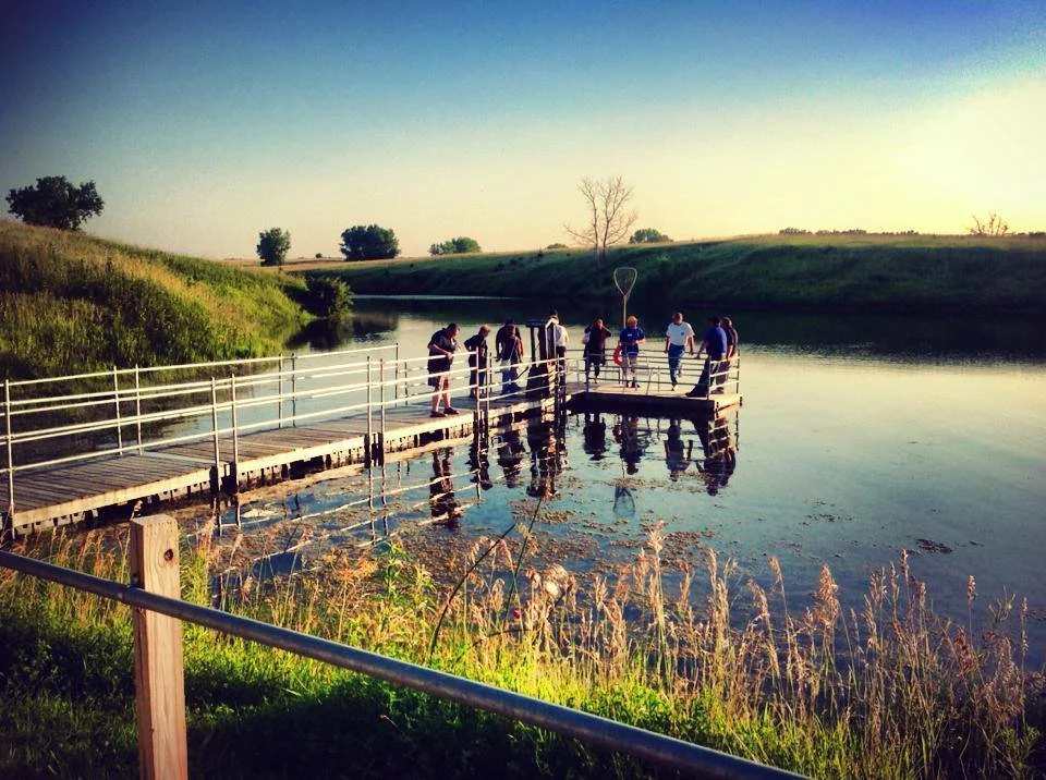
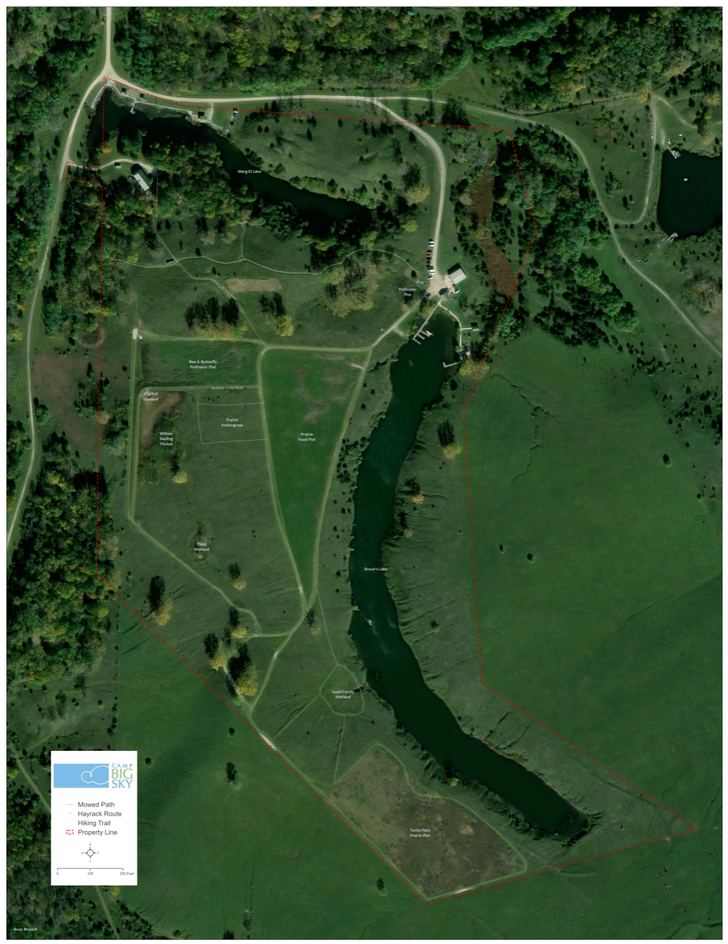
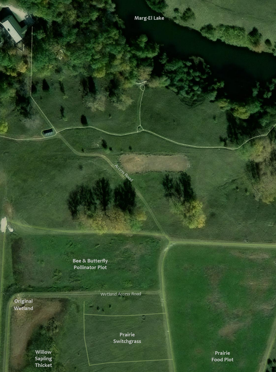
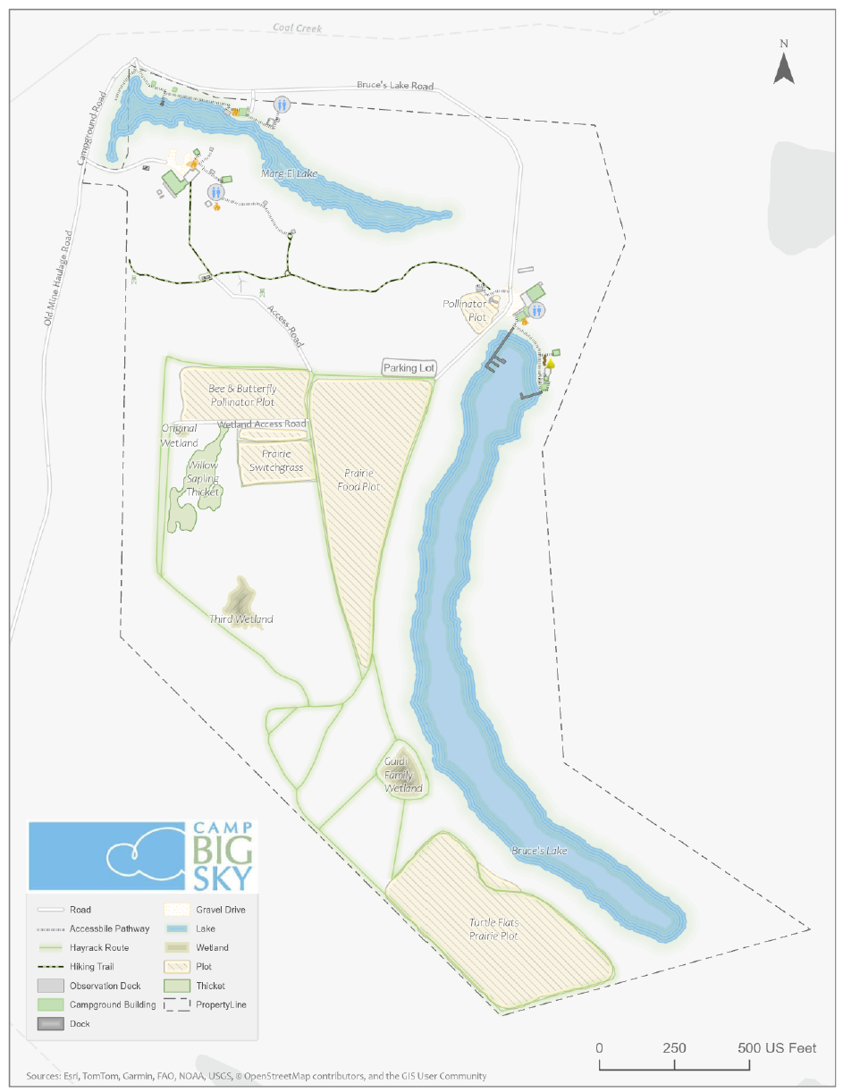
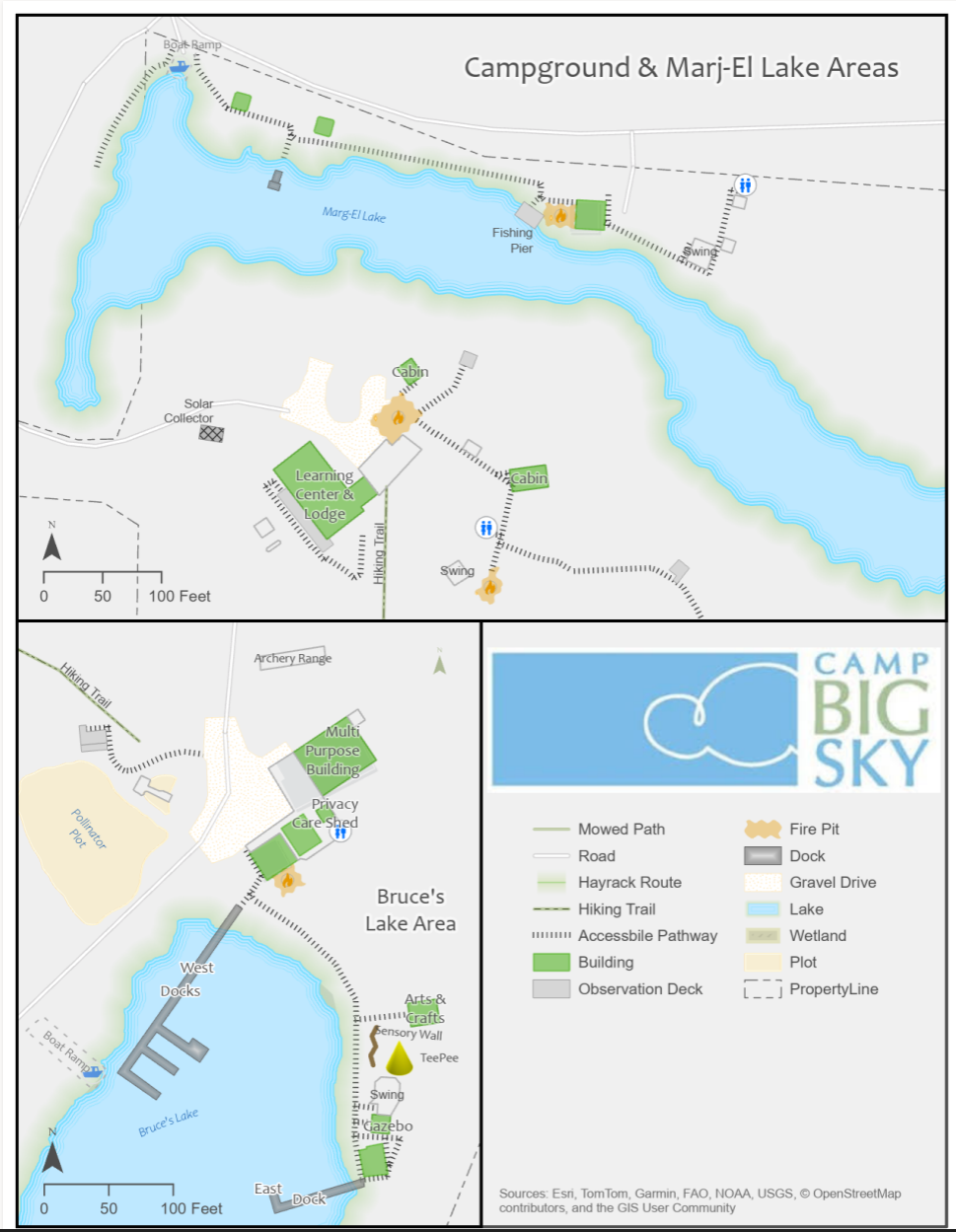
How We’re Helping
Using drone imagery, we captured high-resolution aerial views of the camp, allowing us to digitize important features with precision. This data forms the foundation of our maps, ensuring accuracy and detail.
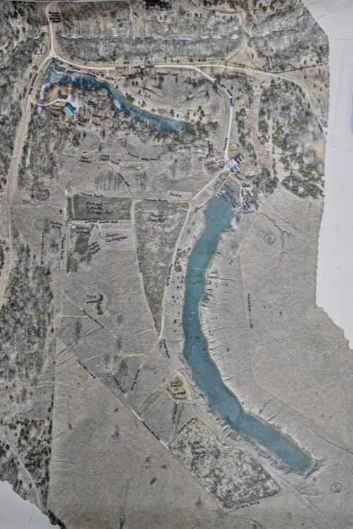
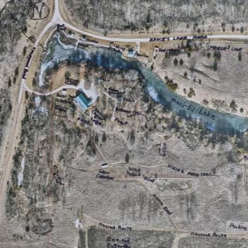
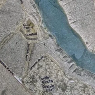
We provided the founder of Camp Big Sky, Brad Guidi, with a poster-sized printout of the aerial imagery. He identified the names of the features that had been digitized so that we could develop a GIS database that includes:
Natural features like lakes, trails, and tree cover.
Infrastructure elements such as buildings, parking areas, and accessibility features.
Points of interest that allow visitors and staff to both enjoy and navigate the camp more easily.
Mapping paper products like a wall map with great imagery or a 8.5 X 11 photocopy to hand out to visitors.
The Impact
These maps will help visitors, volunteers, and staff make the most of Camp Big Sky’s outdoor experiences. The GIS solution will also enable the organization to manage their property more efficiently and plan for future improvements. We have their GIS saved securely for continued updates or applications they may need.
By expanding beyond the original request for “a map,” we’re providing Camp Big Sky with tools that will help them enhance visitor experiences and support future growth and funding opportunities.
This project showcases how GIS technology can support nonprofits in meaningful ways, and we’re proud to contribute to Camp Big Sky’s mission.
To learn more about Camp Big Sky, visit their website at: https://campbigsky.org
If you have more question about how we can help you or your Organization with GIS, Contact us!

A Map, a Move, and a Mission
A map, a move, and a mission: MSGS Geospatial Engineer, Baylor Wagehoft, comments on the City of Chattanooga Tennessee and gives his thoughts on a historic, visionary map for the City's Park System.
Geospatial > The Layer File > A Map, A Move, and A Mission
During an evening newscast in 1969, Walter Cronkite coined Chattanooga, Tennessee, as the “Dirtiest City in America”. This moniker was probably not that far from the truth, as the City’s historic Iron Foundries (dating back to the Civil War) and industrial sites polluted to air and water. However, since then, the City has completely shed that title. It is consistently ranked as the best place to live in Tennessee and named the “Best Town Ever” by Outdoor Magazine. It’s a hub for insurance giants (BCBS and UNUM), startups (specifically Quantum computing research), electric vehicle manufacturing (Volkswagen North America), and a thriving logistics network along a major interstate junction (I-75 & I-24).
Recently, the City embarked on an ambitious plan to become a National Park City. As part of this initiative, Charlie Hale (GIS Director at the University of Tennessee Chattanooga), was asked to develop an inspiring map that would chart a “vision” for Chattanooga’s Park System. This article is definitely worth a read itself (that map went on to be a winner at the 2023 ESRI UC map contest), but one of the things I found most interesting was actually the 1911 John Nolen Map.
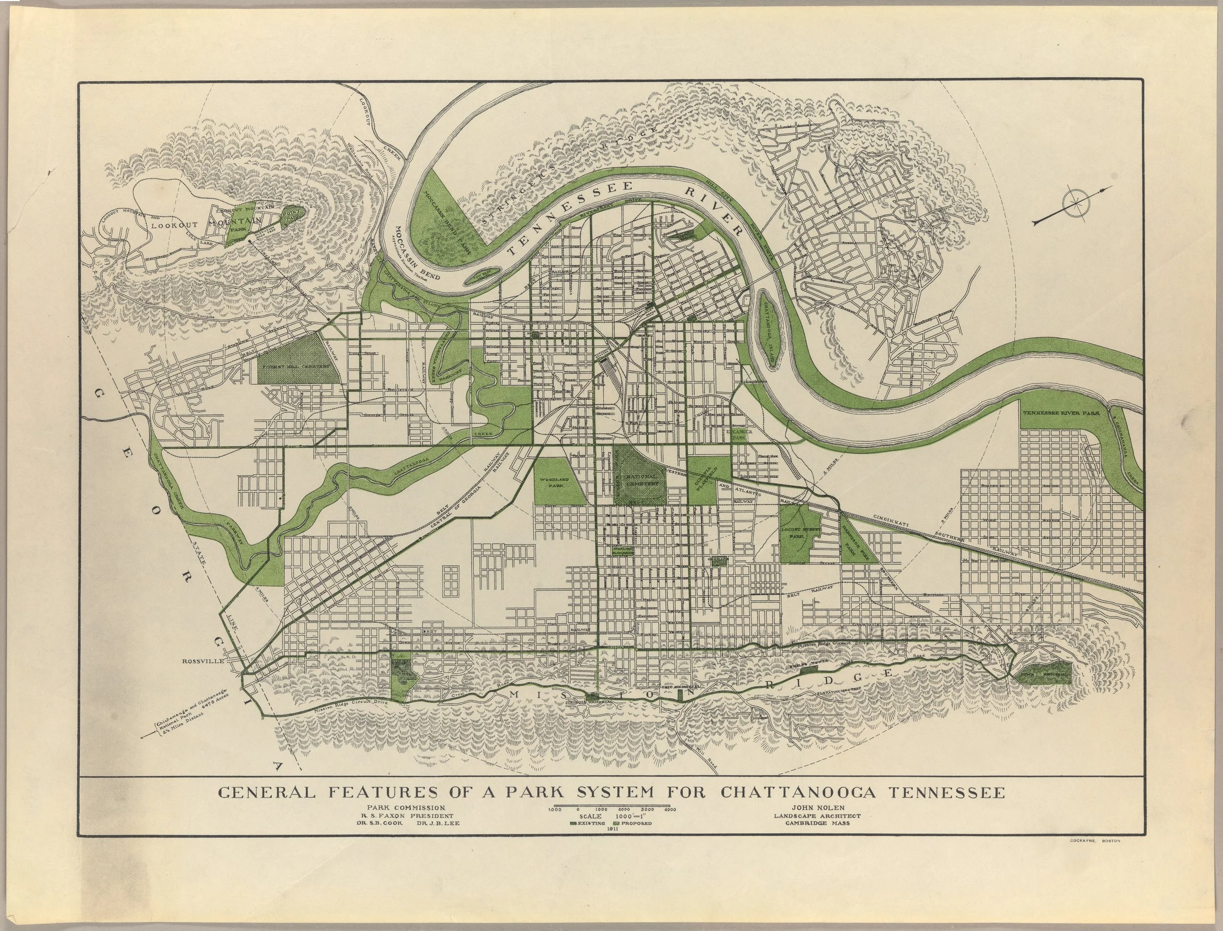
Credit: John Nolen Papers, #2903. Division of Rare and Manuscript Collections, Cornell University Library.
I think what I love about this map most is how simply it calls the viewer to a vision. There are only two colors: Black cadastral lines and Green for Parks/Greenways. Readers are immediately drawn to the most prominent geologic features of the area (Tennessee River, Lookout/Signal Mountain, and Missionary Ridge) and how the park system can work with them. Upon closer inspection, the designer has connected the larger park areas with Greenways along existing major thoroughfares - a call to the current day Complete Streets movement. Small details – like the map being rotated to the street grid and the hilly, forested areas hatched – enhance the map’s purpose and vision.
This map does one thing really well – it sets a vision for a thriving park system in a town plagued (at the time) by industrial waste and smog. I can put myself in the eyes of a resident and say “yeah, I can get behind this vision”. It may have taken over 100 years (and maybe a few decades more to fully “realize”) but I’d call its mission a success.
If you haven’t guessed already, I love talking about (okay, more like fawning over) the city of Chattanooga, Tennessee. My family and I love this area of the Country and the sense of place that is present here. It’s always been our dream to make the “big move” and raise our family here. Well, that dream officially became a reality 2 weeks ago. Thankfully, the move went very smooth and the only “casualty” was a broke salt-shaker!
Although the move may be a bit bittersweet in some ways (missing those impromptu office chats with the great team at Maurer-Stutz), we see this is a great opportunity to expand the mission and vision of Maurer-Stutz Geospatial Services to clients throughout the Tennessee and the Southeast. I recently attended the GEOGRAPH User Conference in Greenville, South Carolina. Be on the lookout for that blog soon!
The Southeast is booming, and MSGS will be there to help communities, businesses, and stakeholders meet their geospatial needs.