Maurer-Stutz
  • Home
  • Services
    • Agricultural and Livestock Engineering
      • Livestock Facility Planning and Design
    • Conservation and Natural Resources
    • Site Development and Private Civil
      • Transportation
      • Surveying Support
    • Municipal and Public Works
      • Water Systems
      • Wastewater Systems
      • Transportation
      • Construction Engineering and Observation
    • Structural Engineering
    • Surveying and Geospatial
      • GIS / Geospatial Solutions
      • Land Surveying
  • News
  • About Us
    • Licensure and Prequals
  • Careers
  • Contact
  • Click to open the search input field Click to open the search input field Search
  • Menu Menu

ArcGIS Earth Actually Isn’t That Bad!

November 25, 2024/in GIS Industry News/by Maurer-Stutz

Geospatial andgt; The Layer File andgt; ArcGIS Earth Actually Isn’t That Bad

When it comes to free GIS applications, expectations should be modest—but ArcGIS Earth is trying to defy the norm. Despite its somewhat modest reputation and certain rendering limitations, this tool offers a surprisingly robust experience for visualizing and interacting with geospatial data in 2D and 3D. Designed for both desktop and mobile environments, ArcGIS Earth provides intuitive capabilities for viewing most GIS files, conducting quick analyses, and navigating large datasets, all on a global scale.

This past ILGISA conference I gave a presentation called. “The Best GIS Viewer You’re Probably Not Using” all about ArcGIS Earth. The presentation is here, but the best way to experience it is to just dive in.

ArcGIS Earth supports a wide range of formats, from shapefiles to KML/KMZ, GPX, and even OGC web services, allowing users to work with various data types seamlessly. Its 3D-first design also enables interactive analysis tools like line-of-sight views and elevation profiles, making it easier to plan and collaborate across teams, especially in infrastructure or environmental projects. You can customize the experience further to fit organizational workflows, enhancing usability and reducing the steep learning curve often associated with GIS software.

Customization

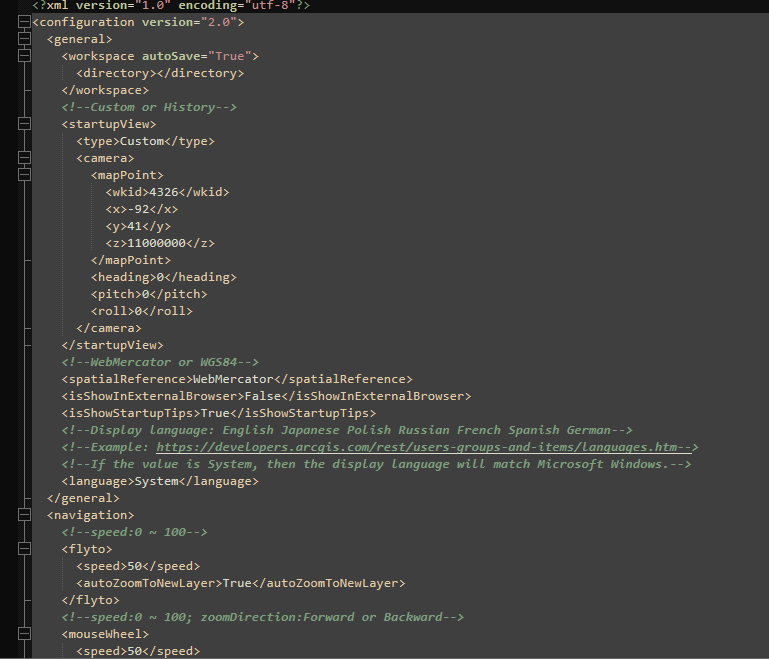
One of its standout capabilities is the ability to configure the application using custom configuration files. This feature allows administrators to tailor user experiences by adjusting default settings, defining data sources, and controlling functionality based on organizational needs. These customizations ensure a consistent environment across teams, aligning ArcGIS Earth with specific project or enterprise requirements​. A configuration file can be saved on a shared drive or even online.

Another useful feature is the option to save and share workspaces. Users can preserve their current map views, layers, and data configurations as workspaces, enabling easy retrieval and continuation of projects. This functionality streamlines collaboration by allowing users to share complex setups with colleagues, ensuring consistent visualization and analysis across teams. Together, these tools make ArcGIS Earth more flexible and user-friendly, accommodating both individual customization and team-based workflows

Summary

Despite some challenges with performance, particularly in rendering complex 3D datasets or point clouds, the platform excels in simplicity and accessibility. Its integration with ArcGIS Online and Enterprise allows you to share maps, sync data, and perform edits collaboratively across devices—whether you’re in the office or out in the field. For many, ArcGIS Earth serves as a valuable entry point into advanced GIS tools or a convenient option for lightweight tasks that don’t require the full power of ArcGIS Pro.

NOTE: Version 2.3 is slated for release in December of 2024 and should have a good set of upgrades (including performance updates and Survey123 integration)

Overall, ArcGIS Earth is more than just a free viewer; it’s a practical, surprisingly capable solution for organizations looking to add a dynamic data and a 3D perspective to their workflows.
https://www.mstutz.com/wp-content/uploads/2024/11/2024-11-2510_20_16-ArcGISEarth.webp 620 1062 Maurer-Stutz https://www.mstutz.com/wp-content/uploads/2026/08/Logo-1030x301.webp Maurer-Stutz2024-11-25 15:23:212024-11-25 15:23:21ArcGIS Earth Actually Isn’t That Bad!

From Maps to Meaning: Celebrating GIS Day

November 11, 2024/in Events/by Maurer-Stutz

Geospatial andgt; The Layer File andgt; From Maps to Meaning

Celebrate GIS Day on November 20, 2024, and Explore the Power of Maps!

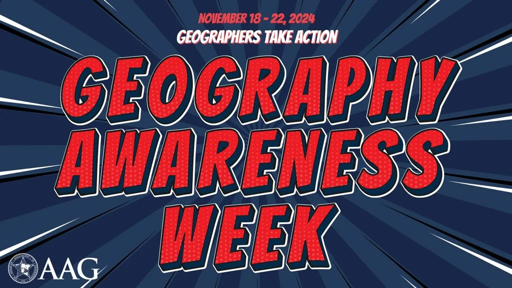
Join us on November 20 for GIS Day, part of American Association of Geographers’ Geography Awareness Week, as we celebrate the impact of Geographic Information Systems in solving real-world challenges! Established by Esri in 1999, GIS Day brings together GIS professionals, students, and curious minds worldwide to showcase how mapping technology helps us understand and improve the world around us. This year, I’m honored to speak at the McLean County GIS Consortium’s event, where we’ll explore the latest in GIS technology, real-life applications, and the future of spatial insights. From interactive exhibits to live demos, the event promises something for everyone, whether you’re a GIS pro or simply fascinated by the world of maps.

GIS Day encourages us all to appreciate geography’s role in our lives and its transformative power, from smart city planning to disaster response. As part of Geography Awareness Week, it’s a perfect chance to learn about GIS and connect with others who are passionate about mapping solutions for a better world. To learn more about the event and register, visit the McLean County GIS Consortium’s page.

Let’s celebrate the role of GIS in building a more connected, informed, and resilient world—see you there!

https://www.mstutz.com/wp-content/uploads/2024/11/Geography-Awareness-Week.webp 576 1024 Maurer-Stutz https://www.mstutz.com/wp-content/uploads/2026/08/Logo-1030x301.webp Maurer-Stutz2024-11-11 14:12:002024-11-11 14:12:00From Maps to Meaning: Celebrating GIS Day
Search Search

Categories

  • Events
  • Geospatial Project
  • GIS Industry News
  • MSGS News
  • Uncategorized

Tags

49" Monitor Admin Aerial Services AGLA announcement ArcGIS ArcGIS Earth ArcGIS Online Basic GIS Cartogrpahy Chattanooga Chicago conferences construction Consulting Dell drones East Peoria employee Enterprise GIS Esri Ethics examples Fiber Fulton GEOGRAPH GIS Hiking ILGISA ISU Jelly Belly Kanban Leadership Maps marketing MSI new Parks Partnership Portal Surveying UAS URISA VSM webgis
  • Home
  • Services
  • News
  • About Us
  • Careers
  • Contact
@2026 Maurer-Stutz. All Rights Reserved. | Privacy Policy
Scroll to top Scroll to top Scroll to top