
Maurer-Stutz
  • Home
  • Services
    • Agricultural and Livestock Engineering
      • Livestock Facility Planning and Design
    • Conservation and Natural Resources
    • Site Development and Private Civil
      • Transportation
      • Surveying Support
    • Municipal and Public Works
      • Water Systems
      • Wastewater Systems
      • Transportation
      • Construction Engineering and Observation
    • Structural Engineering
    • Surveying and Geospatial
      • GIS / Geospatial Solutions
      • Land Surveying
  • News
  • About Us
    • Licensure and Prequals
  • Careers
  • Contact
  • Click to open the search input field Click to open the search input field Search
  • Menu Menu

Motor Fuel Tax Assessment / Fulton County, Illinois

October 12, 2026/in Geospatial/by Maurer-Stutz

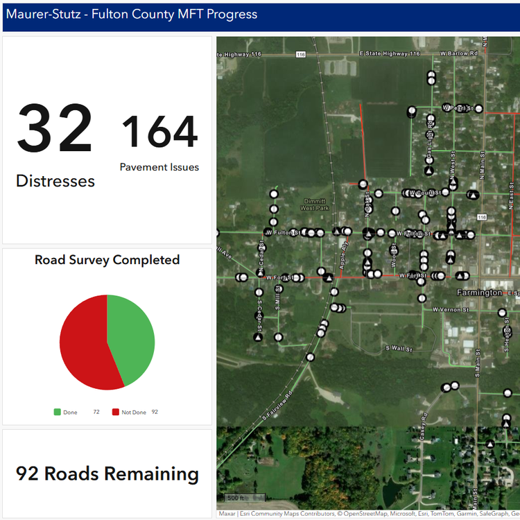
Fulton County, IL required a comprehensive pavement assessment to address critical infrastructure needs, and the Maurer-Stutz Geospatial team and Transportation group provided key support. This assessment involved surveying all township roads to document pavement and shoulder types, as well as identifying road distresses. The data collected helps the county develop a data-driven plan for allocating Motor Fuel Tax funding.

The Geospatial team played a crucial role by utilizing ArcGIS Field Maps, Dashboards, and Quick Capture. With Field Maps, transportation engineers accurately identified pavement types and other road features. Quick Capture allowed for the rapid collection of GPS points to mark pavement distresses, while a customized Dashboard was used to monitor progress and track identified issues throughout the project.

https://www.mstutz.com/wp-content/uploads/2026/10/Screenshot2025-02-26115808.webp 750 750 Maurer-Stutz https://www.mstutz.com/wp-content/uploads/2026/08/Logo-1030x301.webp Maurer-Stutz2026-10-12 18:05:102026-10-12 18:05:10Motor Fuel Tax Assessment / Fulton County, Illinois
Search Search

Categories

  • Events
  • Geospatial Project
  • GIS Industry News
  • MSGS News
  • Uncategorized

Tags

49" Monitor Admin Aerial Services AGLA announcement ArcGIS ArcGIS Earth ArcGIS Online Basic GIS Cartogrpahy Chattanooga Chicago conferences construction Consulting Dell drones East Peoria employee Enterprise GIS Esri Ethics examples Fiber Fulton GEOGRAPH GIS Hiking ILGISA ISU Jelly Belly Kanban Leadership Maps marketing MSI new Parks Partnership Portal Surveying UAS URISA VSM webgis
  • Home
  • Services
  • News
  • About Us
  • Careers
  • Contact
@2026 Maurer-Stutz. All Rights Reserved. | Privacy Policy
Link to: NRCS Dam Assessments / Kentucky, South Carolina Link to: NRCS Dam Assessments / Kentucky, South Carolina NRCS Dam Assessments / Kentucky, South Carolina Link to: Utility Networking / Canton, IL Link to: Utility Networking / Canton, IL Utility Networking / Canton, IL
Scroll to top Scroll to top Scroll to top