Camp Ellis Becomes Ellis City
Nestled in the rural expanses of western Illinois, the remnants of Camp Ellis stand as a testament to a bygone era. This World War II training camp, located near the small town of Ipava in Fulton County, was a bustling hub of military activity with a population over 40,000 at it’s peak. We at Maurer-Stutz Geospatial Services have revived the old footprint of Camp Ellis and used it as a demonstration location for our GIS data, solutions, and applications. We call it: Ellis City
Geospatial > The Layer File > Ellis City
Nestled in the rural expanses of western Illinois, the remnants of Camp Ellis stand as a testament to a bygone era. This World War II training camp, located near the small town of Ipava in Fulton County, was a bustling hub of activity with a population of over 50,000 military & civilian personnel. We at Maurer-Stutz Geospatial Services have revived the old footprint of Camp Ellis and used it as a demonstration location for our GIS data, solutions, and applications. We call it: Ellis City
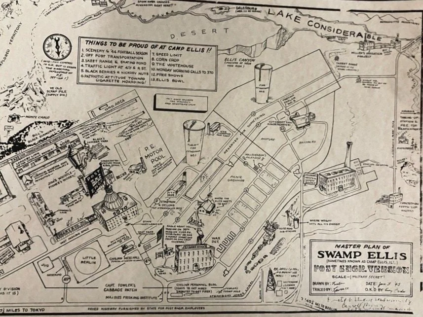
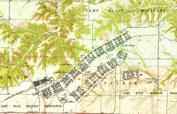
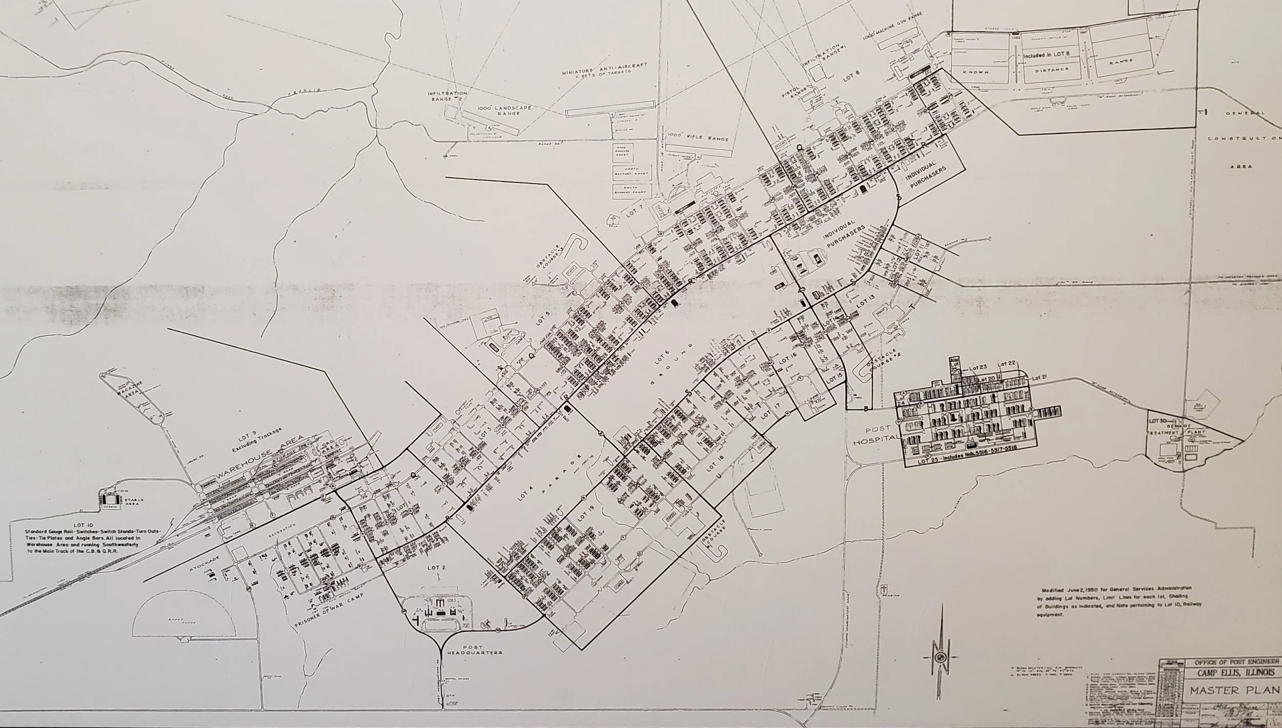
Construction of Camp Ellis began in 1942, in response to the urgent need for training facilities for the U.S. Army. Named after Sergeant Michael B. Ellis, a Medal of Honor recipient from World War I, the camp quickly transformed from tranquil farmland into a sprawling military installation. Covering approximately 17,000 acres, it included barracks, training grounds, firing ranges, a hospital, and even a prisoner of war camp.
At its peak, Camp Ellis housed over 35,000 soldiers, providing them with comprehensive training in various military disciplines. Infantry, engineer, and medical units all cycled through the camp, honing their skills in preparation for deployment to the European and Pacific theaters. The camp's vast training areas were ideal for exercises in maneuver warfare, marksmanship, and engineering projects, making it a versatile training ground and even included a simulated German village. There is a great Museum about Camp Ellis in Ipava Illinois, You can even read hundreds of newspapers that have been collected & preserved.

Project
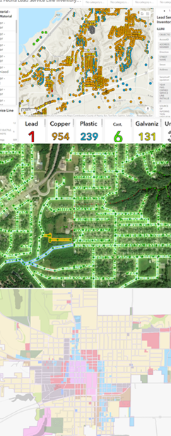
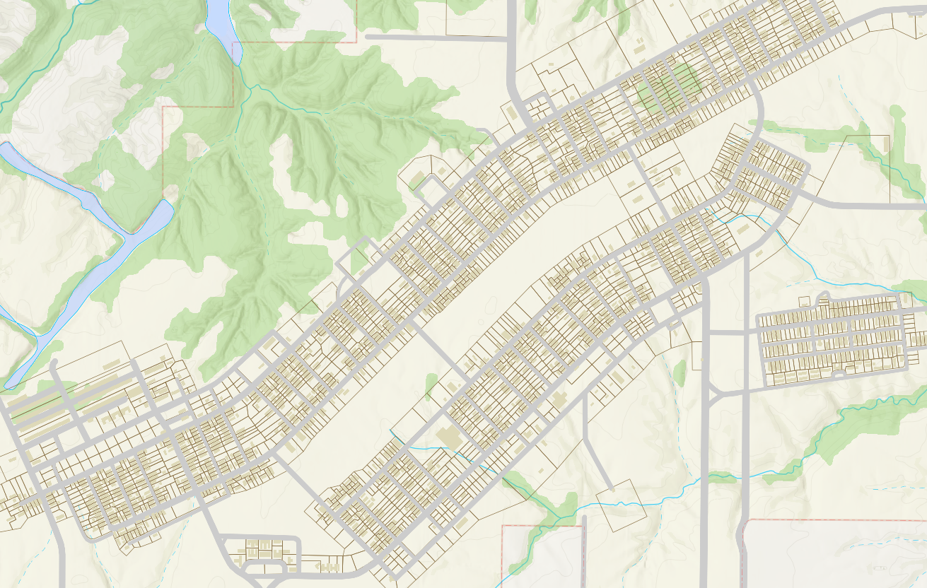
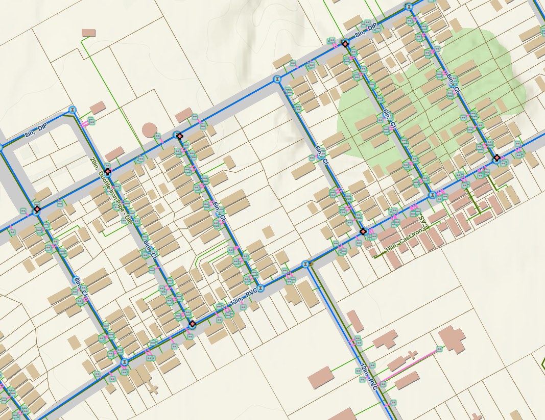
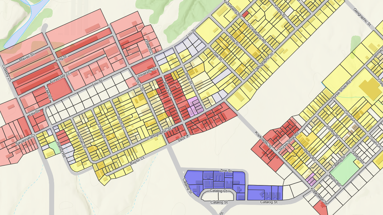
During the summer of 2024, we set out on an attempt to create a demonstration city’s GIS that we could use and show off publicly without the fear of exposing sensitive or personal data. Armed with four historic USGS 7.5 minute topo quads and the assistance of several interns, MSGS digitized what was once a sprawling city in the hills and farm fields of Fulton County. Buildings, roads and a few points of interest were placed as accurately as possible according to the old maps and aerial photography. Features like zoning classifications, parcels lines, street signs, garbage pickup days, and municipal utilities were all created from industry expertise and a few assumptions. Specific road names, speed limits, and addresses were ‘embellished’ from the creative minds of our staff and there may be a few easter eggs in the data. It was an enjoyable experience to create GIS data from nothing and our Civil Engineering interns learned quite a bit about GIS editing tools. We also created parks, businesses, and a cemetery.


Result
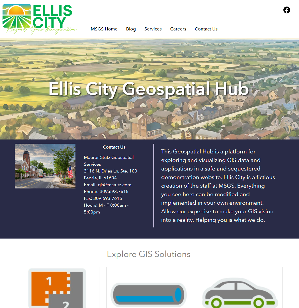
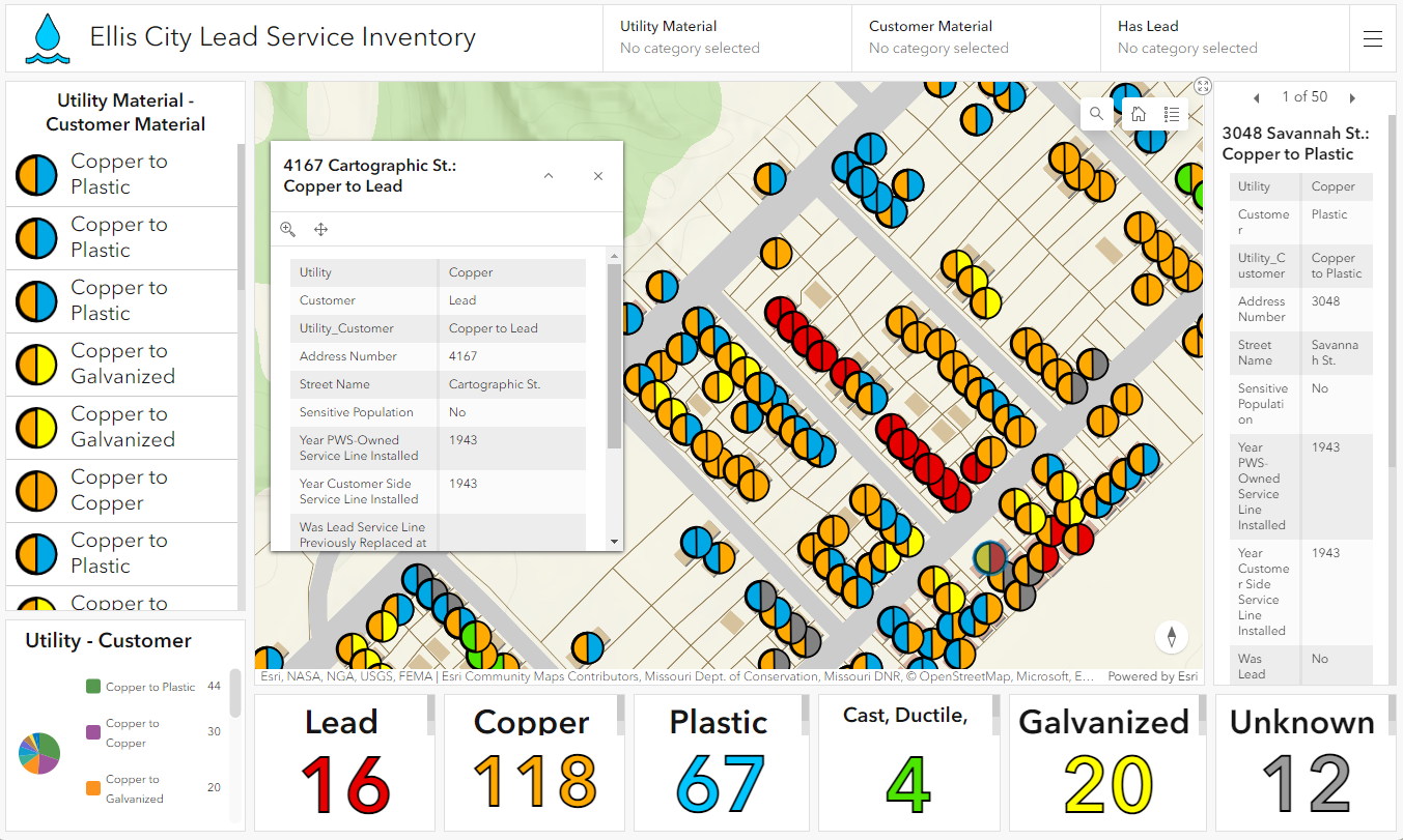
After the land information, utility data, facility features, and other civic layers were created, we began to build applications to display what ArcGIS can do. The creative liberty that we took in creation of these layers made it necessary to change the name of this new urban center. In an attempt to divest affiliation with the historical aspect of Camp Ellis but still maintain an honorable recognition of the military activities and accomplishments, we chose ‘Ellis City’ as the name of our new demonstration municipality. We created a logo, slogan, bought a URL, and with the help of AI, a few paintings and images of this new city. The city’s website is hosted on an ArcGIS Hub. The GIS solutions are downloaded from the Esri Solutions page but customized a bit, because none of them work out of the box with your own data. All the data, solutions, and applications have been created by our MSGS team with customizations only when needed. They all should be open and available without a login required. We could simply not do this with any client data or existing city. As we have time, the Hub site will continue to evolve and improve. We plan on adding some Survey123, Field Maps, and Story Maps. As technology improves, so will our exhibition.
elliscity.info
Let us know if you want assistance doing any of these things or if you have a question on how we did it.

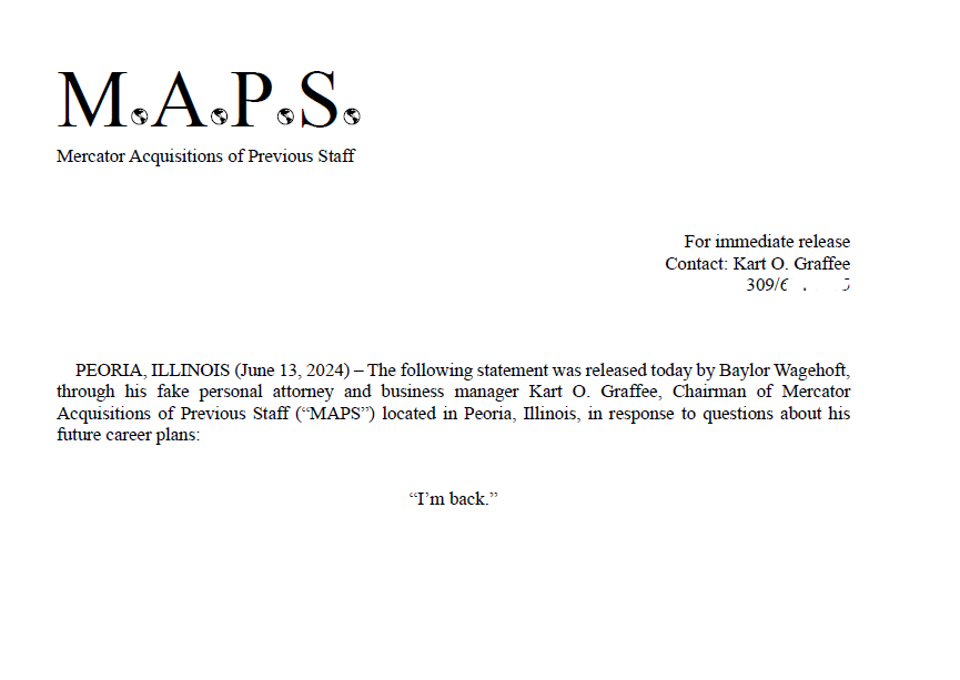
Baylor is Back
PEORIA, ILLINOIS (June 13, 2024) – The following statement was released today by Baylor Wagehoft, through his fake personal attorney and business manager Kart O. Graffee, Chairman of Mercator Acquisitions of Previous Staff (“MAPS”) located in Peoria, Illinois, in response to questions about his future career plans:
“I’m back.”
Geospatial > The Layer File > Baylor is Back
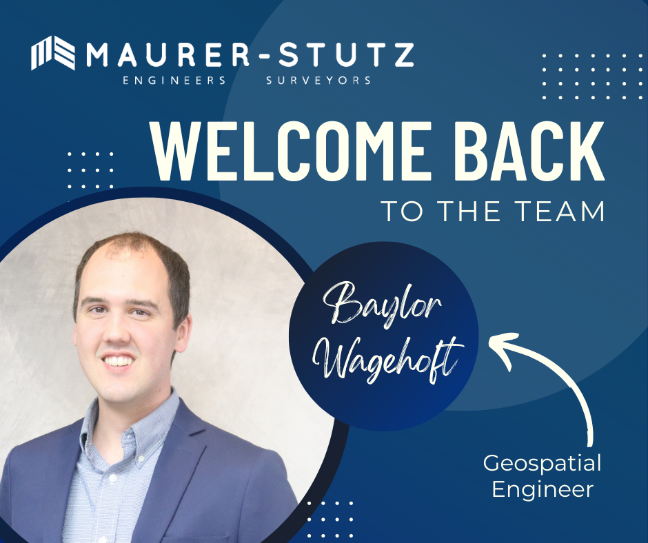
We are very excited and happy to welcome back Baylor Wagehoft as a Geospatial Engineer to the Maurer-Stutz Geospatial Services team.
His email to the Maurer-Stutz staff that announced his return was a geospatial take on the 1995 Michael Jordan Announcement of his return to basketball. I'M BACK.
Baylor’s ‘Fax’ email
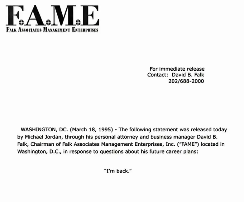
Copy of Jordan’s actual Fax to several sports outlets
Baylor started at MSI in July 2017 as a Transportation Engineer. Then in October 2023 he took a GIS job at i3 Broadband. As we began putting efforts into developing our Maurer-Stutz Geospatial Services group, Baylor stood out as a possible re-acquisition. Thankfully he was open to the idea and we came to an agreement. He finished out June at i3 then took a few weeks off in between to see a sister get married in Spain and will begin his second term at MSI as a Geospatial Engineer on July 30th. We are glad to have him back.

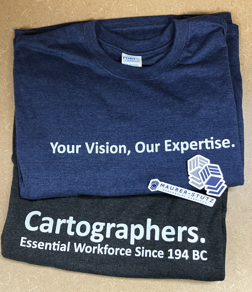
We've got SWAG!
Lets admit it, we all go to conferences to get our own bags of stuff… and training, but really the stuff. Well, thanks to the great marketing strategy already established at Maurer-Stutz INC, We’ve got a whole storage room filled with SWAG to give away Plus some of our own.
Geospatial > The Layer File > We’ve Got Swag
Not the Jay Z kind, rather the Stuff-We-All-Get kind.
Contrary to popular belief, JayZ didn’t come up with the word swag, he just shortened swagger. In the original Middle-English (according to Google) ‘swag’ is a word of Scandinavian origin meaning ‘bulging bag’. Which is fitting.
Let’s admit it, we all go to conferences to get our own bags of stuff… and training, but really the stuff. Well, thanks to the great marketing strategy already established at Maurer-Stutz, We’ve got a whole storage room filled with SWAG to give away, including a few humorous stress toys from our Agriculture group. While we are not bringing cows or poop-emojis to ILGISA, we are bringing some MSGS-specific stuff: Stickers, Pens, and a few t-shirt for selected clients. We have our own geospatial-related banners and an expanding table-top display. In short, we are ready for the fall conference season.


See you at ILGISA!
Introducing MSGS
Maurer-Stutz Inc. is excited to announce the launch of Maurer-Stutz Geospatial Services (MSGS), our newly revamped and dedicated geospatial division. With a clear vision and strategic direction, MSGS is set to elevate our geospatial capabilities to new heights. This is not a new bolt-on service, rather the effort is a transformative shift to the geospatial industry.
Geospatial > The Layer File > Introducing MSGS
Maurer-Stutz Inc. is excited to announce the launch of Maurer-Stutz Geospatial Services (MSGS), our newly revamped and dedicated geospatial division. With a clear vision and strategic direction, MSGS is set to elevate our geospatial capabilities to new heights. This is not a new bolt-on service, rather the effort is a transformative shift to the geospatial industry.
Your Vision, Our Expertise. Led by Micah Williamson, GISP, a seasoned geospatial professional with extensive GIS and mapping expertise, MSGS is designed to operate like a new company within Maurer-Stutz. This allows us to collaborate closely with our civil, survey, agriculture, and transportation groups while maintaining our unique identity and focus. We're not just providing maps for engineering projects; we're offering comprehensive geospatial solutions that drive innovation and enhance project outcomes.
Providing solutions for your GIS problems. Our mission is to bring our clients' visions to life through our specialized geospatial expertise. We are committed to delivering precise, innovative mapping solutions that offer actionable insights and lead to successful project outcomes. Our vision is to set the benchmark in the geospatial industry by blending unmatched expertise with a strong focus on client needs. We aim to be the go-to partner for organizations seeking exceptional, tailored geospatial solutions that improve the execution of their GIS projects.
Helping You is What We Do. One of the standout features of MSGS is our ‘Block of Hours’ service model. This flexible approach allows clients to purchase a set number of hours in advance, providing the freedom to access our specialized services whenever they are needed. Whether it's immediate support for ongoing projects or customized assistance for new initiatives, our team is ready to deliver.
We are excited to embark on this journey and look forward to collaborating with you to bring your geospatial projects to fruition. Thank you for your continued support and trust in our capabilities.